Category:Roads in Torfaen
Jump to navigation
Jump to search

Wikimedia category | |||||
| Upload media | |||||
| Instance of | |||||
|---|---|---|---|---|---|
| Category combines topics | |||||
| Torfaen | |||||
principal area in south-east Wales    | |||||
| Instance of |
| ||||
| Named after |
| ||||
| Location | Wales | ||||
| Located in or next to body of water | |||||
| Visitor center |
| ||||
| Capital | |||||
| Official language | |||||
| Has part(s) | |||||
| Population |
| ||||
| Area |
| ||||
| Connecting line | |||||
| Replaces | |||||
| Different from | |||||
| official website | |||||
 | |||||
Subcategories
This category has the following 21 subcategories, out of 21 total.
- Cattle grids in Torfaen (3 F)
- Dirt roads in Torfaen (20 F)
- Roundabouts in Torfaen (5 F)
- Road signs in Torfaen (5 F)
A
- A4042 in Torfaen (12 F)
B
- B4236 in Torfaen (9 F)
- B4246 road in Torfaen (3 F)
- B4248 road (Wales) (2 F)
C
- Cwrdy Road, Griffithstown (3 F)
N
O
- Old Crumlin Road, Pontypool (3 F)
R
S
- Station Road, Griffithstown (3 F)
W
Media in category "Roads in Torfaen"
The following 54 files are in this category, out of 54 total.
-
 20191020 Blean-Y-cwm road.jpg 4,160 × 2,340; 3.2 MB
-
 B Road near Cwmbran - geograph.org.uk - 957941.jpg 640 × 480; 92 KB
-
 Back along the track - geograph.org.uk - 633684.jpg 640 × 480; 67 KB
-

-
 Bevan's Lane, Sebastopol - geograph.org.uk - 1594719.jpg 640 × 480; 86 KB
-
 Blaen-y-cwm road and Tir-pentwys - geograph.org.uk - 488019.jpg 640 × 480; 80 KB
-
 Blaen-Y-cwm Road, Pontypool.jpg 5,472 × 3,648; 6.11 MB
-
 Byrgwm towards Abersychan - geograph.org.uk - 983415.jpg 640 × 480; 62 KB
-
 Church Avenue, Trevethin - geograph.org.uk - 399111.jpg 640 × 480; 77 KB
-
 Church Road, Llanfrechfa - geograph.org.uk - 1634266.jpg 625 × 640; 108 KB
-
 Coch-y-north Road - geograph.org.uk - 488096.jpg 640 × 480; 147 KB
-
 Coch-Y-North Road, Pontypool.jpg 2,121 × 1,414; 1.78 MB
-
 Cow jam at Croes-y-Mwyalch farm - geograph.org.uk - 1595845.jpg 640 × 319; 48 KB
-
 Crown Road, Llanfrechfa - geograph.org.uk - 1633648.jpg 640 × 621; 105 KB
-
-
 Disused railway bridge - geograph.org.uk - 558132.jpg 640 × 482; 104 KB
-
 Disused railway bridge - geograph.org.uk - 558137.jpg 640 × 482; 124 KB
-
-
 Garndiffaith Viaduct crosses Viaduct Road (geograph 2137517).jpg 640 × 496; 96 KB
-
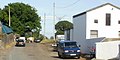
 Gilchrist industrial estate - geograph.org.uk - 928832.jpg 640 × 480; 80 KB
-
 Glyndwr Road, Cwmbran, Wales, 11 July 2011.jpg 640 × 480; 71 KB
-

-
 Hairpin bend, Upper Race - geograph.org.uk - 361595.jpg 640 × 334; 43 KB
-
 John Baker Close - geograph.org.uk - 1595270.jpg 640 × 544; 108 KB
-

-
 Junction with phonebox - geograph.org.uk - 558131.jpg 640 × 482; 96 KB
-
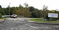
 Lakeside northern junction - geograph.org.uk - 1595279.jpg 640 × 277; 52 KB
-
 Lakeside southern junction - geograph.org.uk - 1595819.jpg 640 × 342; 74 KB
-
 Lansdowne Gardens - geograph.org.uk - 1594774.jpg 640 × 392; 69 KB
-
 Looking down the road with footpath signs - geograph.org.uk - 558126.jpg 640 × 482; 100 KB
-
 Maesderwen Road, Pontymoel - geograph.org.uk - 1578400.jpg 640 × 498; 89 KB
-
 Mitchell Close, Llanfrechfa - geograph.org.uk - 1633614.jpg 640 × 404; 109 KB
-

-
 New Road, New Inn - geograph.org.uk - 1670655.jpg 640 × 464; 52 KB
-
 North Road , Croesyceiliog - geograph.org.uk - 1534511.jpg 640 × 399; 66 KB
-
 Old building and icy puddle - geograph.org.uk - 633676.jpg 640 × 480; 68 KB
-
 Residential area of Cwmbran - geograph.org.uk - 1049087.jpg 640 × 480; 64 KB
-
 Ridge track on Cefn Garnyrerw - geograph.org.uk - 497659.jpg 640 × 480; 144 KB
-
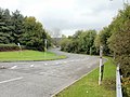
 Road junction in Cwmbran - geograph.org.uk - 1047127.jpg 640 × 480; 63 KB
-
 Sebastopol - Griffithstown boundary - geograph.org.uk - 1577182.jpg 640 × 384; 69 KB
-
 Slow sign at Pantygasseg - geograph.org.uk - 487363.jpg 640 × 480; 81 KB
-
 Spring by the hill road - geograph.org.uk - 507022.jpg 640 × 480; 104 KB
-

-

-
 St David's Road, Cwmbran - geograph.org.uk - 1611659.jpg 640 × 480; 80 KB
-
 The end of Stafford Road, Pontymoel - geograph.org.uk - 1578884.jpg 640 × 480; 79 KB
-

-
 The road towards Abertillery - geograph.org.uk - 633696.jpg 640 × 480; 59 KB
-
 The Square, Upper Cwmbran - geograph.org.uk - 756785.jpg 640 × 427; 70 KB
-
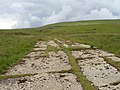
 Track across the moors - geograph.org.uk - 681152.jpg 639 × 479; 163 KB
-
 Track across the moors - geograph.org.uk - 681159.jpg 639 × 479; 219 KB
-
 Ty Coch Close - geograph.org.uk - 1594779.jpg 640 × 418; 86 KB
-
 Ty-bwmpyn Road - geograph.org.uk - 488111.jpg 640 × 480; 89 KB
-
 Upper Cwmbran Road - geograph.org.uk - 1612648.jpg 640 × 331; 71 KB


.jpg)


