Category:Roads in Highland council area
Jump to navigation
Jump to search
Council areas (municipalities) of Scotland: Aberdeen · Aberdeenshire · Angus · Argyll and Bute · Clackmannanshire · Dumfries and Galloway · Dundee · East Ayrshire · East Dunbartonshire · East Lothian · East Renfrewshire · Edinburgh · Falkirk · Fife · Glasgow · Highland · Inverclyde · Midlothian · Moray · North Ayrshire · North Lanarkshire · Outer Hebrides · Orkney Islands · Perth and Kinross · Renfrewshire · Scottish Borders · Shetland Islands · South Ayrshire · South Lanarkshire · Stirling · West Dunbartonshire · West Lothian
Subcategories
This category has the following 43 subcategories, out of 43 total.
A
- A99 road (Scotland) (39 F)
- A833 road (Scotland) (24 F)
- A851 road (Scotland) (52 F)
- A855 road (Scotland) (101 F)
- A863 road (Scotland) (59 F)
- A884 road (Scotland) (27 F)
- A890 road (Scotland) (37 F)
- A896 road (Scotland) (33 F)
B
- B871 road (Scotland) (22 F)
- B874 road (Scotland) (6 F)
- B885 road (Scotland) (14 F)
- B8006 road (Moidart) (1 F)
- B8007 road (Scotland) (12 F)
- B8009 road (Scotland) (15 F)
- B8043 road (Scotland) (23 F)
- B862 road (Scotland) (38 F)
- B9152 road (Scotland) (5 F)
- B9162 road (Scotland) (2 F)
- B9163 road (Scotland) (11 F)
- Bealach na Bà (145 F)
C
- Calum's Road (29 F)
D
F
N
- North Coast 500, Scotland (6 F)
R
S
- Road signs in Highland council area (159 F)
Media in category "Roads in Highland council area"
The following 200 files are in this category, out of 2,050 total.
(previous page) (next page)-

-
 "Path" Allt Bad an t-Sagairt - geograph.org.uk - 213904.jpg 640 × 480; 109 KB
-
 "Roundabouts for 1 mile" - geograph.org.uk - 5842894.jpg 2,592 × 1,944; 1.03 MB
-
 "The Road to Nowhere" - geograph.org.uk - 2446466.jpg 1,600 × 1,074; 625 KB
-
 'Golspie by-pass' - geograph.org.uk - 486723.jpg 480 × 640; 85 KB
-
 ...Just Open Bevor - panoramio.jpg 4,320 × 2,756; 4.97 MB
-
 A cold morning in Greshornish Forest - geograph.org.uk - 1062297.jpg 640 × 480; 201 KB
-
 A Forest Road - geograph.org.uk - 57652.jpg 640 × 480; 138 KB
-
 A gentle roll down to Broadford bay. - geograph.org.uk - 360762.jpg 640 × 480; 119 KB
-

-
 A nice long stretch - geograph.org.uk - 877739.jpg 640 × 480; 63 KB
-
 A Packhorse Bridge near Burnside - geograph.org.uk - 1428827.jpg 640 × 414; 118 KB
-
 A parting of the ways in Tomich - geograph.org.uk - 1536526.jpg 640 × 480; 92 KB
-
 A Quiet Lane at Clashmore in Sutherland - geograph.org.uk - 4218839.jpg 2,464 × 1,632; 2.46 MB
-
 A Road - panoramio (5).jpg 3,000 × 4,000; 6.28 MB
-
 A serpentine road heading eastwards. - geograph.org.uk - 229185.jpg 640 × 426; 93 KB
-
 A Snowy Footpath To Carn nam Bo Maola - geograph.org.uk - 85873.jpg 640 × 480; 102 KB
-
 A stand of Scots pine - geograph.org.uk - 1753964.jpg 640 × 480; 85 KB
-
 A Wade Road. A889. - geograph.org.uk - 130386.jpg 640 × 480; 71 KB
-
 A wet track beside Loch an Daimh - geograph.org.uk - 586924.jpg 640 × 426; 132 KB
-
 A830 at head of Loch Ailort - geograph.org.uk - 23953.jpg 640 × 494; 131 KB
-
 A830 at the head of Loch Nan Uamh - geograph.org.uk - 23939.jpg 640 × 493; 129 KB
-
 A830 between Morar and Arisaig - geograph.org.uk - 23913.jpg 640 × 456; 107 KB
-
 A830 by Beasdale - geograph.org.uk - 185229.jpg 640 × 480; 116 KB
-
 A830 near Corpach - geograph.org.uk - 15578.jpg 640 × 464; 151 KB
-
 A830 near Glasnacardoch - geograph.org.uk - 23869.jpg 640 × 448; 111 KB
-
 A830 near Glasnacardoch - geograph.org.uk - 23870.jpg 640 × 469; 138 KB
-
 A830 near Kinloid junction - geograph.org.uk - 23923.jpg 640 × 451; 110 KB
-
 A830 near Morar - geograph.org.uk - 23872.jpg 640 × 468; 120 KB
-
 A830 near Morar - geograph.org.uk - 23875.jpg 640 × 450; 119 KB
-
 A87 at Inverinate - geograph.org.uk - 6144139.jpg 1,024 × 768; 166 KB
-
 A87 below Carr Brae - geograph.org.uk - 6144050.jpg 1,024 × 576; 197 KB
-
 A87 below Carr Brae - geograph.org.uk - 6144060.jpg 1,024 × 576; 214 KB
-
 A87 by Loch Duich - geograph.org.uk - 6144112.jpg 1,024 × 576; 189 KB
-
 A9 heading north, Dornoch Firth - geograph.org.uk - 3977193.jpg 640 × 480; 52 KB
-
 A9, Ardullie - geograph.org.uk - 4763617.jpg 800 × 600; 145 KB
-
 Above Glen Kyllachy - geograph.org.uk - 121619.jpg 640 × 480; 113 KB
-
 Abriachan - geograph.org.uk - 4306011.jpg 800 × 600; 364 KB
-

-
 Access Track to Mains Farm - geograph.org.uk - 112905.jpg 640 × 409; 51 KB
-
 Achnahaird Road - geograph.org.uk - 935312.jpg 640 × 427; 254 KB
-
 Achnahaird to Altandhu Road - geograph.org.uk - 930612.jpg 640 × 427; 243 KB
-
 Achnahatnich farm entrance - geograph.org.uk - 1022639.jpg 640 × 428; 127 KB
-
 Achterneed Level Crossing - geograph.org.uk - 367212.jpg 640 × 482; 92 KB
-
 After the golf course - geograph.org.uk - 330351.jpg 640 × 480; 127 KB
-
 Allangrange station site geograph-3227313-by-Ben-Brooksbank.jpg 2,395 × 1,461; 3.75 MB
-

-

-
 Along the A96 towards Inverness. - geograph.org.uk - 201642.jpg 640 × 427; 59 KB
-
 An access road from Kerrow - geograph.org.uk - 1553613.jpg 640 × 480; 68 KB
-
 Approach to Fasnakyle Bridge - geograph.org.uk - 1536037.jpg 640 × 441; 86 KB
-
 Approach to Gordonbush Mains - geograph.org.uk - 484514.jpg 640 × 480; 75 KB
-
 Approach to Reiss - geograph.org.uk - 479246.jpg 526 × 384; 44 KB
-
 Approach to the Kylerhea Ferry - geograph.org.uk - 920602.jpg 640 × 480; 213 KB
-
 Approaching A99 - geograph.org.uk - 824079.jpg 640 × 480; 62 KB
-
 Approaching Broomhill - geograph.org.uk - 244527.jpg 640 × 480; 73 KB
-
 Approaching Kilchoan from North West - geograph.org.uk - 212095.jpg 640 × 480; 90 KB
-
 Approaching Scrabster - geograph.org.uk - 243316.jpg 480 × 640; 86 KB
-

-
 Approaching the Dornoch Firth Bridge - geograph.org.uk - 5743278.jpg 1,024 × 731; 73 KB
-
 Approaching the Dornoch Firth Bridge on the A9 - geograph.org.uk - 5545103.jpg 1,600 × 1,067; 358 KB
-

-
 At Mains Farm crossroads. - geograph.org.uk - 203433.jpg 600 × 396; 82 KB
-
 Autumn colours near Kilmuir, Black Isle - geograph.org.uk - 596207.jpg 640 × 481; 136 KB
-
 Aviemore from Craigellachie - geograph.org.uk - 258853.jpg 640 × 480; 64 KB
-
 B1953 and Woodland Walk - geograph.org.uk - 232263.jpg 640 × 427; 106 KB
-
 B863 on North side of Loch Leven - geograph.org.uk - 21926.jpg 640 × 472; 126 KB
-
 B863 on North side of Loch Leven - geograph.org.uk - 21927.jpg 640 × 463; 118 KB
-
 B863 on North side of Loch Leven - geograph.org.uk - 21928.jpg 640 × 493; 108 KB
-
 B871 road and River Helmsdale - geograph.org.uk - 505091.jpg 640 × 480; 69 KB
-
 B886 looking south - geograph.org.uk - 1217790.jpg 600 × 450; 253 KB
-
 Barn at Belladrum Farm - geograph.org.uk - 1540026.jpg 640 × 458; 63 KB
-
 Barn Church Road - geograph.org.uk - 2016857.jpg 800 × 531; 174 KB
-
 Barrock junction - geograph.org.uk - 479516.jpg 483 × 384; 44 KB
-
 Bealach between Uig and the Quiraing - geograph.org.uk - 112147.jpg 640 × 480; 62 KB
-
 Beallachnagore track - geograph.org.uk - 207817.jpg 640 × 480; 144 KB
-
 Beasdale Bridge - geograph.org.uk - 217445.jpg 640 × 480; 121 KB
-
 Beauly Firth and A9 - geograph.org.uk - 56574.jpg 640 × 480; 77 KB
-
 Ben Klibreck - geograph.org.uk - 395309.jpg 640 × 505; 133 KB
-
 Ben Tee from Glen Garry - geograph.org.uk - 135820.jpg 640 × 409; 53 KB
-
 Bend - geograph.org.uk - 219722.jpg 640 × 424; 87 KB
-
 Bend in Glen Affric road - geograph.org.uk - 1551135.jpg 640 × 480; 113 KB
-
 Berridale Brae hairpin - geograph.org.uk - 162192.jpg 640 × 424; 237 KB
-
 Berridale Braes - geograph.org.uk - 162297.jpg 424 × 640; 234 KB
-

-
 Blairfoid junction - geograph.org.uk - 408983.jpg 640 × 452; 64 KB
-
 Blargie - geograph.org.uk - 2254905.jpg 640 × 480; 252 KB
-
 Blarmachfoldach - geograph.org.uk - 106735.jpg 640 × 484; 102 KB
-
 Bleak moorland - geograph.org.uk - 657555.jpg 640 × 426; 74 KB
-
 Boulder Field by the Brochel Road - geograph.org.uk - 136900.jpg 640 × 480; 101 KB
-
 Brabsterdorran Mains - geograph.org.uk - 825018.jpg 640 × 480; 71 KB
-
 Bridge of Hecken - geograph.org.uk - 551833.jpg 640 × 480; 63 KB
-
 Bridge over An Dubh Lighe - geograph.org.uk - 784029.jpg 640 × 427; 65 KB
-
-
 Brogaig junction - geograph.org.uk - 1176354.jpg 640 × 480; 107 KB
-
 Bus stop, Hughton - geograph.org.uk - 446357.jpg 640 × 480; 76 KB
-
 By Coulnakyle Cottages - geograph.org.uk - 219899.jpg 640 × 424; 83 KB
-
 By Latheronwheel Bridge - geograph.org.uk - 149429.jpg 640 × 480; 409 KB
-
 By Rhymore, Tulloch - geograph.org.uk - 212193.jpg 640 × 424; 72 KB
-
 Camas Ban - geograph.org.uk - 212201.jpg 640 × 480; 76 KB
-
 Caochan Breac - geograph.org.uk - 192059.jpg 640 × 424; 73 KB
-
 Carn a'Chuilinn - panoramio.jpg 2,560 × 1,920; 2.43 MB
-
 Carnmore Path - geograph.org.uk - 39386.jpg 640 × 480; 84 KB
-
 Carrich Viaduct, Skye Crossing - geograph.org.uk - 5793050.jpg 640 × 480; 65 KB
-

-
 Cattle grid on the Affric road - geograph.org.uk - 170075.jpg 640 × 478; 99 KB
-
 Cattle Grid on the Cleadale Road - geograph.org.uk - 41893.jpg 640 × 480; 70 KB
-
 Coast Road near Kilmalieu - geograph.org.uk - 792671.jpg 640 × 427; 80 KB
-
 Corntown Brae - geograph.org.uk - 207705.jpg 640 × 480; 65 KB
-
 Cottage and A9 - geograph.org.uk - 6529.jpg 640 × 480; 93 KB
-
 Cottage on the B9165 . - geograph.org.uk - 226105.jpg 640 × 426; 82 KB
-
 Coupall Bridge - geograph.org.uk - 1376951.jpg 1,000 × 669; 501 KB
-
 Creag nan Eun - geograph.org.uk - 403285.jpg 640 × 425; 390 KB
-
 Crofting Township.jpg 640 × 480; 109 KB
-
 Culburnie - geograph.org.uk - 446369.jpg 640 × 440; 57 KB
-
 Culligran Cottage - geograph.org.uk - 448636.jpg 640 × 480; 141 KB
-
 Culloden Viaduct - geograph.org.uk - 4324786.jpg 800 × 600; 364 KB
-
 Cutting on the A831 - geograph.org.uk - 247729.jpg 640 × 480; 113 KB
-
 Dalmichy House - geograph.org.uk - 868523.jpg 640 × 480; 58 KB
-
 Danger - no grit - geograph.org.uk - 1102392.jpg 640 × 480; 74 KB
-
 Deanie Power Station - geograph.org.uk - 553286.jpg 640 × 480; 66 KB
-
 Deer in Glen Affric.JPG 2,940 × 2,150; 3.15 MB
-
 Descent to Bridge of Brown - geograph.org.uk - 1549103.jpg 640 × 480; 75 KB
-
 Downhill all the way - geograph.org.uk - 951905.jpg 640 × 480; 63 KB
-
 Drive to Revack Lodge - geograph.org.uk - 330207.jpg 640 × 480; 92 KB
-
 Driveway to Langwell House - geograph.org.uk - 1212011.jpg 640 × 480; 170 KB
-
 Drumsmittal Lane - geograph.org.uk - 203516.jpg 600 × 443; 155 KB
-
 Drumsmittal Lane - geograph.org.uk - 207863.jpg 640 × 480; 163 KB
-
 Duirinish to Achnandarach road - geograph.org.uk - 1088071.jpg 640 × 480; 80 KB
-
 Dump, Glen Arroch. - geograph.org.uk - 70223.jpg 640 × 480; 110 KB
-
 Edge of Forest - geograph.org.uk - 235593.jpg 640 × 427; 72 KB
-
 Edge of Stone Circle at Clava Cairns - geograph.org.uk - 4289529.jpg 640 × 480; 112 KB
-
 End of Skye of Curr road - geograph.org.uk - 213120.jpg 640 × 424; 81 KB
-
 End of the public road at Torlundy - geograph.org.uk - 2030425.jpg 800 × 531; 251 KB
-
 End of the road, Badluarach - geograph.org.uk - 102147.jpg 640 × 441; 185 KB
-
 Entrance to Knockloam Farm - geograph.org.uk - 244530.jpg 640 × 480; 73 KB
-
 Entry to Helmsdale - geograph.org.uk - 483169.jpg 640 × 477; 64 KB
-
 Estate road, Ardtornish estate - geograph.org.uk - 851710.jpg 640 × 480; 114 KB
-
 Evening light, near Tomdoun - geograph.org.uk - 187590.jpg 640 × 480; 222 KB
-

-
 Farm buildings on hillock - geograph.org.uk - 490732.jpg 640 × 480; 110 KB
-
 Farm road near Rebeg - geograph.org.uk - 1741246.jpg 800 × 531; 268 KB
-
 Farmland above Nigg. - geograph.org.uk - 1295940.jpg 640 × 480; 199 KB
-
 Feed me NOW^ - geograph.org.uk - 130571.jpg 640 × 480; 89 KB
-
 Flooded track beside Loch an Daimh - geograph.org.uk - 586955.jpg 640 × 426; 122 KB
-
 Footpath Erosion Cairngorms - geograph.org.uk - 11450.jpg 640 × 427; 86 KB
-
 Forest road end, Glen Chia-aig. - geograph.org.uk - 68240.jpg 640 × 480; 111 KB
-
 Forest Track, Near Loch Vaa - geograph.org.uk - 233972.jpg 640 × 480; 156 KB
-
 Fort Augustus - geograph.org.uk - 685236.jpg 640 × 480; 250 KB
-
 From the Kilmarie road end - geograph.org.uk - 1069340.jpg 640 × 480; 128 KB
-
 Frosty tree Blackstand, Highland.jpg 1,944 × 2,592; 1.97 MB
-
 Garbole road in Winter - geograph.org.uk - 281799.jpg 640 × 480; 33 KB
-
 Gate on the track to Fionn Loch - geograph.org.uk - 1315915.jpg 640 × 426; 251 KB
-
 Gated entrance to Glen Strathfarrar - geograph.org.uk - 1534520.jpg 640 × 478; 114 KB
-

-
 General Wades Military Road - geograph.org.uk - 137891.jpg 640 × 480; 118 KB
-

-
 Glen Einig - geograph.org.uk - 169307.jpg 640 × 461; 92 KB
-
 Glen Einig - geograph.org.uk - 169308.jpg 640 × 458; 65 KB
-
 Glen Einig - geograph.org.uk - 169312.jpg 640 × 446; 83 KB
-
 Glen Finnan - geograph.org.uk - 1594375.jpg 800 × 600; 192 KB
-
 Glen Glass Road, Assynt - geograph.org.uk - 207867.jpg 640 × 480; 109 KB
-
 Glen Kyllachy - geograph.org.uk - 135922.jpg 640 × 480; 97 KB
-
 Glencairn - geograph.org.uk - 212099.jpg 640 × 424; 86 KB
-
 Glenmore Hairpins - geograph.org.uk - 108645.jpg 640 × 480; 109 KB
-
 Glenmore Lodge road - geograph.org.uk - 326446.jpg 640 × 480; 96 KB
-
 Glenmore Road - geograph.org.uk - 108577.jpg 640 × 480; 99 KB
-
 Grampian Road, Aviemore - geograph.org.uk - 1658067.jpg 640 × 480; 71 KB
-
 Great Glen Route - geograph.org.uk - 172047.jpg 640 × 480; 123 KB
-
 Hairpin bend - geograph.org.uk - 1128657.jpg 640 × 480; 95 KB
-
 Heavy plant by Kerrow Farm - geograph.org.uk - 1553607.jpg 640 × 452; 74 KB
-
 Hill road to Carn na Seanalich - geograph.org.uk - 191679.jpg 640 × 424; 91 KB
-
 Hill track near Drynachan - geograph.org.uk - 660477.jpg 640 × 426; 82 KB
-
 Hillside above Nigg - geograph.org.uk - 1710535.jpg 640 × 480; 155 KB
-
 House at Cluaisnahadig - geograph.org.uk - 1220567.jpg 640 × 480; 72 KB
-
 Houses at South Cuil - geograph.org.uk - 1705081.jpg 640 × 480; 101 KB
-
 Infrequently used forest track - geograph.org.uk - 452713.jpg 600 × 450; 163 KB
-
 Inverarish to Brochel road - geograph.org.uk - 1806194.jpg 640 × 480; 108 KB
-
 Inverness West Link Stage 2 construction - 51033448576.jpg 5,472 × 3,648; 8.98 MB
-
 Inverness West Link Stage 2 construction - 51034174457.jpg 5,470 × 3,646; 12.76 MB
-
 Inverness West Link Stage 2 construction - 51050078241.jpg 3,998 × 2,997; 8.67 MB
-
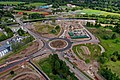 Inverness West Link Stage 2 construction.jpg 5,468 × 3,645; 13.37 MB
-
 Joining the A9 east of Alness. - geograph.org.uk - 225854.jpg 640 × 427; 94 KB
-

-
 Kearvaig road - geograph.org.uk - 890892.jpg 640 × 359; 71 KB
-
 Kibraur Road - geograph.org.uk - 1458590.jpg 640 × 427; 60 KB
-
 Kinchurdy Road End - geograph.org.uk - 244392.jpg 640 × 384; 96 KB
-
 Kingairloch Turning near Achagavel - geograph.org.uk - 785717.jpg 640 × 427; 74 KB
-
 Kinloch Hourn Road - geograph.org.uk - 233496.jpg 640 × 480; 140 KB
-
 Kinloch Hourn Road - geograph.org.uk - 233581.jpg 640 × 480; 111 KB
-
 Kyle causeway - geograph.org.uk - 94570.jpg 640 × 480; 104 KB
-

-
 Landslide Shelter - geograph.org.uk - 8251.jpg 640 × 281; 98 KB
-
 Lane junction near Durran Mains - geograph.org.uk - 1215312.jpg 640 × 375; 72 KB
-
 Lane near Durran Mains - geograph.org.uk - 1215297.jpg 640 × 425; 91 KB
-
 Lane to Auchtereang off the B9007. - geograph.org.uk - 242484.jpg 640 × 426; 87 KB
-
 Lane, North Brora Muir - geograph.org.uk - 854761.jpg 640 × 480; 105 KB
-

-
 Layby near Cluanie Dam - geograph.org.uk - 1352726.jpg 640 × 480; 95 KB
-
 Lethendry - geograph.org.uk - 212654.jpg 640 × 424; 86 KB


.jpg)


