Category:Roads in Conwy County Borough
Jump to navigation
Jump to search
Wikimedia category | |||||
| Upload media | |||||
| Instance of | |||||
|---|---|---|---|---|---|
| Category combines topics | |||||
| Conwy County Borough | |||||
principal area in north-east Wales   | |||||
| Instance of |
| ||||
| Location | Wales | ||||
| Located in or next to body of water | |||||
| Capital | |||||
| Inception |
| ||||
| Population |
| ||||
| Area |
| ||||
| Replaces |
| ||||
| official website | |||||
 | |||||
Subcategories
This category has the following 18 subcategories, out of 18 total.
5
- B5113 road (Wales) (2 F)
A
- A543 road (Wales) (10 F)
- A544 road (Wales) (5 F)
B
- B4409 road (Wales) (8 F)
- B4501 road (Wales) (8 F)
- B5435 road (Wales) (4 F)
C
D
G
J
L
S
- Station Road, Deganwy (12 F)
Media in category "Roads in Conwy County Borough"
The following 200 files are in this category, out of 332 total.
(previous page) (next page)-
 'Cool running' at Glan Conwy - geograph.org.uk - 1434748.jpg 640 × 480; 87 KB
-
 A "no through road" above Coed Gwydyr - geograph.org.uk - 2012577.jpg 4,592 × 3,056; 5.79 MB
-
 A470 - geograph.org.uk - 134998.jpg 640 × 480; 90 KB
-

-
 A5, Afon Llugwy - geograph.org.uk - 35927.jpg 640 × 480; 139 KB
-
 A5, Near Capel Curig - geograph.org.uk - 35923.jpg 640 × 480; 146 KB
-
 A544 at Clwt - geograph.org.uk - 54853.jpg 512 × 384; 40 KB
-
 A55 eastbound from junction 17 (Conwy) - geograph.org.uk - 1724517.jpg 2,816 × 2,112; 1.47 MB
-

-

-
 Albert Drive - geograph.org.uk - 1483393.jpg 640 × 430; 149 KB
-
 Alltwen - geograph.org.uk - 842288.jpg 640 × 478; 112 KB
-

-

-

-
 Approaching Conwy - geograph.org.uk - 842236.jpg 640 × 480; 113 KB
-
 Approaching Llyn Bychan - geograph.org.uk - 1032321.jpg 640 × 480; 81 KB
-
 Arrival in Gwytherin - geograph.org.uk - 194858.jpg 640 × 480; 90 KB
-
 At Llandudno 2020 109.jpg 6,960 × 4,640; 23.62 MB
-
 At Llandudno 2020 110.jpg 6,960 × 4,640; 21.32 MB
-
 At Llandudno 2020 192.jpg 6,960 × 4,640; 24.17 MB
-
 B5113 Nebo to Pentrefoelas - geograph.org.uk - 615011.jpg 640 × 480; 62 KB
-
 B5427 looking over fields - geograph.org.uk - 152774.jpg 640 × 480; 58 KB
-
 Bangor Road, Penmaenmawr - geograph.org.uk - 150017.jpg 640 × 480; 90 KB
-
 Bangor Street, Penmaenmawr - geograph.org.uk - 1273234.jpg 640 × 480; 76 KB
-
 Benkid77 A55 1 220709.JPG 2,240 × 1,680; 820 KB
-
 Benkid77 A55 2 220709.JPG 2,240 × 1,680; 891 KB
-
 Betws-Y-Coed - geograph.org.uk - 51647.jpg 640 × 480; 135 KB
-
 Blaen y Nant and Llyn Crafnant - geograph.org.uk - 223731.jpg 640 × 427; 64 KB
-
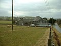
 Bodunig Farm near Llangernyw - geograph.org.uk - 218464.jpg 640 × 427; 73 KB
-
 Bridge at the end of the Road - geograph.org.uk - 222118.jpg 640 × 427; 109 KB
-
 Bridge over the Dulas - geograph.org.uk - 125449.jpg 640 × 480; 68 KB
-
 Bron-Y-Gaer - geograph.org.uk - 1483510.jpg 640 × 430; 130 KB
-
 Bryn Gosol Road from Deganwy Road - geograph.org.uk - 591448.jpg 640 × 480; 72 KB
-

-
 Bryn Locyn Mast near Gyffin - geograph.org.uk - 209102.jpg 640 × 427; 53 KB
-
 Bryn-llys farm - geograph.org.uk - 181914.jpg 640 × 480; 84 KB
-
 Bwlch Farm - geograph.org.uk - 1017041.jpg 640 × 480; 98 KB
-

-
 Byway to Rowen - geograph.org.uk - 1564688.jpg 425 × 640; 115 KB
-
 Cadnant Park - geograph.org.uk - 1479409.jpg 640 × 430; 151 KB
-
 Capel Curig, UK - panoramio (72).jpg 2,624 × 1,968; 2.49 MB
-
 Capel Curig, UK - panoramio (73).jpg 2,624 × 1,968; 3.27 MB
-
 Capel Curig, UK - panoramio (74).jpg 2,624 × 1,968; 3.31 MB
-
 Capel Siloam village - geograph.org.uk - 173081.jpg 640 × 480; 71 KB
-
 Capelulo Village - geograph.org.uk - 1478825.jpg 640 × 430; 134 KB
-

-
 Carrog, Cwm Penmachno - geograph.org.uk - 172611.jpg 640 × 480; 119 KB
-

-
 Cattle Grid near Garthmyn - geograph.org.uk - 222125.jpg 640 × 427; 109 KB
-
 Chapel near Bryn y maen - geograph.org.uk - 206265.jpg 640 × 427; 86 KB
-
 Clwb Golff Penmaenmawr a'r Alltwen.JPG 1,280 × 960; 253 KB
-
 Construction Nightmare^ - geograph.org.uk - 150033.jpg 640 × 480; 99 KB
-
 Conway 2009 01.png 2,097 × 1,517; 6.09 MB
-
 Conway 2009 05.png 2,084 × 1,481; 7.05 MB
-
 Conway 2009 06.png 2,096 × 1,272; 6.05 MB
-
 Conway 2009 10.png 2,088 × 1,488; 5.75 MB
-
 Conway 2009 15.png 2,096 × 1,472; 5.55 MB
-
 Conway 2009 22.png 2,080 × 1,476; 6.43 MB
-
 Conwy Bay - geograph.org.uk - 395425.jpg 640 × 480; 60 KB
-
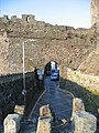
 Conwy Castle - geograph.org.uk - 834877.jpg 640 × 480; 76 KB
-
 Conwy Castle and bridges (7973).jpg 4,288 × 2,848; 5.74 MB
-
 Conwy Castle MMB 01.jpg 2,400 × 1,600; 1.93 MB
-
 Conwy Mountain path - geograph.org.uk - 476124.jpg 640 × 391; 43 KB
-
 Cottages at Rhydlydan - geograph.org.uk - 118370.jpg 640 × 480; 99 KB
-
 Country lane at Rhyd y Foel - geograph.org.uk - 29877.jpg 512 × 384; 54 KB
-
 Crimea Pass - geograph.org.uk - 134929.jpg 640 × 480; 77 KB
-
 Cwm Eigiau. - geograph.org.uk - 75199.jpg 637 × 390; 44 KB
-

-
 Cwm Penmachno - geograph.org.uk - 147746.jpg 640 × 480; 82 KB
-
 Cyffordd Llandudno - ger yr orsaf.JPG 1,280 × 960; 194 KB
-
 Derelict buildings near Yspyty Ifan - geograph.org.uk - 118375.jpg 640 × 480; 105 KB
-
 Derelict farm near Llechwedd - geograph.org.uk - 175959.jpg 640 × 480; 100 KB
-
 Descending the Sychnant Pass Rd - geograph.org.uk - 1478813.jpg 640 × 430; 188 KB
-
 Difficult parking, Llandudno seafront - geograph.org.uk - 162656.jpg 640 × 479; 81 KB
-
 Dolwen junction - geograph.org.uk - 29885.jpg 512 × 384; 38 KB
-
-
 Dual Footpaths near Hafod Gau - geograph.org.uk - 221178.jpg 640 × 427; 71 KB
-
 End of the Road - geograph.org.uk - 220867.jpg 640 × 427; 75 KB
-
 Entering Capelulo - geograph.org.uk - 1478823.jpg 640 × 430; 173 KB
-
 Fairy Glen Rd, Capelulo - geograph.org.uk - 1478856.jpg 640 × 430; 158 KB
-
 Farm and lane - geograph.org.uk - 157465.jpg 640 × 480; 69 KB
-
 Farm lane near Ty Mawr farm - geograph.org.uk - 181799.jpg 640 × 480; 106 KB
-
 Farm track, wonderful view - geograph.org.uk - 340634.jpg 640 × 480; 81 KB
-
 Farmland alongside A5, near Glasfryn - geograph.org.uk - 35947.jpg 640 × 480; 114 KB
-
 Farmland near Rhydlydan - geograph.org.uk - 118365.jpg 640 × 480; 117 KB
-
 Farmland near Tal y Bont - geograph.org.uk - 53677.jpg 512 × 384; 33 KB
-
 Ffordd Rufeinig. Roman Road - geograph.org.uk - 404957.jpg 640 × 480; 200 KB
-
 Footpath near Gelli Lydan - geograph.org.uk - 210792.jpg 640 × 427; 121 KB
-
 Ford, Afon Roe - geograph.org.uk - 252148.jpg 600 × 450; 139 KB
-
 Forest track towards Llyn Bychan - geograph.org.uk - 1437013.jpg 640 × 426; 187 KB
-
 Forestry road - geograph.org.uk - 199915.jpg 640 × 427; 116 KB
-
 Forestry road junction - geograph.org.uk - 197110.jpg 640 × 427; 99 KB
-
 Forestry Road Junction - geograph.org.uk - 207421.jpg 640 × 427; 113 KB
-

-
 Former church near Bont y Gwyddel - geograph.org.uk - 30100.jpg 512 × 384; 57 KB
-
 Gate and Leat near Rowlyn Isa - geograph.org.uk - 221748.jpg 640 × 427; 100 KB
-

-
 Gate near Llugallt Cottage - geograph.org.uk - 224879.jpg 640 × 427; 126 KB
-
 Gate to Field near Pant-glas - geograph.org.uk - 211219.jpg 640 × 427; 75 KB
-
 Gate to Field near Tyddyn Rhobin - geograph.org.uk - 212670.jpg 640 × 427; 85 KB
-
 Glanwydden - geograph.org.uk - 122496.jpg 640 × 480; 33 KB
-
 Glasfryn Village - geograph.org.uk - 118360.jpg 640 × 480; 102 KB
-
 Great Orme, Llandudno - geograph.org.uk - 341455.jpg 640 × 480; 100 KB
-
 Gregory Avenue - geograph.org.uk - 50874.jpg 640 × 480; 35 KB
-
 Gyffin 01.JPG 1,280 × 960; 225 KB
-
 Hafodyredwydd farm - geograph.org.uk - 172587.jpg 640 × 480; 75 KB
-
 Hairpin bends on Marine Drive - geograph.org.uk - 2398083.jpg 639 × 473; 98 KB
-
 Hawes Drive, Deganwy - geograph.org.uk - 590584.jpg 640 × 480; 59 KB
-
 Hen arwydd ffordd - An old road sign - geograph.org.uk - 871959.jpg 439 × 640; 119 KB
-
 Hightide at Rhos on Sea - geograph.org.uk - 29829.jpg 512 × 384; 28 KB
-
 Hills to sea - geograph.org.uk - 140596.jpg 640 × 480; 52 KB
-
 House near Nant y Felin - geograph.org.uk - 181862.jpg 640 × 480; 72 KB
-
 Lane and hills - geograph.org.uk - 124514.jpg 640 × 480; 58 KB
-
 Lane near Cefn Madoc farm - geograph.org.uk - 218427.jpg 640 × 427; 73 KB
-
 Lane near Glanwydden - geograph.org.uk - 122495.jpg 640 × 480; 37 KB
-
 Lane north of Rhydlydan - geograph.org.uk - 766301.jpg 640 × 480; 97 KB
-
 Lane through Bodgynydd Nature Reserve - geograph.org.uk - 777260.jpg 640 × 426; 110 KB
-
 Lane to somewhere - geograph.org.uk - 127751.jpg 640 × 480; 80 KB
-
 Lay-By near Cae Cwmpas - geograph.org.uk - 222190.jpg 640 × 427; 101 KB
-
 Layby on the A470 near Bod Hyfryd - geograph.org.uk - 222137.jpg 640 × 427; 104 KB
-
 St. Trillo's Church - geograph.org.uk - 55759.jpg 640 × 480; 104 KB
-
 Llandudno Junction - geograph.org.uk - 871135.jpg 640 × 480; 107 KB
-
 Llandudno Junction - geograph.org.uk - 871141.jpg 640 × 480; 110 KB
-
 Llangernyw01.JPG 1,280 × 960; 251 KB
-
 Llanrwst Road into Conwy town - geograph.org.uk - 696960.jpg 480 × 640; 201 KB
-
 Llycrochan Avenue - Colwyn Bay - geograph.org.uk - 51681.jpg 494 × 381; 52 KB
-
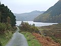 Llyn Geirionydd - geograph.org.uk - 597955.jpg 640 × 480; 73 KB
-
 Llyn Ogwen and the A5 - geograph.org.uk - 126600.jpg 640 × 480; 99 KB
-
 Llyn Syberi road junction - geograph.org.uk - 200013.jpg 640 × 427; 106 KB
-
 Lon Glasgwm. The Glasgwm road - geograph.org.uk - 556850.jpg 640 × 480; 141 KB
-
 Looking back to Cerrigydrudion - geograph.org.uk - 157725.jpg 640 × 480; 78 KB
-
 Looking out to sea from Sirior Bach - geograph.org.uk - 27184.jpg 384 × 288; 18 KB
-

-
 LOW Bridge - geograph.org.uk - 149407.jpg 640 × 480; 113 KB
-
 Main road through Betws yn Rhos - geograph.org.uk - 29869.jpg 512 × 384; 40 KB
-
 Marine Drive - geograph.org.uk - 122374.jpg 640 × 481; 117 KB
-
 Marine Parade at Colwyn Bay - geograph.org.uk - 29824.jpg 512 × 384; 27 KB
-
 Milestone A5, Holyhead 37 miles - geograph.org.uk - 35936.jpg 640 × 480; 147 KB
-
 Miners lane to the sea - geograph.org.uk - 156026.jpg 640 × 480; 83 KB
-
 Minor road near Cyffylliog - geograph.org.uk - 161093.jpg 509 × 640; 142 KB
-
 Mochdre from Bryn Euryn - geograph.org.uk - 823230.jpg 640 × 427; 106 KB
-
 Moorland at Bwlch Gwyn - geograph.org.uk - 54801.jpg 512 × 384; 24 KB
-
 Morfa Conwy.JPG 1,280 × 960; 181 KB
-
 Mountain Lane - geograph.org.uk - 242543.jpg 600 × 450; 91 KB
-
 Nant-y-Glyn, Colwyn Bay - geograph.org.uk - 224312.jpg 600 × 450; 88 KB
-
 Near Rhydlydan - geograph.org.uk - 118371.jpg 640 × 480; 98 KB
-

-
 Ogwen Valley from Crimpiau.jpg 1,024 × 768; 280 KB
-
 Old Colwyn Hills - geograph.org.uk - 127735.jpg 640 × 480; 85 KB
-

-
 Pandy Tudur - geograph.org.uk - 194865.jpg 640 × 480; 82 KB
-
 Pandy Tudur lanes - geograph.org.uk - 194867.jpg 640 × 480; 99 KB
-
 Pen Llithrig y Wrach - geograph.org.uk - 223653.jpg 640 × 427; 65 KB
-
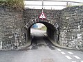
 Pen-y-Clip Tunnel - geograph.org.uk - 208208.jpg 640 × 480; 130 KB
-

-

-
 Penmaenmawr & Foel Lus - geograph.org.uk - 3153833.jpg 640 × 476; 87 KB
-
 Penrhyn, near Rhydlydan - geograph.org.uk - 118369.jpg 640 × 480; 111 KB
-
 Plas Iolyn 768546.jpg 640 × 480; 64 KB
-
 Playground - geograph.org.uk - 252142.jpg 600 × 450; 75 KB
-
 Pont Garth Roadbridge - geograph.org.uk - 206255.jpg 640 × 427; 100 KB
-
 Pont Gethin - geograph.org.uk - 134974.jpg 640 × 480; 91 KB
-
 Pont y Garreg Newydd near Pandy Tudur - geograph.org.uk - 220859.jpg 640 × 427; 108 KB
-
 Postbox at Caerllo Entrance - geograph.org.uk - 218433.jpg 640 × 427; 96 KB
-
 Postbox at Gymannog - geograph.org.uk - 222321.jpg 640 × 427; 103 KB
-

-
 Rainbow's end - geograph.org.uk - 1589191.jpg 640 × 474; 140 KB
-
 Rhydlydan Chapel - geograph.org.uk - 52320.jpg 640 × 480; 55 KB
-
 Road Bridge East of Graig Lwyd - geograph.org.uk - 210800.jpg 640 × 427; 124 KB
-
 Road bridge near Coedty Mawr - geograph.org.uk - 212049.jpg 640 × 427; 104 KB
-
 Road bridge near Llangelynin - geograph.org.uk - 209022.jpg 640 × 427; 110 KB
-
 Road from Bala - geograph.org.uk - 964830.jpg 640 × 480; 85 KB
-
 Road from Oerfa to Maes Gwyn - geograph.org.uk - 432209.jpg 640 × 480; 220 KB
-

-
 Road Junction in Pentre-tafarn-y fedw - geograph.org.uk - 206224.jpg 640 × 427; 91 KB
-
 Road Junction in Trefriw - geograph.org.uk - 213655.jpg 640 × 427; 106 KB
-
 Road Junction near Bod Hyfryd - geograph.org.uk - 222143.jpg 640 × 427; 119 KB
-
 Road Junction near Coed Isaf - geograph.org.uk - 208998.jpg 640 × 427; 124 KB
-
 Road Junction near Hafoty Gwyn - geograph.org.uk - 220255.jpg 640 × 427; 80 KB
-
 Road Junction near Henryd - geograph.org.uk - 209092.jpg 640 × 427; 83 KB
-
 Road Junction near Pandy Mill - geograph.org.uk - 224917.jpg 640 × 427; 109 KB
-
 Road Junction on the Great Orme - geograph.org.uk - 343753.jpg 640 × 480; 130 KB
-
 Road near Betws-y-Coed - scan01.jpg 2,024 × 1,440; 1.96 MB
-
 Road through Bwlch Gwyn - geograph.org.uk - 54797.jpg 512 × 384; 20 KB
-
 Road through the forestry above Penmachno - geograph.org.uk - 172932.jpg 640 × 480; 137 KB
-
 Road to Conwy from Sychnant Pass - geograph.org.uk - 1014309.jpg 640 × 480; 108 KB
-
 Road to Cwm Eigiau - geograph.org.uk - 107417.jpg 640 × 480; 88 KB
-
 Road to Fron Isa, north of Rhydlydan - geograph.org.uk - 766606.jpg 640 × 480; 61 KB
-
 Road to Llyn Cowlyd Reservoir - geograph.org.uk - 222163.jpg 640 × 427; 64 KB
-
 Road To Tai'n-y-foel, Cerrigydrudion. - geograph.org.uk - 125889.jpg 640 × 480; 104 KB
-
 Road Works, Mochdre - geograph.org.uk - 614268.jpg 640 × 480; 69 KB
-
 Roadbridge near Cae Crwn Farm - geograph.org.uk - 213663.jpg 640 × 427; 115 KB
-
 Roadbridge near Foelasfechan - geograph.org.uk - 211191.jpg 640 × 427; 74 KB
-
 Roadbridge near Llyn Geirionydd - geograph.org.uk - 221628.jpg 640 × 427; 96 KB
-
 Roadbridge near Maes-yr-Groes - geograph.org.uk - 201897.jpg 640 × 427; 98 KB
-
 Roadbridge near Penmachno Woollen Mill - geograph.org.uk - 224897.jpg 640 × 427; 109 KB
-
 Roadbridge near Plas Glasgwm - geograph.org.uk - 224883.jpg 640 × 427; 128 KB
-
 Roadbridge over Afon Ystumiau - geograph.org.uk - 207407.jpg 640 × 427; 119 KB
-
 Roadbridge over Leat near Llyn Coedty - geograph.org.uk - 220286.jpg 640 × 427; 106 KB


_-_geograph.org.uk_-_1724517.jpg)


.jpg)
.jpg)
.jpg)


.jpg)


