Category:Road signs in Upper Austria
Jump to navigation
Jump to search
States of Austria: Burgenland · Carinthia · Lower Austria · Salzburg · Styria · Tyrol · Upper Austria · Vienna · Vorarlberg
Subcategories
This category has the following 2 subcategories, out of 2 total.
*
Media in category "Road signs in Upper Austria"
The following 78 files are in this category, out of 78 total.
-
 2021 — Drittte Juli-Reise Mateus2019 — Batch (15).jpg 3,648 × 2,736; 2.54 MB
-
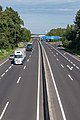
 A7 Treffling Pannenstreifen Autobusse.jpg 2,655 × 1,764; 4.73 MB
-
 Achtung Hochwasserfurt.jpg 3,578 × 2,389; 3.23 MB
-
 Am Fünfundzwanziger Turm - Gallanderstraße.jpg 2,750 × 1,627; 592 KB
-
 Anfahrt zu den wichtigsten Städten - panoramio.jpg 3,648 × 2,432; 2.75 MB
-
 Ansfelden Autobahndreieck-1020.jpg 4,482 × 2,988; 8.74 MB
-
 B127 Vorrangstraße.jpg 1,031 × 1,375; 240 KB
-
 B38 Bad Leonfeldner Straße, Abzweigung Gewerbegebiet.jpg 5,000 × 2,871; 7.45 MB
-
 Bahnhof Engelhof Halle Aussenansicht.jpg 8,256 × 5,504; 9.24 MB
-
 Bahnhof Timelkam EK Unterau.JPG 4,511 × 3,011; 4.58 MB
-
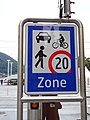
 Begegnungszone Gmunden.jpg 5,838 × 3,892; 5.64 MB
-
 Begegnungszone Schild.jpg 3,888 × 5,184; 4.09 MB
-
 Begegnungszone.jpg 3,888 × 5,184; 5.47 MB
-
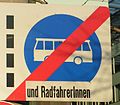 Binnen-i-radfahrerinnen.jpg 1,600 × 1,400; 170 KB
-
 Bus routing road sign, Hallstatt.jpg 1,070 × 1,683; 1.29 MB
-
 Canongasse.jpg 2,484 × 1,863; 1.08 MB
-
 Crossing L110 - L5017, near Wetzmannsthal.jpg 3,128 × 4,792; 5.78 MB
-
 Drosing Street Sign.JPG 1,600 × 1,200; 506 KB
-
 Erdmannsdorf EK 25.025.JPG 3,250 × 2,170; 4.29 MB
-
 Floriani 2017 Bad Leonfelden (34496615476).jpg 6,000 × 4,000; 17.88 MB
-
 Fußgängerzone Altstadt Schild.JPG 2,211 × 3,312; 1.6 MB
-
 Georgenberg Fahrverbot.jpg 1,400 × 2,097; 2.14 MB
-
 Gesunde Gemeinde Bruck-Waasen.JPG 6,016 × 4,016; 9.23 MB
-
 GPS-Verbot, 1.jpeg 1,441 × 2,910; 685 KB
-
 Götzlingstraße - Nöbauerstraße.jpg 802 × 1,070; 112 KB
-
 Güterweg Außertreffling.jpg 2,053 × 2,738; 1.41 MB
-
 Güterweg Oberweidling.JPG 3,974 × 2,653; 4.48 MB
-
 Hallstatt traffic signs.jpg 1,595 × 2,882; 2.65 MB
-
 Hauptplatz Linz.jpg 1,257 × 1,658; 262 KB
-
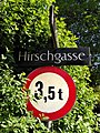 Hirschgasse.jpg 1,518 × 2,024; 1.06 MB
-
 Hohe Straße (2).jpg 1,006 × 1,342; 262 KB
-
 Hopfenweg, Mühlviertel, Bad Leonfelden.jpg 5,000 × 3,333; 12 MB
-
 Industriezeile Bahnübergänge.JPG 3,221 × 2,150; 1.45 MB
-
 Kreuzweg - Ländl. Zufahrtsweg Pösmayr.jpg 1,287 × 1,715; 788 KB
-
 Kubinweg.jpg 1,042 × 782; 291 KB
-
 Kühnestraße.jpg 1,051 × 945; 164 KB
-
 Lachstattstraße.jpg 2,185 × 2,913; 1.03 MB
-
 Lambach Marktplatz Stift.jpg 5,845 × 3,897; 5.52 MB
-
 Linz - Pöstlingberg - Motiv - 2016 03 18 - Schild (1).jpg 3,456 × 5,184; 2.58 MB
-
 Linz Harrachstraße Abbiegeverbot RadfahrerInnen.jpg 5,225 × 3,483; 5.84 MB
-
 Linz Volksgartenstraße Busspur.jpg 5,523 × 3,683; 4.02 MB
-
 Linz Volksgartenstraße Radfahrerüberfahrt Z.jpg 5,493 × 3,704; 5.43 MB
-
 Linzer Straße, Bad Leonfelden - Süd, 04.jpg 5,000 × 2,630; 5.95 MB
-
 Mühlkreisautobahn A7 Knoten Linz-1045.jpg 5,089 × 3,393; 11.24 MB
-
 Niederaching Sackgasse.JPG 4,002 × 2,672; 3.86 MB
-
 No entry sign, Hallstatt tunnel.jpeg 4,032 × 3,024; 2.53 MB
-
 Nöbauerstraße Zugang zu den Häusern.jpg 2,064 × 1,548; 886 KB
-
 Perg-Oberösterreich-Herrenstr-54-Sozialer-Wohnbau.JPG 1,961 × 1,200; 260 KB
-
 Pfeifferstraße.jpg 1,628 × 1,640; 576 KB
-
 Ranshofen-4.JPG 2,560 × 1,920; 521 KB
-
 Rosenauerstraße.jpg 1,373 × 1,362; 256 KB
-
 Rottmayrstraße.jpg 1,482 × 1,975; 633 KB
-
 Roßleithen - Pyhrnautobahn Ausfahrt - 2014 11 14.jpg 4,776 × 3,184; 7.33 MB
-
 Roßleithen - Pyhrnautobahn Roßleithentunnel - 2014 11 14.jpg 4,961 × 3,307; 10.11 MB
-
 Salzburger Str 2 Perwang.jpg 4,000 × 2,852; 2.28 MB
-
 Sattledt B 139-8902.jpg 4,878 × 3,252; 8.89 MB
-
 Sattledt Hauptstraße B122-8895.jpg 5,568 × 3,712; 9.36 MB
-
 Sattledt Voralpenkreuz A1 A8 A9 von Nordwest-8912.jpg 4,982 × 3,321; 7.27 MB
-
 Sattledt Voralpenkreuz A1 A9 von Süden-8905.jpg 5,335 × 3,557; 7.22 MB
-
 Sattledt Voralpenkreuz A1 A9 von Süden-8906.jpg 2,835 × 4,252; 8.36 MB
-
 Schärding - Wegweiserschilder Bahnhofstr.JPG 2,304 × 3,072; 2.65 MB
-
 Stefansdorf Ortsstraße.JPG 3,664 × 2,446; 3.35 MB
-
 Tafel Landesstraße B38, Kreisverkehr in Freistadt, Oberösterreich.jpg 5,000 × 3,153; 4.88 MB
-
 Teichstraße.jpg 1,154 × 1,539; 285 KB
-
 Timelkam - Ort - Linzer Straße - Bildstock - 2017 11 23-1.jpg 4,998 × 3,332; 2.98 MB
-
 Tussen Bad Leonfelden en Studánky wegpanorama IMG 5981 2018-07-29 12.56.jpg 5,232 × 2,632; 7.9 MB
-
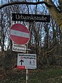 Urbanskistraße.jpg 1,837 × 2,450; 1.37 MB
-

-
 Vöcklabruck - 2017 11 23 - Radweg 1.jpg 3,456 × 5,184; 3.1 MB
-
 Waldneukirchen Kirchenweg-4007.jpg 2,829 × 4,243; 12.42 MB
-
 Wels Dragonerkaserne Hof Mitte Haupttor Säulen.jpg 6,000 × 4,000; 5.35 MB
-
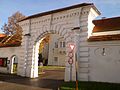
 Wels Dragonerkaserne Osttor.jpg 4,888 × 3,259; 3.84 MB
-
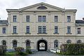
 Wels Dragonerkaserne Südtrakt Haupttor Süd.jpg 6,000 × 4,000; 7.69 MB
-
 Wels Dragonerkaserne Westtor.jpg 3,577 × 5,365; 4.1 MB
-
 Wien & Salzburg ! (8167911950).jpg 2,586 × 1,867; 1.41 MB
-
 WMB 20230722 Kefermarkt 9981.jpg 6,450 × 4,361; 21.8 MB
-
 Zaubertalstraße 11.jpg 1,349 × 1,012; 234 KB
-
 Zeitlham Wartehäuschen Schulbus-3935.jpg 5,000 × 3,333; 16.4 MB
.jpg)


.jpg)


.jpg)


.jpg)


.jpg)


