Category:Road signs in Montgomery County, New York
Jump to navigation
Jump to search
Counties of New York (state): Albany · Allegany · Broome · Cattaraugus · Cayuga · Chautauqua · Chemung · Chenango · Clinton · Columbia · Cortland · Delaware · Dutchess · Erie · Essex · Franklin · Fulton · Genesee · Greene · Hamilton · Herkimer · Jefferson · Lewis · Livingston · Madison · Monroe · Montgomery · Nassau · Niagara · Oneida · Onondaga · Ontario · Orange · Orleans · Oswego · Otsego · Putnam · Rensselaer · Rockland · Saratoga · Schenectady · Schoharie · Schuyler · Seneca · St. Lawrence · Steuben · Suffolk · Sullivan · Tioga · Tompkins · Ulster · Warren · Washington · Wayne · Westchester · Wyoming · Yates

Media in category "Road signs in Montgomery County, New York"
The following 14 files are in this category, out of 14 total.
-
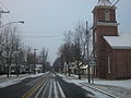
 Church Street Canajoharie.JPG 2,523 × 1,758; 1.18 MB
-
 Montgomery County 104 NY reference marker.svg 200 × 200; 10 KB
-
 Montgomery County 57 NY reference marker.svg 200 × 200; 10 KB
-
 NY 160 at Montgomery County line.jpg 2,048 × 1,536; 956 KB
-
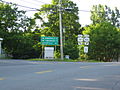
 NY 161W approaching NY 30A in Glen.jpg 2,816 × 2,112; 516 KB
-
 NY 163E approaching NY 10.jpg 1,024 × 768; 176 KB
-
 NY 288 at NY 5S.jpg 1,024 × 768; 181 KB
-
 NY 30A at NY 161.jpg 1,600 × 1,200; 755 KB
-
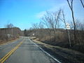
 NY 331 becoming CR 57.jpg 2,048 × 1,536; 705 KB
-
 NY 334 at Fulton-Montgomery county line.jpg 2,048 × 1,536; 770 KB
-
 NY 80 at NY 163.jpg 640 × 480; 45 KB
-
 NY163atNY80.jpg 1,932 × 2,576; 1.76 MB
-
 NY30A north in Fonda.jpg 5,152 × 3,864; 4.43 MB
-
 Route 10 Canajoharie Switchback.JPG 1,651 × 1,257; 543 KB


