Category:Road signs in Lancashire
Jump to navigation
Jump to search
Ceremonial counties of England: Bedfordshire · Berkshire · Buckinghamshire · Cambridgeshire · Cheshire · Cornwall · Cumbria · Derbyshire · Devon · Dorset · Durham · East Riding of Yorkshire · East Sussex · Essex · Gloucestershire · Greater London · Greater Manchester · Hampshire · Herefordshire · Hertfordshire · Kent · Lancashire · Leicestershire · Lincolnshire · Merseyside · Norfolk · North Yorkshire · Northamptonshire · Northumberland · Nottinghamshire · Oxfordshire · Rutland · Shropshire · Somerset · South Yorkshire · Staffordshire · Suffolk · Surrey · Tyne and Wear · Warwickshire · West Midlands · West Sussex · West Yorkshire · Wiltshire · Worcestershire
City-counties: City of London
Former historic counties:
Other former counties:
City-counties: City of London
Former historic counties:
Other former counties:
Subcategories
This category has the following 4 subcategories, out of 4 total.
Media in category "Road signs in Lancashire"
The following 36 files are in this category, out of 36 total.
-
 32 ton weight limit, Wrightington, Lancs..jpg 4,608 × 2,304; 3.94 MB
-
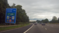
 A56 Slip Road Signs - geograph.org.uk - 1015052.jpg 640 × 480; 85 KB
-
 Bacup Centre - geograph.org.uk - 462762.jpg 640 × 480; 104 KB
-
 St Anne's Catholic Church, Blackburn, Lancashire 02.jpg 2,048 × 1,536; 1.46 MB
-
 Blackpool United Hebrew Synagogue 2.JPG 2,976 × 3,968; 6.3 MB
-
 Blackpool United Hebrew Synagogue 254.jpg 2,560 × 1,920; 1.25 MB
-
 Blackpool United Hebrew Synagogue 3.jpg 3,968 × 2,976; 6.26 MB
-
 Public house with church - geograph.org.uk - 273818.jpg 640 × 480; 75 KB
-
 Buck Inn, Clitheroe - geograph.org.uk - 648427.jpg 640 × 480; 177 KB
-
 Post Office in Caton, Lancs. (3066020163).jpg 1,280 × 960; 172 KB
-
 St John's Church, Coppull.jpg 640 × 481; 295 KB
-
 Donkey Danger at Blackpool - geograph.org.uk - 2380726.jpg 480 × 640; 44 KB
-
 Edenfield Boundary - geograph.org.uk - 371702.jpg 640 × 480; 61 KB
-
 Haddings Lane - geograph.org.uk - 1141135.jpg 640 × 454; 65 KB
-

-
 Hunger Hill, Wrightington - geograph.org.uk - 23722.jpg 640 × 480; 129 KB
-
 Lancaster Services Sign.png 1,920 × 1,080; 1.5 MB
-
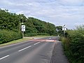 Leaving Staining on Chain Lane - geograph.org.uk - 1394619.jpg 640 × 480; 123 KB
-
 New Roundabout A682 Rawtenstall - geograph.org.uk - 752241.jpg 640 × 480; 72 KB
-
 Old road sign - geograph.org.uk - 653329.jpg 640 × 522; 319 KB
-
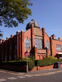
 Bridge House (St Luke's Church) - geograph.org.uk - 671607.jpg 480 × 640; 138 KB
-
 Bridge House (St Luke's Church) - geograph.org.uk - 671620.jpg 640 × 480; 171 KB
-
 Preston-on-a-rainy-day-1.JPG 1,440 × 1,109; 184 KB
-
 Former Moor Park Methodist Church, Preston.jpg 3,518 × 2,152; 3.57 MB
-
 The Antiques Centre - Garstang Road - geograph.org.uk - 529645.jpg 640 × 389; 34 KB
-
 Road sign, A587, Fleetwood - DSC06543.JPG 3,648 × 2,736; 3.61 MB
-
 St. Andrew's Church, Slaidburn - geograph.org.uk - 874587.jpg 640 × 448; 126 KB
-
 Starr Gate sign, Blackpool - DSC07108.JPG 3,648 × 2,736; 3.58 MB
-
 Church Wall Detail - geograph.org.uk - 475052.jpg 640 × 480; 127 KB
-
 Little Town Dairy - geograph.org.uk - 102622.jpg 640 × 426; 203 KB
-
 Montague Street Sign - geograph.org.uk - 476267.jpg 613 × 640; 142 KB
-
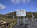
 Public Information Sign - geograph.org.uk - 676167.jpg 600 × 640; 96 KB
-
 Roeburndale - geograph.org.uk - 120356.jpg 640 × 480; 102 KB
-
 Scronkey - geograph.org.uk - 97708.jpg 640 × 426; 162 KB
-

-
 Welcome to Belmont - geograph.org.uk - 302666.jpg 640 × 425; 71 KB


.jpg)


_-_geograph.org.uk_-_671607.jpg)
_-_geograph.org.uk_-_671620.jpg)


