Category:Road maps of Norway
Jump to navigation
Jump to search
Countries of Europe: Albania · Andorra · Armenia‡ · Austria · Azerbaijan‡ · Belarus · Belgium · Bosnia and Herzegovina · Bulgaria · Croatia · Czech Republic · Estonia · Finland · France‡ · Georgia‡ · Germany · Greece · Hungary · Iceland · Republic of Ireland · Italy · Kazakhstan‡ · Latvia · Lithuania · Luxembourg · Moldova · Montenegro · Netherlands‡ · North Macedonia · Norway · Poland · Portugal‡ · Romania · Russia‡ · Serbia · Slovakia · Slovenia · Spain‡ · Sweden · Switzerland · Turkey‡ · Ukraine · United Kingdom
Limited recognition: Kosovo
‡: partly located in Europe
Limited recognition: Kosovo
‡: partly located in Europe
Subcategories
This category has the following 20 subcategories, out of 20 total.
Media in category "Road maps of Norway"
The following 43 files are in this category, out of 43 total.
-
 Blank map of Europe cropped - E10.svg 645 × 690; 524 KB
-
 Blank map of Europe cropped - E12.svg 645 × 690; 525 KB
-
 Blank map of Europe cropped - E134.svg 645 × 690; 523 KB
-
 Blank map of Europe cropped - E136.svg 645 × 690; 523 KB
-
 Blank map of Europe cropped - E14.svg 645 × 690; 523 KB
-
 Blank map of Europe cropped - E16-2011.svg 645 × 690; 525 KB
-
 Blank map of Europe cropped - E16.svg 645 × 690; 524 KB
-
 Blank map of Europe cropped - E18.svg 645 × 690; 525 KB
-
 Blank map of Europe cropped - E39.svg 645 × 690; 524 KB
-
 Blank map of Europe cropped - E6.svg 645 × 690; 523 KB
-
 Blank map of Europe cropped - E69.svg 645 × 690; 523 KB
-
 Blank map of Europe cropped - E8.svg 645 × 690; 524 KB
-
 Blank map of Europe cropped1 - E134.svg 645 × 690; 523 KB
-
 Blank map of Europe cropped1 - E136.svg 645 × 690; 523 KB
-
 Blank map of Europe cropped1 - E69.svg 645 × 690; 526 KB
-
 Blue Highway.svg 1,052 × 602; 108 KB
-
 Blå vägen.svg 1,052 × 602; 98 KB
-
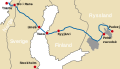
 E10 route.svg 401 × 420; 101 KB
-
 E10.jpg 560 × 599; 66 KB
-
 E105 route.svg 401 × 420; 101 KB
-
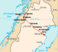
 E134Oppgraderinger.png 750 × 450; 527 KB
-
 E39 route.jpg 560 × 599; 66 KB
-
 E6 Ringebu-Otta oversikt.png 1,816 × 526; 1.12 MB
-
 E75 Norway.png 1,170 × 698; 475 KB
-
 E75 route.svg 401 × 420; 102 KB
-
 FV311(Hordaland).svg 1,433 × 600; 567 KB
-
 Map Rv70.svg 956 × 694; 280 KB
-
 Motorveier-i-Norge.png 466 × 570; 74 KB
-
 Motorways Norway.svg 1,912 × 2,992; 1.92 MB
-
 Norges nasjonale transportnett.gif 700 × 709; 77 KB
-
 Norske motorveier og motortrafikkveier 2014.png 709 × 595; 190 KB
-
 Plan over de vigtigste af Norges Hoved- og Bi-Weie - no-nb krt 00623.jpg 5,714 × 8,676; 15.66 MB
-
 Silvervägen.png 326 × 294; 16 KB
-
 Stamvegnett pr 2002.png 2,556 × 3,082; 568 KB
-
 Stamveier Norge.svg 9,039 × 11,324; 557 KB
-
 Trollheimstunnelen.png 579 × 653; 144 KB
-
 Veikart over Norge (14553369241).jpg 1,834 × 2,048; 705 KB
-
 Veikart over Norge - no-nb krt 00621.jpg 6,380 × 8,804; 19.99 MB
-
 Veikart over Norge - no-nb krt 00709.jpg 11,180 × 7,976; 23.41 MB
-
 Veikart over Norge - no-nb krt 00710.jpg 10,974 × 7,768; 23.85 MB
-
 Veikart over Norge - no-nb krt 00731.jpg 10,756 × 8,654; 26.62 MB
-
 Veikart over Norge - no-nb krt 00732.jpg 9,217 × 7,471; 24.66 MB
-
 Veikart over Norge. Sydlige Deel. (Coloreret) - no-nb krt 00834.jpg 11,122 × 8,889; 26.04 MB


.svg)


.jpg)


_-_no-nb_krt_00834.jpg)