Category:Road maps of Hong Kong
Jump to navigation
Jump to search
有關香港地方的zh:路線圖
Pages in category "Road maps of Hong Kong"
This category contains only the following page.
Media in category "Road maps of Hong Kong"
The following 17 files are in this category, out of 17 total.
-
 0 HK TST Nathan Road Minibus 78 Road map.JPG 1,200 × 1,600; 1.11 MB
-
 HK Disneyland Resort Shuttle Bus 穿梭巴士 時間表 Time Schedule 路線圖 Roadmap.JPG 1,200 × 1,600; 1.18 MB
-
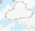
 HK Route1 map coloured.svg 512 × 512; 5.09 MB
-
 HK Route10 map coloured.svg 512 × 448; 4.49 MB
-
 HK Route11 map coloured.svg 512 × 448; 4.31 MB
-
 HK Route2 map coloured.svg 512 × 512; 5.02 MB
-
 HK Route3 map coloured.svg 512 × 448; 4.78 MB
-
 HK Route4 map coloured.svg 512 × 512; 5.32 MB
-
 HK Route5 map coloured.svg 512 × 512; 5.32 MB
-
 HK Route6 map coloured.svg 512 × 512; 4.35 MB
-
 HK Route7 map coloured.svg 512 × 512; 5.06 MB
-
 HK Route8 map coloured.svg 512 × 448; 4.87 MB
-
 HK Route9 map coloured.svg 512 × 448; 5.79 MB
-
 HK TST Ashley Road Green Minibus Route 3 roadmap.JPG 1,200 × 1,600; 1.11 MB
-
 Hong Kong Expressway map.svg 512 × 384; 2.6 MB
-
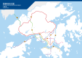
 Hong Kong Strategic Route Map coloured retouched.svg 512 × 384; 4.19 MB
-
 Hong Kong Strategic Route Map coloured zh.svg 1,191 × 842; 151 KB


