Category:River Beauly
Jump to navigation
Jump to search
English: The River Beauly (Scottish Gaelic: Abhainn nam Manach) is a river in the Scottish Highlands, about 15 km west of the city of Inverness.
river in Highland, Scotland, UK, flows into the Moray Firth  | |||||
| Upload media | |||||
| Instance of | |||||
|---|---|---|---|---|---|
| Location | Highland, Scottish Highlands, Scotland | ||||
| Length |
| ||||
| Origin of the watercourse |
| ||||
| Mouth of the watercourse |
| ||||
| Tributary | |||||
 | |||||
Subcategories
This category has the following 4 subcategories, out of 4 total.
A
- Aigas Power Station (8 F)
E
- Eilean Aigas (12 F)
K
- Kilmorack Power Station (7 F)
L
- Lovat Bridge (10 F)
Media in category "River Beauly"
The following 39 files are in this category, out of 39 total.
-
 A glimpse of the River Beauly - geograph.org.uk - 1534472.jpg 640 × 480; 133 KB
-
 A stretch of the River Beauly - geograph.org.uk - 1533507.jpg 640 × 480; 69 KB
-
 Aigas field centre and golf course. - geograph.org.uk - 1041985.jpg 3,500 × 2,333; 6.44 MB
-
 Aigas Power Station PH-1.jpg 640 × 480; 97 KB
-
 Aigas Rocks - geograph.org.uk - 993496.jpg 612 × 640; 136 KB
-

-
 Beauly River - geograph.org.uk - 853047.jpg 426 × 640; 54 KB
-
 Beauly Viaduct - geograph.org.uk - 2961129.jpg 3,000 × 2,020; 1.87 MB
-
 Bend in the river - geograph.org.uk - 589021.jpg 640 × 480; 96 KB
-
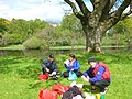
 Canoe on the River Beauly at Aigas - geograph.org.uk - 5484556.jpg 1,024 × 682; 186 KB
-

-
 Downstream Beauly River - geograph.org.uk - 1531499.jpg 640 × 480; 89 KB
-
 Hut At The Bank - panoramio.jpg 3,932 × 2,909; 6.86 MB
-
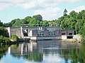 Kilmorack Power Station PH-1.jpg 640 × 480; 106 KB
-
 Kilmorack power station, near Beauly.jpg 640 × 424; 81 KB
-
 Looking across the River Beauly - geograph.org.uk - 208327.jpg 640 × 480; 345 KB
-
 Looking down the River Beauly - geograph.org.uk - 208323.jpg 640 × 480; 328 KB
-
 Mula River at Malinga Ghat Aundh.jpg 1,600 × 900; 319 KB
-
 River Beauly - geograph.org.uk - 104963.jpg 640 × 480; 65 KB
-
 River Beauly - geograph.org.uk - 1532841.jpg 640 × 480; 78 KB
-
 River Beauly and Aigas golf course - geograph.org.uk - 1160401.jpg 640 × 480; 156 KB
-
 River Beauly at Beauly - geograph.org.uk - 1802910.jpg 800 × 534; 195 KB
-
 River Beauly at Beauly - geograph.org.uk - 1802913.jpg 800 × 533; 84 KB
-
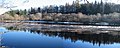
 River Beauly at Erchless - geograph.org.uk - 1007023.jpg 640 × 426; 93 KB
-
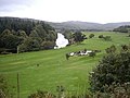
 River Beauly below Dun Fionn - geograph.org.uk - 1533065.jpg 640 × 480; 103 KB
-
 River Beauly by A831 - geograph.org.uk - 1534417.jpg 640 × 480; 87 KB
-
 River Beauly near Wester Lovat - geograph.org.uk - 178175.jpg 640 × 480; 72 KB
-
 River Beauly, looking upstream - geograph.org.uk - 928534.jpg 640 × 480; 235 KB
-

-
 The Cruives on the Beauly River - geograph.org.uk - 87287.jpg 640 × 480; 265 KB
-
 The River Beauly - panoramio (1).jpg 3,240 × 4,320; 6.64 MB
-
 The River Beauly - panoramio (2).jpg 4,000 × 3,000; 5.54 MB
-
 The River Beauly - panoramio.jpg 4,320 × 3,240; 4.98 MB
-
 The River Beauly at a High Spring Tide (geograph 4837039).jpg 1,600 × 1,199; 698 KB
-
 Upstream River Beauly - geograph.org.uk - 1531504.jpg 640 × 480; 78 KB
-
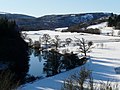
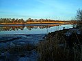
 Winter reflections in the River Beauly - geograph.org.uk - 1719700.jpg 1,600 × 636; 347 KB
-
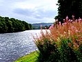
 Banks of the Beauly - geograph.org.uk - 446336.jpg 640 × 480; 142 KB
-
 River Beauly - geograph.org.uk - 693820.jpg 640 × 360; 31 KB
-
 River Beauly before it enters the sea - geograph.org.uk - 354266.jpg 640 × 480; 50 KB


.png)


.jpg)
.jpg)

.jpg)


