Category:Rittergut (Schlottenhof)
Jump to navigation
Jump to search
| Object location | | View all coordinates using: OpenStreetMap |
|---|
Media in category "Rittergut (Schlottenhof)"
The following 19 files are in this category, out of 19 total.
-
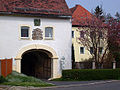 Rittergut Schlottenhof.jpg 640 × 480; 117 KB
-
 Schlottenhof - Rittergut - 01.jpg 4,458 × 2,953; 10.71 MB
-
 Schlottenhof - Rittergut - 02.jpg 4,522 × 2,996; 12.67 MB
-
 Schlottenhof - Rittergut - 03.jpg 4,799 × 3,180; 13.21 MB
-
 Schlottenhof - Rittergut - 04.jpg 4,758 × 3,153; 9.25 MB
-
 Schlottenhof - Rittergut - 05.jpg 4,358 × 2,886; 10.44 MB
-
 Schlottenhof - Rittergut - 06.jpg 4,700 × 3,115; 11.68 MB
-
 Schlottenhof - Rittergut - 07.jpg 4,566 × 3,025; 9.37 MB
-
 Schlottenhof - Rittergut - 08.jpg 4,756 × 3,150; 10.09 MB
-
 Schlottenhof - Rittergut - 09.jpg 4,821 × 3,192; 11.64 MB
-
 Schlottenhof - Rittergut - 10.jpg 2,700 × 4,076; 7.99 MB
-
 Schlottenhof - Rittergut - 11.jpg 2,599 × 3,924; 6.5 MB
-
 Schlottenhof - Rittergut - 12.jpg 2,608 × 2,608; 6.69 MB
-
 Schlottenhof - Rittergut - 13.jpg 3,061 × 3,061; 8.87 MB
-
 Schlottenhof - Rittergut - 14.jpg 2,623 × 3,961; 6.9 MB
-
 Schlottenhof - Rittergut - 15.jpg 4,266 × 2,826; 8.99 MB
-
 Schlottenhof - Rittergut - 16.jpg 2,760 × 4,167; 10.27 MB
-
 Schlottenhof - Rittergut - 17.jpg 3,922 × 2,598; 7.19 MB
-
 Schlottenhof - Rittergut - 18.jpg 3,023 × 4,564; 9.8 MB


