Category:Riccarton (civil parish)
Jump to navigation
Jump to search
Scottish parish in East Ayrshire, Scotland, UK | |||||
| Upload media | |||||
| Instance of | |||||
|---|---|---|---|---|---|
| Part of |
| ||||
| Named after | |||||
| Location |
| ||||
| Population |
| ||||
| Area |
| ||||
 | |||||
Subcategories
This category has the following 2 subcategories, out of 2 total.
H
R
Media in category "Riccarton (civil parish)"
The following 200 files are in this category, out of 303 total.
(previous page) (next page)-
 A bend to the right - geograph.org.uk - 6117439.jpg 2,000 × 1,246; 2.05 MB
-

-
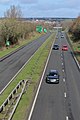
 A71 at Riccarton - geograph.org.uk - 1860441.jpg 640 × 480; 50 KB
-
 A71 east from the river bridge - geograph.org.uk - 3475537.jpg 640 × 411; 48 KB
-
 A71 in Hurlford - geograph.org.uk - 1860451.jpg 640 × 480; 54 KB
-

-
 A71 River crossing - geograph.org.uk - 3156478.jpg 640 × 426; 68 KB
-
 A71 roundabout at service area - geograph.org.uk - 3475627.jpg 640 × 420; 55 KB
-
 A71, Hurlford Road, near Kilmarnock - geograph.org.uk - 6384605.jpg 800 × 601; 347 KB
-
 A719 near Crossroads - geograph.org.uk - 2835747.jpg 3,541 × 2,197; 5.22 MB
-
 A719, Bridge crossing Cessnock Water - geograph.org.uk - 2005421.jpg 1,600 × 1,163; 368 KB
-
 A735 on a wet Sunday evening - geograph.org.uk - 4670226.jpg 3,264 × 1,836; 1.75 MB
-
 A76 crossing Cessnock Water - geograph.org.uk - 3475650.jpg 640 × 305; 49 KB
-
 A76 near Kilmarnock - geograph.org.uk - 2912509.jpg 3,748 × 2,811; 7.05 MB
-

-

-
 A76 west of HMP Kilmarnock - geograph.org.uk - 3523206.jpg 640 × 481; 65 KB
-
 A76 west of Hurlford - geograph.org.uk - 3523209.jpg 640 × 481; 64 KB
-
 A76, Bridge at Cessnock Water - geograph.org.uk - 2919363.jpg 2,825 × 2,248; 4.79 MB
-
 A77 Bridges - geograph.org.uk - 4243901.jpg 640 × 426; 61 KB
-
 A77 Kilmarnock - geograph.org.uk - 2424981.jpg 640 × 480; 41 KB
-
 A77 Kilmarnock Bypass - geograph.org.uk - 3900942.jpg 5,184 × 3,456; 6.88 MB
-
 A77 Kilmarnock Bypass - geograph.org.uk - 3900953.jpg 800 × 1,200; 275 KB
-
 A77 south from A76 junction - geograph.org.uk - 3993464.jpg 640 × 450; 40 KB
-
 Academy Street, Hurlford - geograph.org.uk - 4703194.jpg 1,920 × 1,280; 1.28 MB
-
 Approaching the B7038 - geograph.org.uk - 6060171.jpg 2,976 × 1,984; 2.67 MB
-
 Approaching the Junction for Kilmarnock ^ Caprington - geograph.org.uk - 3994088.jpg 1,920 × 1,280; 1.11 MB
-
 Arnold Clark Ford Transit Centre - Kilmarnock - geograph.org.uk - 6026725.jpg 1,600 × 1,067; 1.3 MB
-
 Arriving at Crookedholm - geograph.org.uk - 4703079.jpg 1,920 × 1,280; 1.15 MB
-
 Arriving at Earlston - geograph.org.uk - 3994271.jpg 1,920 × 1,280; 1.58 MB
-
 Arriving at Hurlford - geograph.org.uk - 4703113.jpg 1,920 × 1,280; 1.23 MB
-
 Arriving at Kilmarnock - geograph.org.uk - 6060183.jpg 2,976 × 1,984; 1.26 MB
-
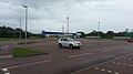
 Asda - Kilmarnock - geograph.org.uk - 6026603.jpg 1,600 × 1,067; 1.12 MB
-
 Asda Car Park - geograph.org.uk - 2502731.jpg 640 × 480; 50 KB
-
 Asda Petrol Station - Kilmarnock - geograph.org.uk - 6026601.jpg 1,600 × 1,067; 1.26 MB
-
 Asda Superstore - geograph.org.uk - 2502739.jpg 1,600 × 1,200; 416 KB
-
 Asda Superstore - geograph.org.uk - 2769178.jpg 1,600 × 1,200; 394 KB
-
 ASDA Superstore, Kilmarnock - geograph.org.uk - 3613256.jpg 1,920 × 1,280; 1.15 MB
-
 Asda, Kilmarnock - geograph.org.uk - 5596666.jpg 2,592 × 1,728; 1.68 MB
-

-
 Ayr Road, Kilmarnock - geograph.org.uk - 3993921.jpg 1,920 × 1,280; 1.34 MB
-
 Ayr Road, Kilmarnock - geograph.org.uk - 3994013.jpg 1,920 × 1,280; 1.32 MB
-
 Ayrshire Athletics Arena - geograph.org.uk - 4670221.jpg 3,264 × 1,836; 1.54 MB
-
 Ayrshire Weather, Panorama - geograph.org.uk - 2880457.jpg 3,748 × 1,030; 2.31 MB
-
 B7038 looking south-west - geograph.org.uk - 3523238.jpg 640 × 481; 45 KB
-

-
 B7072 and A735 junction - geograph.org.uk - 5063734.jpg 640 × 491; 55 KB
-
 Beech Trees and Track - geograph.org.uk - 2835172.jpg 2,811 × 3,748; 6.23 MB
-
 Black Cloud over Queens Drive Retail Park, Kilmarnock - geograph.org.uk - 5762178.jpg 2,927 × 1,906; 553 KB
-
 Bridge over Simon's Burn - geograph.org.uk - 6060165.jpg 2,976 × 1,984; 3.44 MB
-
 Bridgehouse bridge over A77 - geograph.org.uk - 3993470.jpg 640 × 342; 40 KB
-
 Builder's Skips, Kilmarnock - geograph.org.uk - 6060215.jpg 2,976 × 1,984; 3.03 MB
-
 Burger King - Kilmarnock - geograph.org.uk - 6026715.jpg 1,600 × 1,067; 1.26 MB
-
 Burger King, Kilmarnock - geograph.org.uk - 4924023.jpg 1,874 × 1,236; 347 KB
-
 Bus stop at Crossroads roundabout - geograph.org.uk - 3475648.jpg 640 × 386; 35 KB
-
 B^m at Queens Drive Retail Park, Kilmarnock - geograph.org.uk - 5517432.jpg 2,592 × 1,728; 1.73 MB
-
 B^M, Kilmarnock - geograph.org.uk - 5596665.jpg 2,486 × 1,642; 477 KB
-
 B^Q at Queens Drive Retail Park, Kilmarnock - geograph.org.uk - 5517423.jpg 2,592 × 1,728; 1.63 MB
-
 B^Q Superstore - geograph.org.uk - 2769174.jpg 1,600 × 1,200; 387 KB
-
 B^Q, Kilmarnock - geograph.org.uk - 5596662.jpg 2,592 × 1,728; 1.51 MB
-
 B^Q, Kilmarnock - geograph.org.uk - 6249801.jpg 2,901 × 1,896; 736 KB
-
 Campbell Street, Kilmarnock - geograph.org.uk - 1846880.jpg 640 × 480; 49 KB
-
 Campbell Street, Kilmarnock - geograph.org.uk - 5596635.jpg 2,592 × 1,728; 2.68 MB
-
 Campbell Street, Kilmarnock - geograph.org.uk - 5596638.jpg 2,376 × 1,728; 918 KB
-
 Caprington Avenue Kilmarnock - geograph.org.uk - 1866721.jpg 2,272 × 1,704; 860 KB
-
 Caprington Avenue, Kilmarnock - geograph.org.uk - 3506299.jpg 640 × 472; 112 KB
-
 Caprington Avenue, Kilmarnock - geograph.org.uk - 3506301.jpg 640 × 423; 81 KB
-
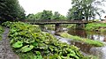
 Caprington Bridge and Bridge Lodge, River Irvine, Riccarton.jpg 1,920 × 1,080; 1.05 MB
-
 Caprington Bridge crossing, River Irvine, Riccarton, East Ayrshire.jpg 1,920 × 1,080; 1.05 MB
-
 Caprington Bridge, ornamental lamp standard, Riccarton.jpg 1,920 × 1,080; 1.11 MB
-
 Caprington Bridge, River Irvine, Riccarton, East Ayrshire.jpg 1,920 × 1,080; 1.04 MB
-
 Caprington Golf Course - geograph.org.uk - 6060200.jpg 2,903 × 1,867; 1,024 KB
-
 Caprington Golf Course - geograph.org.uk - 6060203.jpg 2,976 × 1,984; 4.66 MB
-
 Caprington Golf Course - geograph.org.uk - 6060205.jpg 2,976 × 1,984; 2.3 MB
-
 Castle Hill, Caprington, East Ayrshire, Scotland.jpg 4,896 × 2,752; 3.35 MB
-
 Cattle, Caprington - geograph.org.uk - 3706629.jpg 640 × 345; 187 KB
-
 Cessnock Water east of Hurlford - geograph.org.uk - 3689047.jpg 5,184 × 3,456; 7.63 MB
-
 Chris Hoy Cycle Way - geograph.org.uk - 3689038.jpg 1,600 × 1,067; 811 KB
-
 Chris Hoy Cycle Way - geograph.org.uk - 3689041.jpg 1,600 × 1,067; 449 KB
-
 Chris Hoy Cycle Way - geograph.org.uk - 4018237.jpg 1,600 × 1,067; 659 KB
-
 Chris Hoy Cycle Way - geograph.org.uk - 4018302.jpg 1,600 × 1,067; 481 KB
-
 Clock Tower, Riccarton Parish Church - geograph.org.uk - 5596617.jpg 1,728 × 2,592; 1.43 MB
-
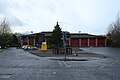
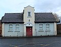 Community Centre, Riccarton - geograph.org.uk - 5596645.jpg 2,178 × 1,688; 587 KB
-
 Construction Site, Kilmarnock - geograph.org.uk - 6060212.jpg 2,976 × 1,984; 3.07 MB
-
 Craigie Road - geograph.org.uk - 5306743.jpg 640 × 412; 63 KB
-

-
 Crossroads roundabout on A76 - geograph.org.uk - 3475645.jpg 640 × 330; 39 KB
-
 Cycling Near Caprington - geograph.org.uk - 5302668.jpg 640 × 425; 77 KB
-

-
 Derelict cottage - geograph.org.uk - 2919257.jpg 640 × 426; 99 KB
-
 DeWaldens Garden Centre, Kilmarnock - geograph.org.uk - 3994025.jpg 1,920 × 1,280; 1.13 MB
-
 DeWaldens Garden Centre, Kilmarnock - geograph.org.uk - 6060196.jpg 2,976 × 1,984; 2.49 MB
-
 Dismantled Railway east of Hurlford - geograph.org.uk - 3689120.jpg 1,600 × 1,067; 614 KB
-
 Earlston by Kilmarnock - geograph.org.uk - 2835174.jpg 3,592 × 2,215; 5.75 MB
-

-
 Entering Kilmarnock - geograph.org.uk - 1846834.jpg 640 × 480; 78 KB
-
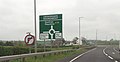
 Exit for Kilmarnock from Riccarton - geograph.org.uk - 3475542.jpg 640 × 380; 37 KB
-

-
 Farm Track at Earlston - geograph.org.uk - 3994276.jpg 1,920 × 1,280; 1.18 MB
-
 Farm Track to Crossroads - geograph.org.uk - 2922348.jpg 640 × 480; 95 KB
-
 Farmland at Ditton - geograph.org.uk - 6060175.jpg 2,976 × 1,984; 3.35 MB
-
 Farmland at Kilmarnock - geograph.org.uk - 6060189.jpg 2,976 × 1,984; 4.07 MB
-
 Farmland at Kilmarnock - geograph.org.uk - 6060190.jpg 2,976 × 1,984; 3.83 MB
-
 Farmland near Ditton - geograph.org.uk - 3994060.jpg 1,920 × 1,280; 1.54 MB
-
 Farmland near Earlston - geograph.org.uk - 3994262.jpg 1,906 × 1,280; 367 KB
-
 Farmland near Galston from the air - geograph.org.uk - 5395451.jpg 640 × 414; 103 KB
-
 Farmland near Inchbean - geograph.org.uk - 4924033.jpg 1,920 × 1,280; 1.05 MB
-
 Farmland near Kilmarnock - geograph.org.uk - 6060177.jpg 2,976 × 1,984; 2.72 MB
-
 Farmland near Overland Farms - geograph.org.uk - 2914974.jpg 3,748 × 2,811; 7.07 MB
-
 Farmland near Scargie - geograph.org.uk - 4924035.jpg 1,920 × 1,280; 349 KB
-
 Farmland near West Overland - geograph.org.uk - 2914815.jpg 3,748 × 2,811; 4.21 MB
-
 Farmland near West Overland - geograph.org.uk - 2922341.jpg 3,748 × 2,811; 4.45 MB
-
 Farmland, Trees Farm - geograph.org.uk - 2880444.jpg 3,748 × 2,811; 6.45 MB
-
 Field and houses at Crossroads - geograph.org.uk - 2835763.jpg 3,270 × 1,943; 4.36 MB
-
 Field near Gatehead Farm - geograph.org.uk - 2878806.jpg 3,508 × 2,527; 5.12 MB
-
 Fields and Woods Near Kilmarnock - geograph.org.uk - 5302674.jpg 640 × 426; 69 KB
-
 Fire Engine at ASDA, Kilmarnock - geograph.org.uk - 3613369.jpg 1,920 × 1,280; 1,010 KB
-
 Fire Engine at ASDA, Kilmarnock - geograph.org.uk - 3613380.jpg 1,920 × 1,280; 1.03 MB
-
 Fire Station, Kilmarnock - geograph.org.uk - 5596632.jpg 2,592 × 1,728; 2.37 MB
-
 Fire Station, Kilmarnock - geograph.org.uk - 5596644.jpg 2,474 × 1,651; 731 KB
-
 Fleet Number KC 689 - geograph.org.uk - 6060187.jpg 2,976 × 1,984; 2.21 MB
-
 Former Unionist Church, Mauchline Road, Hurlford - geograph.org.uk - 4018176.jpg 800 × 1,200; 283 KB
-
 Frankie ^ Benny's Kilmarnock - geograph.org.uk - 6026639.jpg 1,600 × 1,067; 1.26 MB
-
 Galston Road, Hurlford - geograph.org.uk - 4703071.jpg 1,920 × 1,280; 1.32 MB
-
 Galston, aerial 2016 - geograph.org.uk - 5087459.jpg 640 × 427; 58 KB
-
 Gated Farm Track near Crossroads - geograph.org.uk - 2912590.jpg 3,748 × 2,811; 7.57 MB
-
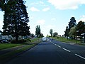
 Grampian Road - geograph.org.uk - 4410697.jpg 800 × 600; 412 KB
-
 Grampian Road, Bellfield, Kilmarnock - geograph.org.uk - 2835477.jpg 3,594 × 2,521; 5.52 MB
-
 Grassland, Inchgotrick - geograph.org.uk - 3706638.jpg 640 × 480; 334 KB
-
 Halfords, Kilmarnock - geograph.org.uk - 5596637.jpg 2,592 × 1,728; 2.41 MB
-
 Heading east on the A71 in Hurlford - geograph.org.uk - 5880930.jpg 640 × 481; 59 KB
-
 High Coodham, Riccarton, East Ayrshire, Scotland.jpg 1,858 × 934; 543 KB
-
 Hill of Judgement - geograph.org.uk - 5596600.jpg 1,728 × 2,592; 2.44 MB
-
 History of Riccarton Churchyard - geograph.org.uk - 5596657.jpg 1,728 × 2,592; 3.39 MB
-
 HM Prison Kilmarnock - geograph.org.uk - 2912497.jpg 3,748 × 2,427; 5.55 MB
-
 HM Prison Kilmarnock, aerial 2016 - geograph.org.uk - 5087448.jpg 640 × 427; 46 KB
-
 Hoodston Bridge ^ Cessnock Water - geograph.org.uk - 3689101.jpg 1,600 × 1,067; 510 KB
-
 Hurlford from the air - geograph.org.uk - 5613150.jpg 640 × 480; 160 KB
-
 Hurlford Primary School - geograph.org.uk - 3689024.jpg 5,184 × 3,456; 6.93 MB
-
 Hurlford Road looking west - geograph.org.uk - 3523212.jpg 640 × 481; 75 KB
-
 Hurlford Roundabout - geograph.org.uk - 4703065.jpg 1,920 × 1,280; 1.22 MB
-
 Hurlford Roundabout - geograph.org.uk - 4703179.jpg 1,920 × 1,280; 1.4 MB
-
 Hurlford Roundabout - geograph.org.uk - 4703189.jpg 1,920 × 1,280; 1.34 MB
-
 Inchbean Farm - geograph.org.uk - 2878761.jpg 3,748 × 2,811; 7.14 MB
-
 Inchbean Farm - geograph.org.uk - 4924038.jpg 1,920 × 1,280; 848 KB
-

-
 Kentucky Fried Chicken (KFC) - Kilmarnock - geograph.org.uk - 6026635.jpg 1,600 × 1,067; 1.14 MB
-
 Kilmarnock - 1972 - geograph.org.uk - 2945456.jpg 2,272 × 1,514; 487 KB
-
 Kilmarnock - 1975 - geograph.org.uk - 3233279.jpg 2,272 × 1,514; 531 KB
-
 Kilmarnock Car Breakers, Old Street, Kilmarnock - geograph.org.uk - 4006971.jpg 5,184 × 3,456; 7.72 MB
-
 Kilmarnock from the air - geograph.org.uk - 5613144.jpg 640 × 480; 197 KB
-
 Kilmarnock's B^Q - geograph.org.uk - 5306755.jpg 640 × 364; 73 KB
-
 Knockmarloch Farm, Craigie, Riccarton, Ayrshire.jpg 3,651 × 2,150; 1.89 MB
-
 Kyle Farmland View - geograph.org.uk - 5302663.jpg 640 × 428; 102 KB
-
 Kyle View - geograph.org.uk - 5302671.jpg 640 × 419; 81 KB
-
 Langside Avenue, Shortlees, Kilmarnock - geograph.org.uk - 2687792.jpg 3,748 × 2,811; 7.54 MB
-
 Laputa miners row site, Riccarton, East Ayrshire.jpg 1,920 × 1,080; 975 KB
-
 Lay by on A76 near Barleith - geograph.org.uk - 3475636.jpg 640 × 352; 48 KB
-

-
 Leaving Kilmarnock - geograph.org.uk - 6117442.jpg 2,000 × 1,308; 1.8 MB
-
 Looking towards Bellfield, Kilmarnock - geograph.org.uk - 2878775.jpg 3,748 × 2,811; 7.72 MB
-
 Low Bridge, B7073, Hurlford - geograph.org.uk - 2835708.jpg 2,953 × 2,139; 4.64 MB
-
 Mauchline Road, Hurlford - geograph.org.uk - 4703120.jpg 1,920 × 1,280; 434 KB
-
 Maxholm Farm, River Irvine, Riccarton, East Ayrshire.jpg 1,920 × 1,080; 1.1 MB
-
 Maxholm from the old railway, Riccarton, East Ayrshire.jpg 1,920 × 1,080; 954 KB
-
 Maxholm looking towards, Riccarton, East Ayrshire.jpg 1,920 × 1,080; 848 KB
-
 Maxholm Road, Riccarton, East Ayrshire.jpg 1,920 × 1,080; 679 KB
-

-
 Mini Roundabout at Superstores, Kilmarnock - geograph.org.uk - 3613266.jpg 1,920 × 1,280; 1.15 MB
-
 Minor Road near Earlston - geograph.org.uk - 2835228.jpg 3,748 × 2,811; 6.55 MB
-
 Minor Road near Townend of Caprington - geograph.org.uk - 2835199.jpg 3,748 × 2,811; 6.24 MB
-
 Minor Road to Earlston - geograph.org.uk - 3994048.jpg 1,920 × 1,280; 1.19 MB
-
 Minor Road to Fortacres - geograph.org.uk - 3994078.jpg 1,920 × 1,280; 1.13 MB
-
 Minor Road to the B7038 near Kilmarnock - geograph.org.uk - 3994267.jpg 1,920 × 1,280; 1.17 MB
-
 Minor road, Caprington - geograph.org.uk - 3706631.jpg 640 × 480; 282 KB
-
 New farm buildings, Barleith - geograph.org.uk - 3765589.jpg 640 × 480; 66 KB
-
 New Street, Kilmarnock - geograph.org.uk - 5596587.jpg 2,592 × 1,728; 3.45 MB
-
 Newly Ploughed Field - geograph.org.uk - 2880378.jpg 3,748 × 2,811; 4.57 MB
-
 Next Store - geograph.org.uk - 2769167.jpg 1,600 × 1,200; 460 KB
-
 Odeon - Kilmarnock - geograph.org.uk - 6026646.jpg 1,600 × 1,067; 1.16 MB
-
 Old Maxholm Farm fields looking towards Caprington, Riccarton, East Ayrshire.jpg 1,920 × 1,080; 881 KB
-
 Old Maxholm Farm fields looking towards Riccarton, East Ayrshire.jpg 1,920 × 1,080; 1.03 MB
-

-
 Old mine and plateway site, Riccarton, East Ayrshire, Scotland.jpg 1,920 × 1,080; 826 KB
-
 Old stone building - geograph.org.uk - 2919249.jpg 640 × 426; 97 KB
-
 Old Street, Kilmarnock - geograph.org.uk - 5596595.jpg 2,592 × 1,728; 2.4 MB
-
 Old Street, Kilmarnock - geograph.org.uk - 5596626.jpg 2,592 × 1,728; 2.55 MB
-
 Old Street, Kilmarnock - geograph.org.uk - 5596653.jpg 2,592 × 1,728; 2.11 MB
-

-
 Old Whitehill site and Simon's Burn, Riccarton, East Ayrshire.jpg 1,920 × 1,080; 555 KB
-
 On the A77 slip road - geograph.org.uk - 6117446.jpg 2,000 × 1,413; 3.08 MB
-
 On The Craigie Road - geograph.org.uk - 5306726.jpg 640 × 428; 65 KB
-
 Over bridge at Byre Hill - geograph.org.uk - 3993471.jpg 640 × 481; 54 KB
-
 Parking for Retail Outlets - geograph.org.uk - 5306757.jpg 640 × 341; 54 KB
-
 Passing Howcommon - geograph.org.uk - 6117438.jpg 2,000 × 1,462; 2.1 MB
-
 Pets at Home - Kilmarnock - geograph.org.uk - 6026616.jpg 1,600 × 1,067; 1.11 MB
-
 Play Ground, Shortlees, Kilmarnock - geograph.org.uk - 2692980.jpg 3,748 × 2,235; 6.59 MB
-

-
 Prestwick and Monkton from the air - geograph.org.uk - 5140036.jpg 3,264 × 2,448; 3.99 MB
-
 Queen's Drive, Kilmarnock - geograph.org.uk - 3613274.jpg 1,920 × 1,280; 1.43 MB


_-_Kilmarnock_-_geograph.org.uk_-_6026635.jpg)


&filefrom=Queen%27s+Drive%2C+Kilmarnock+-+geograph.org.uk+-+3613281.jpg#mw-category-media)