Category:Ribblehead
Jump to navigation
Jump to search
Area near the River Ribble in North Yorkshire, England | |||||
| Upload media | |||||
| Location |
| ||||
|---|---|---|---|---|---|
 | |||||
Subcategories
This category has the following 4 subcategories, out of 4 total.
Media in category "Ribblehead"
The following 60 files are in this category, out of 60 total.
-
 40074 approaches Batty Moss Viaduct.jpg 1,024 × 768; 312 KB
-
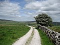 Access Lane from Colt Park - geograph.org.uk - 850325.jpg 640 × 480; 80 KB
-
 Approaching Little Dale Beck - geograph.org.uk - 3210059.jpg 640 × 480; 84 KB
-
 Batty Green, Ribblehead - geograph.org.uk - 3209975.jpg 800 × 600; 95 KB
-
 Batty Moss - geograph.org.uk - 1151907.jpg 640 × 480; 211 KB
-
 Bleak Landscape (21331130488).jpg 5,184 × 3,456; 3.74 MB
-
 Blind Beck, nr. Ribblehead - geograph.org.uk - 1530083.jpg 425 × 640; 58 KB
-
 Blue Clay Ridge - geograph.org.uk - 3210053.jpg 800 × 600; 123 KB
-
 Bunk Barn - geograph.org.uk - 1584808.jpg 388 × 640; 189 KB
-
 Dales Way between Ribbleshead and Sedbergh (9th October 2019) 001.jpg 5,152 × 3,864; 7.03 MB
-
 Down signal on Settle-Carlisle line - geograph.org.uk - 640267.jpg 480 × 640; 56 KB
-
 EIIR Postbox at Ribblehead - geograph.org.uk - 1151328.jpg 480 × 640; 240 KB
-
 Erratic boulder above Thorns Gill - geograph.org.uk - 1237045.jpg 640 × 480; 85 KB
-
 Gauber Limekiln Pasture - geograph.org.uk - 1151281.jpg 640 × 480; 169 KB
-
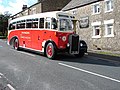 Guy Arab at Ribblehead - geograph.org.uk - 253951.jpg 640 × 480; 129 KB
-
 Hare Gill Beck (1) - geograph.org.uk - 3210026.jpg 800 × 600; 123 KB
-
 Hare Gill Beck (2) - geograph.org.uk - 3210035.jpg 800 × 600; 112 KB
-
 Ice Cream Van at Ribblehead - geograph.org.uk - 2522380.jpg 640 × 427; 225 KB
-
 Ivescar Farm - geograph.org.uk - 3210690.jpg 800 × 600; 104 KB
-

-
 Moorland around Runscar Scar - geograph.org.uk - 846067.jpg 640 × 480; 76 KB
-
 Moorland at Ribblehead Viaduct - geograph.org.uk - 829603.jpg 640 × 431; 50 KB
-
 Next to the viaduct - geograph.org.uk - 1458623.jpg 640 × 480; 107 KB
-
 Northern Dalesman at Ribblehead.jpg 4,000 × 3,000; 902 KB
-

-
 Ordnance Survey Sheet SD 77 Ingleborough Hill, Published 1959.jpg 5,565 × 5,861; 3.5 MB
-
 Passing Colt Park - geograph.org.uk - 850317.jpg 640 × 480; 133 KB
-
 Platelayers trolley - geograph.org.uk - 502482.jpg 478 × 640; 156 KB
-
 Primeval Soup at Ribblehead - geograph.org.uk - 851238.jpg 640 × 480; 123 KB
-
 Railway Bridge at Ribblehead - geograph.org.uk - 1382558.jpg 640 × 480; 74 KB
-
 Railway Signal - geograph.org.uk - 672687.jpg 427 × 640; 187 KB
-
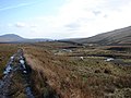
 Railway South of Ribblehead - geograph.org.uk - 851197.jpg 640 × 480; 100 KB
-
 Railway towards Pen-y-ghent - geograph.org.uk - 851206.jpg 640 × 480; 86 KB
-
 Ribblehead (7557373936).jpg 3,272 × 2,568; 1.7 MB
-
 Ribblehead Locomotive Depot and Brickworks - geograph.org.uk - 3209988.jpg 3,072 × 2,304; 2.33 MB
-
 Ribblehead Viaduct Walk 22nd July 2007 - geograph.org.uk - 503151.jpg 640 × 480; 307 KB
-
 Road junction at Ribblehead - geograph.org.uk - 857182.jpg 640 × 480; 53 KB
-
 South of Blea Moor sidings - geograph.org.uk - 3210009.jpg 800 × 600; 139 KB
-
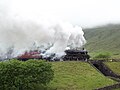 Steam on the Settle to Carlisle Line 7.JPG 4,288 × 3,216; 3.46 MB
-
 Stile at the car park - geograph.org.uk - 1584806.jpg 479 × 640; 211 KB
-
 Thorns Gill - geograph.org.uk - 1206765.jpg 480 × 640; 99 KB
-
 Track across Batty Moss - geograph.org.uk - 1151350.jpg 640 × 480; 219 KB
-
-
 Track on Batty Moss - geograph.org.uk - 1151405.jpg 640 × 480; 231 KB
-
 Track to Ribblehead Viaduct - geograph.org.uk - 3210001.jpg 800 × 600; 115 KB
-
 Train to Carlise (7167678778).jpg 5,184 × 3,456; 12.22 MB
-

-
 View from Station Inn Ribblehead - geograph.org.uk - 1382567.jpg 640 × 480; 64 KB
-
 Viking kitchen - geograph.org.uk - 237343.jpg 640 × 480; 172 KB
-
 Viking longhouse - geograph.org.uk - 816867.jpg 640 × 480; 109 KB
-
 Viking smithy - geograph.org.uk - 237347.jpg 640 × 480; 157 KB
-
 Walker at Ribblehead - geograph.org.uk - 1151260.jpg 640 × 480; 229 KB
-
 Access road to Ribblehead Station - geograph.org.uk - 1151476.jpg 640 × 480; 214 KB
-
 Bridge over the road - geograph.org.uk - 502195.jpg 478 × 640; 127 KB
-
 Limekiln on Batty Moss - geograph.org.uk - 503616.jpg 640 × 480; 198 KB
-
 Limestone outcrop - geograph.org.uk - 502948.jpg 640 × 478; 165 KB
-
 Ribblehead Viaduct Walk 22nd July 2007 - geograph.org.uk - 503172.jpg 640 × 480; 173 KB
-
 Ribblehead Viaduct Walk 22nd July 2007 - geograph.org.uk - 503517.jpg 640 × 480; 171 KB
-
 Ribblehead Viaduct Walk 22nd July 2007 - geograph.org.uk - 503608.jpg 640 × 480; 192 KB
-
 Sheep at Ribblehead - geograph.org.uk - 502964.jpg 640 × 478; 141 KB


.jpg)


_001.jpg)


_-_geograph.org.uk_-_3210026.jpg)
_-_geograph.org.uk_-_3210035.jpg)


.jpg)


.jpg)


