Category:Republic of Ireland photographs taken on 2009-04-11
Jump to navigation
Jump to search
Countries of Europe: Armenia‡ · Austria · Belarus · Belgium · Bosnia and Herzegovina · Bulgaria · Croatia · Czech Republic · Denmark · Estonia · Finland · France‡ · Georgia‡ · Germany · Greece · Hungary · Republic of Ireland · Italy · Latvia · Netherlands‡ · Norway · Poland · Portugal‡ · Romania · Russia‡ · Serbia · Slovakia · Slovenia · Spain‡ · Sweden · Switzerland · Turkey‡ · Ukraine · United Kingdom
‡: partly located in Europe
‡: partly located in Europe
| ← | 11 April 2009 | → | ||
| ← | April 2009 | → | ||

Republic of Ireland photographs taken on 11 April 2009.
Image files should be categorized here automatically using {{taken on}} template. Direct categorisation is also possible, if automatic is impossible.
Media in category "Republic of Ireland photographs taken on 2009-04-11"
The following 48 files are in this category, out of 48 total.
-
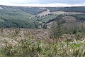
 Above the Camcor River valley - geograph.org.uk - 1254067.jpg 640 × 426; 160 KB
-
 Above the Camcor River valley - geograph.org.uk - 1254070.jpg 640 × 426; 167 KB
-
 Above the Camcor River valley - geograph.org.uk - 1254073.jpg 640 × 426; 172 KB
-
 An Duibh - River Duff - geograph.org.uk - 1246765.jpg 640 × 427; 109 KB
-
 Ballintrane - geograph.org.uk - 1254311.jpg 640 × 427; 198 KB
-
 Ballydavid - geograph.org.uk - 1253978.jpg 640 × 426; 175 KB
-
 Ballykillen - geograph.org.uk - 1254302.jpg 640 × 427; 175 KB
-
 Blake's Hill - geograph.org.uk - 1252340.jpg 640 × 427; 181 KB
-
 Camcor River - geograph.org.uk - 1254058.jpg 640 × 428; 165 KB
-
 Camcor River valley - geograph.org.uk - 1254063.jpg 640 × 426; 180 KB
-
 Clashahillagh - geograph.org.uk - 1254338.jpg 640 × 427; 201 KB
-
 Corraduff - geograph.org.uk - 1254010.jpg 640 × 426; 166 KB
-
 Craughwell Bridge - geograph.org.uk - 1253960.jpg 640 × 428; 203 KB
-
 Daly's Bridge, Cork City - geograph.org.uk - 1248076.jpg 640 × 480; 62 KB
-
 Dereliction at Knockroe - geograph.org.uk - 1254438.jpg 640 × 427; 159 KB
-
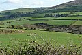
 Farmland at Tomduff - geograph.org.uk - 1254432.jpg 640 × 426; 163 KB
-
 Fortified house, Galway - geograph.org.uk - 1252782.jpg 640 × 428; 172 KB
-
 Foster's Cross Roads - geograph.org.uk - 1254279.jpg 640 × 428; 191 KB
-
 Gort Road, Loughrea - geograph.org.uk - 1296271.jpg 640 × 427; 181 KB
-
 Graveyard outside Bundoran - geograph.org.uk - 1246776.jpg 532 × 640; 89 KB
-
 Joyces on Kingston Road - geograph.org.uk - 1252355.jpg 640 × 426; 171 KB
-
 Kilanure church - geograph.org.uk - 1254116.jpg 640 × 427; 167 KB
-
 Killimor - geograph.org.uk - 1253987.jpg 640 × 426; 177 KB
-
 Kinnitty - geograph.org.uk - 1254017.jpg 640 × 425; 165 KB
-
 Letter Cross Roads - geograph.org.uk - 1254077.jpg 640 × 427; 177 KB
-
 Loughrea library - geograph.org.uk - 1296286.jpg 640 × 426; 173 KB
-
 Maighean Rátha (Mountrath) - geograph.org.uk - 1254127.jpg 640 × 428; 187 KB
-
 Newtown Cross Roads - geograph.org.uk - 1254297.jpg 640 × 426; 157 KB
-
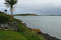
 Oranmore Bay - geograph.org.uk - 1252902.jpg 640 × 425; 192 KB
-
 Portumna VW - geograph.org.uk - 1253991.jpg 640 × 427; 177 KB
-
 River Clody valley - geograph.org.uk - 1254349.jpg 640 × 425; 179 KB
-
 River Shannon at Portumna - geograph.org.uk - 1254003.jpg 640 × 427; 189 KB
-
 River Slaney - geograph.org.uk - 1254497.jpg 640 × 428; 157 KB
-
 River Slaney - geograph.org.uk - 1254504.jpg 640 × 428; 209 KB
-
 River Slaney - geograph.org.uk - 1254508.jpg 640 × 428; 161 KB
-
 River Slaney - geograph.org.uk - 1254517.jpg 640 × 427; 186 KB
-
 Riverstown Bridge - geograph.org.uk - 1254015.jpg 640 × 426; 168 KB
-
 Rosshill level crossing - geograph.org.uk - 1252868.jpg 640 × 428; 202 KB
-
 Roundwood Bridge - geograph.org.uk - 1254119.jpg 640 × 428; 158 KB
-
 South of Slievebawn - geograph.org.uk - 1254420.jpg 640 × 426; 188 KB
-
 The Hanley - geograph.org.uk - 1252380.jpg 640 × 426; 163 KB
-
 The Thatch - geograph.org.uk - 1254445.jpg 640 × 427; 151 KB
-
 Thomas Hynes Road - geograph.org.uk - 1252769.jpg 640 × 427; 165 KB
-
 Towards Croaghaun - geograph.org.uk - 1254353.jpg 640 × 426; 193 KB
-
 Towards Mount Leinster - geograph.org.uk - 1254429.jpg 640 × 426; 167 KB
-
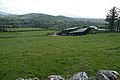
 Track near Carrigmannon Bridge - geograph.org.uk - 1254491.jpg 640 × 426; 171 KB
-
 Tír Oileain (Terryland) - geograph.org.uk - 1252787.jpg 640 × 427; 182 KB
-
 View from the R440 - geograph.org.uk - 1254081.jpg 640 × 427; 173 KB


_-_geograph.org.uk_-_1254127.jpg)


_-_geograph.org.uk_-_1252787.jpg)
