Category:Republic of Ireland photographs taken on 2009-03-31
Jump to navigation
Jump to search
Countries of Europe: Austria · Belarus · Belgium · Croatia · Czech Republic · Denmark · France‡ · Germany · Republic of Ireland · Italy · Netherlands‡ · Poland · Portugal‡ · Russia‡ · Spain‡ · Switzerland · Ukraine · United Kingdom
Specific status: Isle of Man
‡: partly located in Europe
Specific status: Isle of Man
‡: partly located in Europe
| ← | 31 March 2009 | → | ||
| ← | March 2009 | → | ||

Republic of Ireland photographs taken on 31 March 2009.
Image files should be categorized here automatically using {{taken on}} template. Direct categorisation is also possible, if automatic is impossible.
Media in category "Republic of Ireland photographs taken on 2009-03-31"
The following 40 files are in this category, out of 40 total.
-

-

-
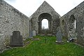 An Tulach (Tulla) church - geograph.org.uk - 1252120.jpg 640 × 428; 163 KB
-
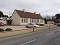 Castlebridge Community Centre - geograph.org.uk - 1237785.jpg 640 × 480; 65 KB
-
 Castlesow Bridge over River Sow - geograph.org.uk - 1237928.jpg 640 × 480; 115 KB
-
 Descent to Piltown - geograph.org.uk - 1251154.jpg 640 × 426; 138 KB
-
 Doon Lough - geograph.org.uk - 1251890.jpg 640 × 426; 194 KB
-
 Estate entrance at Hillpark - geograph.org.uk - 1252222.jpg 640 × 426; 193 KB
-
 Farm near Crossabeg - geograph.org.uk - 1282948.jpg 640 × 480; 67 KB
-
 Farranjordan - geograph.org.uk - 1251216.jpg 640 × 428; 182 KB
-
 From Drumullan Bridge - geograph.org.uk - 1252134.jpg 640 × 427; 193 KB
-
 Granard Villa, Riverside, Wexford - geograph.org.uk - 1280961.jpg 640 × 479; 95 KB
-
 House at Ardcolm, Castlebridge - geograph.org.uk - 1238385.jpg 640 × 480; 70 KB
-
 House near Randallsmill - geograph.org.uk - 1237950.jpg 640 × 480; 77 KB
-
 Kilduff castle - geograph.org.uk - 1251642.jpg 640 × 426; 175 KB
-
 Laban church - geograph.org.uk - 1252207.jpg 640 × 426; 147 KB
-
 Lisduff - geograph.org.uk - 1251979.jpg 640 × 426; 196 KB
-
 Lisduff - geograph.org.uk - 1251985.jpg 640 × 427; 196 KB
-
 Loughaun forestry - geograph.org.uk - 1252175.jpg 640 × 426; 172 KB
-
 Misty River Barrow - geograph.org.uk - 1251129.jpg 640 × 425; 207 KB
-
 Morrissey's Bar - geograph.org.uk - 1296075.jpg 640 × 427; 179 KB
-
 Mount Sion community residence - geograph.org.uk - 1296057.jpg 640 × 426; 184 KB
-
 Murgasty Road - geograph.org.uk - 1296062.jpg 640 × 427; 182 KB
-
 North of O'Callaghansmills - geograph.org.uk - 1251950.jpg 640 × 428; 236 KB
-
 O'Gradys, Barna - geograph.org.uk - 1249344.jpg 640 × 481; 132 KB
-
 Old Cooper's Inn - geograph.org.uk - 1251104.jpg 640 × 425; 150 KB
-
 Pasture at Killavoy - geograph.org.uk - 1251910.jpg 640 × 426; 185 KB
-
 Pasture near Ballymartin - geograph.org.uk - 1294599.jpg 640 × 480; 62 KB
-
 Ploughed field near Castlesow - geograph.org.uk - 1237935.jpg 640 × 480; 85 KB
-
 Poulakerry castle - geograph.org.uk - 1251200.jpg 640 × 427; 178 KB
-
 Powers DIY - geograph.org.uk - 1296091.jpg 640 × 427; 166 KB
-
 Quay Street, Gaillimh-Galway City - geograph.org.uk - 1249982.jpg 636 × 450; 433 KB
-

-

-
 Sheep near Crossabeg - geograph.org.uk - 1237913.jpg 640 × 480; 95 KB
-
 Slipway, Barna - geograph.org.uk - 1249620.jpg 640 × 480; 119 KB
-
 St. Michael's church - geograph.org.uk - 1296026.jpg 428 × 640; 174 KB
-
 The Quay, Galway - geograph.org.uk - 1249569.jpg 640 × 480; 139 KB
-
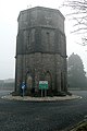 Water tower at Piltown - geograph.org.uk - 1251158.jpg 427 × 640; 164 KB
-
 Wooded bank of River Sow near Castelsow - geograph.org.uk - 1294448.jpg 480 × 640; 132 KB


_church_-_geograph.org.uk_-_1252120.jpg)


_-_geograph.org.uk_-_1251119.jpg)


