Category:Republic of Ireland photographs taken on 2008-07-20
Jump to navigation
Jump to search
Countries of Europe: Austria · Belarus · Belgium · Croatia · Czech Republic · Denmark · Estonia · Finland · France‡ · Germany · Greece · Hungary · Iceland · Republic of Ireland · Italy · Latvia · Malta · Netherlands‡ · Norway · Poland · Portugal‡ · Romania · Russia‡ · Serbia · Slovakia · Spain‡ · Sweden · Switzerland · Turkey‡ · Ukraine · United Kingdom
‡: partly located in Europe
‡: partly located in Europe
| ← | 20 July 2008 | → | ||
| ← | July 2008 | → | ||

Republic of Ireland photographs taken on 20 July 2008.
Image files should be categorized here automatically using {{taken on}} template. Direct categorisation is also possible, if automatic is impossible.
Media in category "Republic of Ireland photographs taken on 2008-07-20"
The following 33 files are in this category, out of 33 total.
-
 Ardmore Co Waterford beach - geograph.org.uk - 1107690.jpg 640 × 360; 37 KB
-
 Church of the Assumption, Dalkey - panoramio.jpg 640 × 428; 110 KB
-
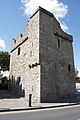 Dalkey Castle - panoramio.jpg 428 × 640; 99 KB
-
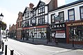 Dalkey High Street - panoramio - Nick Lansley.jpg 640 × 428; 101 KB
-
 Dalkey High Street - panoramio.jpg 640 × 428; 97 KB
-
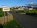
 Dunfanaghy Garda Station - geograph.org.uk - 899453.jpg 546 × 640; 226 KB
-
 Entering Dunfanaghy - geograph.org.uk - 899551.jpg 640 × 480; 241 KB
-
 Fort (ruin) on Dalkey Island - panoramio.jpg 640 × 428; 121 KB
-
 Grange Road - panoramio.jpg 2,048 × 1,536; 1.23 MB
-
 Hornhead Bridge - geograph.org.uk - 899589.jpg 480 × 640; 356 KB
-

-
 Inside St. Begnets Church, Dalkey Island - panoramio - Nick Lansley.jpg 428 × 640; 130 KB
-
 Inside St. Begnets Church, Dalkey Island - panoramio.jpg 428 × 640; 117 KB
-
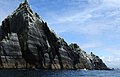 Little Skellig - geograph.org.uk - 895840.jpg 640 × 412; 65 KB
-
 Little Skellig - geograph.org.uk - 895848.jpg 640 × 480; 116 KB
-
 Main Street, Dunfanaghy - geograph.org.uk - 899532.jpg 480 × 640; 209 KB
-
 Mainland view of Dalkey Island - panoramio.jpg 640 × 428; 82 KB
-
 Marble Hill Strand - geograph.org.uk - 899473.jpg 480 × 640; 209 KB
-
 Marble Hill Strand - geograph.org.uk - 899478.jpg 640 × 480; 244 KB
-
 Marble Hill Strand - geograph.org.uk - 899484.jpg 640 × 480; 182 KB
-
 Marble Hill Strand - geograph.org.uk - 899487.jpg 640 × 480; 196 KB
-
 Marble Hill Strand - geograph.org.uk - 899507.jpg 640 × 480; 178 KB
-
 Martello Tower, Dalkey Island - panoramio.jpg 640 × 428; 95 KB
-
 Patsy's Bay, Dunfanaghy - geograph.org.uk - 899458.jpg 640 × 523; 270 KB
-
 Portdale, Dunfanaghy - geograph.org.uk - 899531.jpg 552 × 640; 288 KB
-
 Portmagee (An Caladh) Harbour - geograph.org.uk - 902602.jpg 640 × 485; 101 KB
-
 Road and fields near Knockduff - geograph.org.uk - 899514.jpg 640 × 517; 267 KB
-
 Road and fields near Knockduff - geograph.org.uk - 899516.jpg 480 × 640; 240 KB
-
 Rock outcrop near Dunfanaghy - geograph.org.uk - 899420.jpg 640 × 412; 216 KB
-
 St. Begnets Church, Dalkey Island - panoramio - Nick Lansley.jpg 640 × 428; 116 KB
-
 St. Begnets Church, Dalkey Island - panoramio.jpg 640 × 428; 105 KB
-
 St. Begnets Well, Dalkey Island - panoramio.jpg 428 × 640; 124 KB
-
 Towards Horn Head from Dunfanaghy - geograph.org.uk - 899425.jpg 640 × 425; 241 KB


_on_Dalkey_Island_-_panoramio.jpg)


.jpg)


_Harbour_-_geograph.org.uk_-_902602.jpg)


