Category:Remutaka Range
Jump to navigation
Jump to search
mountain range in the Wellington Region, New Zealand  | |||||
| Upload media | |||||
| Instance of | |||||
|---|---|---|---|---|---|
| Located in protected area | |||||
| Location | Wellington Region, New Zealand | ||||
| Highest point |
| ||||
| Elevation above sea level |
| ||||
 | |||||
Subcategories
This category has the following 6 subcategories, out of 6 total.
M
- Mount Climie (7 F)
R
- Remutaka Forest Park (6 F)
- Rimutaka Road (12 F)
- Rimutaka Tunnel (1 F)
Media in category "Remutaka Range"
The following 41 files are in this category, out of 41 total.
-

-
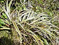 Astelia nervosa 11.JPG 3,824 × 2,976; 2.43 MB
-
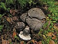 Boletopsis nothofagi habitat.jpg 1,512 × 1,134; 1.18 MB
-
 Brachyglottis lagopus 11.JPG 1,728 × 1,071; 400 KB
-
 City of Wellington from Brooklyn Hill.jpg 4,896 × 1,620; 2.89 MB
-
 Cook Strait with Rimutaka Range.jpg 1,152 × 1,536; 853 KB
-
 Dracophyllum longifolium 11.JPG 3,968 × 2,976; 2.78 MB
-
 Earina mucronata 11.JPG 2,936 × 3,875; 2.63 MB
-
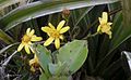
 Euphrasia cuneata 11.JPG 3,968 × 2,579; 2.38 MB
-
 Gaultheria rupestris 11.JPG 3,500 × 2,773; 2.03 MB
-
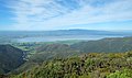 Lake Wairarapa from Remutaka Trig.jpg 4,850 × 2,880; 4.19 MB
-
 Laurelia novae-zelandiae 12.JPG 3,704 × 2,902; 2.48 MB
-
 Lookout, Rimutaka Range ATLIB 194223.png 4,627 × 6,411; 23.02 MB
-
 Low clouds passing over the Rimutakas south of Mount Climie.jpg 1,024 × 768; 268 KB
-
 Lycopodium fastigiatum 11.JPG 3,968 × 2,390; 2.06 MB
-
 Mangaroa railway station 02.JPG 1,632 × 1,224; 855 KB
-
 Maymorn railway station 02.jpg 2,048 × 1,536; 1.4 MB
-
 Moon over south end of Rimutakas (Turakirae Head) at sunset.jpg 1,024 × 768; 232 KB
-
 Mount Matthews.jpg 640 × 429; 173 KB
-
 Mountain Cabbage Trees and ferns on Mount Climie.jpg 1,024 × 768; 342 KB
-
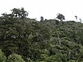 Native bush with Rimu trees on Mount Climie.jpg 1,024 × 768; 301 KB
-
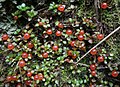 Nertera depressa 11.JPG 3,575 × 2,583; 1.98 MB
-
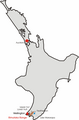 Northisland NZ Rimutaka Range.png 328 × 500; 34 KB
-
 Nothofagus menziesii on Mount Climie.jpg 1,024 × 768; 332 KB
-
 Olearia arborescens 11.JPG 3,831 × 2,876; 1.99 MB
-
 Pakuratahi River from Pakuratahi Truss Bridge.jpg 1,024 × 768; 338 KB
-
 Point Halswell and the Orongorongos, Wellington, 25 June 2005.jpg 2,408 × 1,588; 3.78 MB
-
 Remutaka Range 01.jpg 2,943 × 1,364; 2.96 MB
-
 Remutaka Range 02.jpg 3,000 × 1,322; 2.93 MB
-
 Remutaka Range 03.jpg 4,876 × 1,986; 5.84 MB
-
 Remutaka Trig with trig station (trig point).jpg 4,896 × 3,264; 6.24 MB
-
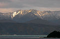
 Rimutaka Range with Turakirae Head.jpg 2,048 × 1,024; 2.39 MB
-
 Sign-1120715, Wainuiomata, Wellington, New Zealand.jpg 4,896 × 3,672; 8.8 MB
-
 View from Ladle Bend south towards summit.jpg 1,024 × 768; 287 KB
-
 View south from Mount Climie.jpg 1,024 × 768; 218 KB
-
 View towards Wairarapa from Mount Climie.jpg 1,024 × 768; 258 KB
-
 View up Catchpool Valley.jpg 1,024 × 768; 332 KB
-
 Wellington Harbour from Brooklyn Hill.jpg 4,896 × 2,880; 5.21 MB
-
 Wellington Rimutaka-Range.jpg 1,600 × 1,200; 590 KB
-
 Wild Coast Track at Ōrongorongo.jpg 4,032 × 3,024; 5.84 MB
-
 Ōrongorongo river mouth.jpg 7,091 × 2,801; 6.99 MB


_at_sunset.jpg)


.jpg)


