Category:Raynes Park
Jump to navigation
Jump to search
area of south London, in the borough of Merton  | |||||
| Upload media | |||||
| Instance of | |||||
|---|---|---|---|---|---|
| Location | London Borough of Merton, Greater London, London, England | ||||
 | |||||
English: Raynes Park is a suburb within the London Borough of Merton south-west London, centred around Raynes Park station and situated between Wimbledon and New Malden. It is 8.2 miles (13.2 km) south-west of Charing Cross. The area is effectively divided into two by the Waterloo - Southampton mainline railway. It is a typical London commuter suburb in that it is relatively prosperous and the residents are mostly middle class although there are few major retail chains. The nearest major shopping area is nearby Wimbledon. Residents can easily travel to nearby Wimbledon, West Wimbledon, Wimbledon Village, Kingston or Sutton.
Subcategories
This category has the following 4 subcategories, out of 4 total.
Media in category "Raynes Park"
The following 43 files are in this category, out of 43 total.
-
 Atterbury Rd - geograph.org.uk - 4792823.jpg 640 × 428; 74 KB
-
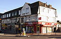
 Blockbuster, Raynes Park - geograph.org.uk - 4134194.jpg 640 × 480; 112 KB
-
 Burlington Rd - geograph.org.uk - 4461024.jpg 640 × 428; 58 KB
-
 Camberley Avenue, Raynes Park - geograph.org.uk - 3994396.jpg 2,304 × 1,728; 827 KB
-
 Camberley Avenue, Raynes Park - geograph.org.uk - 3994403.jpg 2,304 × 1,728; 838 KB
-
 Coombe Gardens, SW20 - geograph.org.uk - 5739554.jpg 746 × 1,024; 269 KB
-
 Coppice Close at the junction of Grand Drive - geograph.org.uk - 3320203.jpg 2,048 × 1,536; 1.43 MB
-
 Coppice Close, Raynes Park - geograph.org.uk - 3320199.jpg 2,048 × 1,536; 1.52 MB
-
 Edna Road at the junction of Kingston Road - geograph.org.uk - 4272055.jpg 2,560 × 1,920; 1.98 MB
-
 Edna Road, Raynes Park - geograph.org.uk - 4272054.jpg 2,560 × 1,920; 1.99 MB
-
 Ethelbert Road - geograph.org.uk - 4333498.jpg 1,600 × 1,064; 452 KB
-
 Fairway - geograph.org.uk - 1021804.jpg 640 × 480; 97 KB
-
 Farnham Gardens bus stop - geograph.org.uk - 2877851.jpg 640 × 480; 142 KB
-
 Farnham Gardens, Raynes Park - geograph.org.uk - 3857320.jpg 2,560 × 1,920; 1.98 MB
-
 Grand Drive at the junction of Bushey Road - geograph.org.uk - 3320238.jpg 2,048 × 1,536; 1.49 MB
-
 Haynt Walk, Raynes Park - geograph.org.uk - 4272094.jpg 2,560 × 1,920; 1.99 MB
-
 Houses on Bodnant Gardens, Raynes Park - geograph.org.uk - 3857446.jpg 2,560 × 1,920; 1.98 MB
-
 IAH WC RaynesPark1.jpg 3,008 × 1,960; 1.98 MB
-
 IAH WC RaynesPark2.jpg 3,008 × 1,960; 1.87 MB
-
 IAH WC RaynesPark3.jpg 3,008 × 1,960; 2.11 MB
-
 IAH WC RaynesPark4.jpg 3,008 × 1,960; 1.7 MB
-
 IAH WC RaynesPark5.jpg 3,008 × 1,960; 1.76 MB
-
 ISH WC2 RaynesPark1.jpg 4,035 × 600; 359 KB
-
 ISH WC2 RaynesPark2.jpg 3,697 × 600; 308 KB
-
 ISH WC2 RaynesPark3.jpg 3,679 × 600; 320 KB
-
 ISH WC2 RaynesPark4.jpg 3,839 × 600; 341 KB
-
 ISH WC2 RaynesPark5.jpg 3,718 × 600; 307 KB
-
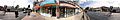 ISH WC2 RaynesPark6.jpg 3,650 × 600; 316 KB
-
 ISH WC2 RaynesPark7.jpg 3,800 × 600; 342 KB
-
 ISH WC2 RaynesPark8.jpg 3,741 × 600; 402 KB
-
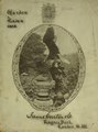 James Carter & Co. materials (IA JamesCarterComa00JameAM).pdf 1,056 × 1,425, 304 pages; 19.01 MB
-
 London Transport RT Bus with Exide Advertisements.jpg 1,206 × 1,417; 919 KB
-

-
 Raynes Park Community Centre. - geograph.org.uk - 21471.jpg 640 × 480; 69 KB
-
 Raynes Park High School.jpg 4,032 × 3,024; 5.11 MB
-
 Raynes Park Station (S) bus stop - geograph.org.uk - 4134309.jpg 640 × 480; 117 KB
-
 Somerset Avenue, Raynes Park - geograph.org.uk - 3994406.jpg 2,304 × 1,728; 817 KB
-
 Sothern Railway FC - Photo of the team.png 874 × 602; 459 KB
-
 Southdown Road - geograph.org.uk - 4333494.jpg 1,600 × 1,064; 483 KB
-
 Tadley Calleva vs Raynes Park Vale. 22.04.2023.jpg 5,092 × 2,845; 11.34 MB
-
 West Barnes Lane - geograph.org.uk - 3139620.jpg 4,000 × 3,000; 3.88 MB
-
 West Barnes Lane, Raynes Park - geograph.org.uk - 3857303.jpg 2,560 × 1,920; 2.13 MB
-
 West Barnes Lane, Raynes Park - geograph.org.uk - 5600594.jpg 1,024 × 683; 136 KB


_bus_stop_-_geograph.org.uk_-_4134309.jpg)


