Category:Rayleigh, Essex
Jump to navigation
Jump to search
Deutsch: Rayleigh ist ein Marktort im Distrikt Rochford in Essex, England. Er liegt zwischen Chelmsford und Southend-on-Sea. Nachdem die Bevölkerung in den 1960er Jahren stark angestiegen war, hat der Ort nun etwa 34.000 Einwohner.
English: Rayleigh is a market town and civil parish in the District of Rochford in Essex, England, located between Chelmsford and Southend-on-Sea. It lies 30 miles to the east of London. It has a population of 30,196, having expanded rapidly in the 1960s.
Nederlands: Rayleigh is een plaats in het bestuurlijke gebied Rochford, in het Engelse graafschap Essex. De plaats telt 34.000 inwoners.
Română: Rayleigh (pronunţat ) este un oraş în comitatul Essex, regiunea East, Anglia. Oraşul se află în districtul Rochford.
town in Essex, United Kingdom  | |||||
| Upload media | |||||
| Instance of | |||||
|---|---|---|---|---|---|
| Location | Rochford, Essex, East of England, England | ||||
| Population |
| ||||
 | |||||
Subcategories
This category has the following 12 subcategories, out of 12 total.
A
- Amber Coaches (bus company) (1 F)
- APT Travel (bus company) (1 F)
C
H
K
- Kirbys (bus company) (2 F)
P
R
- Rayleigh Castle (3 F)
- Rayleigh railway station (6 F)
- Rayleigh Windmill (24 F)
W
Media in category "Rayleigh, Essex"
The following 200 files are in this category, out of 582 total.
(previous page) (next page)-
 "Cut through", Rayleigh - geograph.org.uk - 490915.jpg 473 × 640; 94 KB
-
 "One" Railway Looking Towards Rayleigh - geograph.org.uk - 120402.jpg 640 × 480; 117 KB
-
 'Mill past-Time cast' - geograph.org.uk - 2153073.jpg 768 × 1,024; 325 KB
-

-
 94 High Road - geograph.org.uk - 2778949.jpg 1,600 × 1,200; 342 KB
-
 A glimpse of the Mill - geograph.org.uk - 2127691.jpg 802 × 1,024; 204 KB
-
 A127 Arterial Road - geograph.org.uk - 2232513.jpg 2,000 × 1,500; 2.21 MB
-
 A127 Arterial Road - geograph.org.uk - 2232518.jpg 2,000 × 1,469; 1.8 MB
-
 A127 towards Southend - geograph.org.uk - 5729172.jpg 640 × 428; 103 KB
-
 A127 towards Southend - geograph.org.uk - 5729186.jpg 640 × 428; 108 KB
-
 A127, eastbound - geograph.org.uk - 5738902.jpg 640 × 426; 71 KB
-
 A127, eastbound - geograph.org.uk - 5738904.jpg 640 × 426; 56 KB
-
 A127, eastbound - geograph.org.uk - 5738911.jpg 640 × 426; 49 KB
-
 Abbotts Countrywide Rayleigh.jpg 3,000 × 1,993; 623 KB
-
 Across the fields by Stevens Farm - geograph.org.uk - 5253865.jpg 4,688 × 2,967; 1.72 MB
-
 Aerial view - geograph.org.uk - 2183941.jpg 1,024 × 768; 328 KB
-
 Another path to the park - geograph.org.uk - 3240367.jpg 1,000 × 750; 183 KB
-
 ASDA Rayleigh - geograph.org.uk - 2184198.jpg 1,024 × 768; 287 KB
-
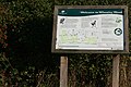 Attractive Information Sign - geograph.org.uk - 598021.jpg 640 × 427; 124 KB
-
 Autumn Bridleway - geograph.org.uk - 2131804.jpg 1,024 × 768; 275 KB
-
 B1013 Hockley Road - geograph.org.uk - 2214682.jpg 1,500 × 2,000; 1,016 KB
-
 Behind the scene - geograph.org.uk - 3238698.jpg 1,000 × 750; 195 KB
-
 Berry's Arcade - geograph.org.uk - 2127694.jpg 1,024 × 754; 211 KB
-
 Birch Close - geograph.org.uk - 2134154.jpg 832 × 1,024; 167 KB
-
 Branching Out - geograph.org.uk - 2751577.jpg 1,500 × 2,000; 1.95 MB
-
 Bridleway, Lubard's Farm - geograph.org.uk - 2127218.jpg 1,024 × 768; 285 KB
-
 Brixham Close - geograph.org.uk - 2181553.jpg 1,024 × 768; 284 KB
-
 Brooklands Public Gardens - geograph.org.uk - 3141307.jpg 2,000 × 1,500; 1,019 KB
-
 Brooklyn Drive - geograph.org.uk - 2181541.jpg 1,024 × 768; 241 KB
-
 Building Land - geograph.org.uk - 2184346.jpg 1,024 × 768; 244 KB
-
 Bull Field - geograph.org.uk - 2752626.jpg 2,000 × 1,513; 780 KB
-
 Bull Lane - geograph.org.uk - 2751578.jpg 1,500 × 2,000; 1.74 MB
-
 Busy Junction - geograph.org.uk - 2134157.jpg 1,024 × 700; 199 KB
-
 Cadet Centre - geograph.org.uk - 2177195.jpg 1,024 × 698; 402 KB
-
 Cadet Centre Building - geograph.org.uk - 4818597.jpg 3,072 × 2,304; 1.94 MB
-
 Cadet Entrance - geograph.org.uk - 2177193.jpg 1,024 × 720; 450 KB
-
 Canterbury Close - geograph.org.uk - 2182362.jpg 1,024 × 768; 380 KB
-
 Car park and retail sites, Rayleigh Weir - geograph.org.uk - 5440679.jpg 1,600 × 899; 187 KB
-
 Car park at Lubard's Farm - geograph.org.uk - 3954132.jpg 1,600 × 1,064; 507 KB
-
 Car Park Stream - geograph.org.uk - 2143737.jpg 1,024 × 708; 253 KB
-
 Carpet of leaves - geograph.org.uk - 2148280.jpg 821 × 1,024; 484 KB
-
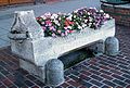 Cattle Trough, Rayleigh High Street - geograph.org.uk - 333201.jpg 640 × 433; 98 KB
-
 Caversham Park Avenue - geograph.org.uk - 3235071.jpg 1,000 × 737; 179 KB
-
 Centisquare Aerial - geograph.org.uk - 3240410.jpg 1,349 × 1,017; 204 KB
-
 Chapman Court sign - geograph.org.uk - 4819889.jpg 3,072 × 2,304; 1.84 MB
-
 Chapman Court, Rayleigh - geograph.org.uk - 4819886.jpg 3,072 × 2,304; 1.79 MB
-
 Cheapside West - geograph.org.uk - 2143753.jpg 1,024 × 768; 195 KB
-
 Clouded Agaric - geograph.org.uk - 608760.jpg 640 × 482; 101 KB
-
 Commemorative Tablet 1939 - 1945 - geograph.org.uk - 2128772.jpg 1,500 × 2,000; 1.11 MB
-
 Connaught Road - geograph.org.uk - 5408291.jpg 3,304 × 2,203; 1.5 MB
-
 Connaught Road, Rayleigh - geograph.org.uk - 531798.jpg 462 × 640; 103 KB
-
 Coppiced area in Starvelarks Wood - geograph.org.uk - 114198.jpg 640 × 482; 131 KB
-
 Culvert and Stream - geograph.org.uk - 2143728.jpg 1,024 × 751; 288 KB
-
 Culvert under Downhall Park Way - geograph.org.uk - 2131768.jpg 1,024 × 768; 314 KB
-
 Cycle path - geograph.org.uk - 339422.jpg 480 × 640; 120 KB
-
 Dartmouth Close - geograph.org.uk - 2181552.jpg 1,024 × 712; 192 KB
-
 Dawlish Crescent - geograph.org.uk - 2181548.jpg 1,024 × 790; 259 KB
-
 Dawlish Crescent - geograph.org.uk - 3240361.jpg 1,000 × 750; 238 KB
-
 Daws Heath Road, Rayleigh - geograph.org.uk - 297510.jpg 468 × 640; 125 KB
-
 Deepdene Avenue - geograph.org.uk - 2182259.jpg 1,024 × 709; 208 KB
-
 Deepdene Avenue - geograph.org.uk - 2182291.jpg 1,024 × 699; 215 KB
-
 Dene Close - geograph.org.uk - 2182248.jpg 1,024 × 756; 248 KB
-
 Depot entrance off Hullbridge Road - geograph.org.uk - 4823994.jpg 3,072 × 2,304; 1.86 MB
-
 Depot entrance off Hullbridge Road - geograph.org.uk - 4823999.jpg 3,072 × 2,304; 1.83 MB
-
 Depot off Hullbridge Road - geograph.org.uk - 4824002.jpg 3,072 × 2,304; 1.7 MB
-
 Derwent Avenue, Rayleigh - geograph.org.uk - 4155967.jpg 640 × 480; 100 KB
-
 Ditch off Hullbridge Road - geograph.org.uk - 4815739.jpg 3,072 × 2,304; 1.92 MB
-
 Ditch off Hullbridge Road - geograph.org.uk - 4815740.jpg 2,304 × 3,072; 3.36 MB
-
 Ditch off Hullbridge Road - geograph.org.uk - 4815742.jpg 3,072 × 2,304; 1.92 MB
-
 Ditch ^ Lubards Lodge Perimeter Bridleway - geograph.org.uk - 4823990.jpg 2,304 × 3,072; 3.32 MB
-
 Down Hall Close - geograph.org.uk - 2231426.jpg 2,000 × 1,500; 2.79 MB
-
 Down Hall Road - geograph.org.uk - 2122913.jpg 1,024 × 788; 277 KB
-
 Down Hall Road, Rayleigh. - geograph.org.uk - 2118166.jpg 768 × 1,024; 245 KB
-
 Down Hall Stores - geograph.org.uk - 2134151.jpg 1,024 × 757; 222 KB
-
 Downhall Park Way - geograph.org.uk - 2182605.jpg 1,024 × 737; 235 KB
-
 Downhall Park Way - geograph.org.uk - 2184190.jpg 1,024 × 718; 250 KB
-
 Downhall Park Way - geograph.org.uk - 2229342.jpg 2,000 × 1,500; 1.61 MB
-
 Downhall Park Way - geograph.org.uk - 3206381.jpg 1,500 × 1,125; 363 KB
-
 Downhall Park Way - geograph.org.uk - 3239986.jpg 1,000 × 750; 152 KB
-
 Downhall Road - geograph.org.uk - 3239975.jpg 1,000 × 751; 156 KB
-
 Dutch Cottage, Rayleigh (built 1621) - geograph.org.uk - 3674293.jpg 1,501 × 1,748; 1.27 MB
-
 Eastern Road - geograph.org.uk - 2138333.jpg 640 × 480; 119 KB
-
 Eastwards from the end of Roach Valley Way - geograph.org.uk - 5253870.jpg 5,184 × 3,456; 6.84 MB
-
 Eastwood Brook - geograph.org.uk - 2268178.jpg 1,500 × 2,000; 3.11 MB
-
 Eastwood Brook - geograph.org.uk - 525345.jpg 491 × 640; 156 KB
-
 Eastwood Brook, Rayleigh - geograph.org.uk - 395716.jpg 489 × 640; 161 KB
-
 Eastwood Road, Rayleigh - geograph.org.uk - 6124840.jpg 1,920 × 1,280; 1.33 MB
-
 Edward VII Post Box - geograph.org.uk - 2134212.jpg 668 × 1,024; 178 KB
-
 Electricity Pylon off Hullbridge Road - geograph.org.uk - 5218294.jpg 2,622 × 3,952; 6.77 MB
-
 End of the line - geograph.org.uk - 3240371.jpg 1,000 × 750; 146 KB
-
 Entering Southend on Sea, A127 - geograph.org.uk - 5739118.jpg 640 × 426; 69 KB
-
 Entrance of Lubards Farm Industrial Estate - geograph.org.uk - 5872451.jpg 3,000 × 4,000; 5.79 MB
-
 Entrance to Bridleway^ - geograph.org.uk - 3235108.jpg 1,000 × 750; 274 KB
-
 Entrance to Essex Army Cadet Force Rayleigh Detachment - geograph.org.uk - 4818655.jpg 3,072 × 2,304; 1.82 MB
-
 Entrance to Essex Army Cadet Force Rayleigh Detachment - geograph.org.uk - 4818665.jpg 3,072 × 2,304; 1.87 MB
-
 Entrance to Hullbridge Pumping Station - geograph.org.uk - 4815720.jpg 3,072 × 2,304; 1.96 MB
-
 Entrance to Hullbridge Pumping Station - geograph.org.uk - 4824439.jpg 3,072 × 2,304; 1.85 MB
-
 Entrance to Lubards Farm - geograph.org.uk - 4818580.jpg 3,072 × 2,304; 1.82 MB
-
 Entrance to Lubards Lodge - geograph.org.uk - 4824006.jpg 3,072 × 2,304; 1.71 MB
-
 Eon's Gone - geograph.org.uk - 2133033.jpg 1,024 × 701; 159 KB
-
 Eskimowear Ski Shop - geograph.org.uk - 2127853.jpg 1,024 × 768; 175 KB
-
 Essex Army Cadet Force sign - geograph.org.uk - 4818656.jpg 3,072 × 2,304; 1.91 MB
-

-
 Everest, not the mountain - geograph.org.uk - 2181540.jpg 1,024 × 767; 204 KB
-
 Exmouth Drive - geograph.org.uk - 2181547.jpg 1,024 × 725; 295 KB
-
 Fairview Playing Field, Rayleigh - geograph.org.uk - 4155958.jpg 640 × 480; 120 KB
-
 Farm Road - geograph.org.uk - 3206362.jpg 1,500 × 1,125; 612 KB
-
 Farm View - geograph.org.uk - 3223876.jpg 750 × 1,000; 524 KB
-
 Farm View - geograph.org.uk - 3235137.jpg 1,000 × 750; 148 KB
-
 Ferndale Road - geograph.org.uk - 2125837.jpg 768 × 1,024; 247 KB
-
 Ferndale Road sign - geograph.org.uk - 4821109.jpg 3,072 × 2,304; 1.94 MB
-
 Ferndale Road, Rayleigh - geograph.org.uk - 4819878.jpg 3,072 × 2,304; 1.87 MB
-
 Ferndale Road, Rayleigh - geograph.org.uk - 4821113.jpg 3,072 × 2,304; 1.86 MB
-
 Field at Lubards Farm Industrial Estate - geograph.org.uk - 4824583.jpg 3,072 × 2,304; 1.78 MB
-
 Field at Lubards Farm Industrial Estate - geograph.org.uk - 5823655.jpg 818 × 1,494; 771 KB
-
 Fields off Lubards Lodge Perimeter Bridleway - geograph.org.uk - 4823971.jpg 3,072 × 2,304; 1.8 MB
-
 Fields off Lubards Lodge Perimeter Bridleway - geograph.org.uk - 4823975.jpg 3,072 × 2,304; 1.9 MB
-
 Fire Engines for hire - geograph.org.uk - 4815744.jpg 3,072 × 2,304; 2.02 MB
-
 Fish ^ Chips - geograph.org.uk - 3206380.jpg 2,000 × 1,500; 522 KB
-
 Flower on the Footpath - geograph.org.uk - 2122965.jpg 767 × 1,024; 156 KB
-
 Footpath Bridge - geograph.org.uk - 2205795.jpg 2,000 × 1,500; 2.93 MB
-
 Footpath divides - geograph.org.uk - 2124294.jpg 1,024 × 768; 414 KB
-
 Footpath off Hullbridge Road - geograph.org.uk - 4818717.jpg 2,304 × 3,072; 2.54 MB
-
 Footpath off Langham Drive - geograph.org.uk - 3954119.jpg 1,064 × 1,600; 702 KB
-
 Footpath on the Hill - geograph.org.uk - 2122952.jpg 768 × 1,024; 278 KB
-
 Footpath sign off Hullbridge Road - geograph.org.uk - 4818718.jpg 2,253 × 2,995; 2.71 MB
-
 Footpath Start - geograph.org.uk - 2744148.jpg 2,000 × 1,500; 1.62 MB
-
 Footpath Stile - geograph.org.uk - 2122975.jpg 768 × 1,024; 379 KB
-
 Footpath to Hockley Wood - geograph.org.uk - 2082581.jpg 640 × 428; 86 KB
-
 Footpath to the Woods - geograph.org.uk - 2752613.jpg 2,000 × 1,500; 1.15 MB
-
 Former post office, Rayleigh (built 1931) - geograph.org.uk - 3675494.jpg 1,288 × 1,572; 1.45 MB
-
 Four pylons - geograph.org.uk - 5738859.jpg 640 × 426; 60 KB
-
 Gas tank at the petrol station on High Road, Weir - geograph.org.uk - 6113957.jpg 1,920 × 1,280; 1.18 MB
-
 Gates to Tinkersfield - geograph.org.uk - 5483168.jpg 640 × 428; 121 KB
-
 GB Domestics - geograph.org.uk - 2117904.jpg 1,024 × 720; 144 KB
-
 George VI Postbox - geograph.org.uk - 2170303.jpg 1,024 × 768; 255 KB
-
 Glade in Grove Wood - geograph.org.uk - 2082548.jpg 640 × 428; 101 KB
-
 Gladwells Pet ^ Country Store - geograph.org.uk - 3206357.jpg 1,500 × 1,125; 378 KB
-
 Glass House Cottages, Rayleigh - geograph.org.uk - 4816895.jpg 3,072 × 2,304; 1.89 MB
-
 Goldsmiths Drive - geograph.org.uk - 2128776.jpg 768 × 1,024; 311 KB
-
 Great Wheatley's - geograph.org.uk - 126064.jpg 640 × 480; 110 KB
-
 Green Fields - geograph.org.uk - 3206365.jpg 2,000 × 1,290; 612 KB
-
 Greening Fields - geograph.org.uk - 2637525.jpg 3,008 × 2,000; 2.44 MB
-
 Grove Road Shopping Arcade - geograph.org.uk - 534137.jpg 640 × 455; 82 KB
-
 Grove Schools, Rayleigh - geograph.org.uk - 341128.jpg 640 × 383; 57 KB
-
 Grove Wood Bomb Crater^ - geograph.org.uk - 2082570.jpg 428 × 640; 126 KB
-
 Grove Woods - geograph.org.uk - 2205778.jpg 2,000 × 1,500; 2.09 MB
-
 Hambro Avenue - geograph.org.uk - 2179658.jpg 1,024 × 768; 252 KB
-
 Hambro Avenue - geograph.org.uk - 2179671.jpg 1,024 × 753; 272 KB
-
 Hambro Hill - geograph.org.uk - 2122948.jpg 768 × 1,024; 338 KB
-
 Hambro Hill Footpath - geograph.org.uk - 2122958.jpg 768 × 1,024; 469 KB
-
 Hambro Parade - geograph.org.uk - 2181545.jpg 1,024 × 768; 272 KB
-
 Hambro Post Office - geograph.org.uk - 582326.jpg 640 × 440; 188 KB
-
 Hambro Post Office Postbox - geograph.org.uk - 4820986.jpg 3,072 × 2,304; 1.81 MB
-
 Hambro Post Office Postbox - geograph.org.uk - 4821005.jpg 2,304 × 3,072; 2.29 MB
-
 Hambro Post Office Postbox - geograph.org.uk - 4821006.jpg 2,304 × 3,072; 2.56 MB
-
 Hambro Post Office Postbox - geograph.org.uk - 4821102.jpg 2,304 × 3,072; 2.75 MB
-
 Hambro Post Office ^ Pharmacy - geograph.org.uk - 4820003.jpg 3,072 × 2,304; 1.76 MB
-
 Happy Days Children's Nursery - geograph.org.uk - 4824451.jpg 3,072 × 2,304; 1.66 MB
-
 Harberts Way - geograph.org.uk - 2229349.jpg 2,000 × 1,500; 1.66 MB
-
 Heritage Plaque - geograph.org.uk - 2127842.jpg 1,024 × 849; 225 KB
-
 Heritage Plaque - geograph.org.uk - 2185415.jpg 2,000 × 1,500; 875 KB
-
 Heritage Plaque on the Rayleigh Weir Public House - geograph.org.uk - 2185420.jpg 2,000 × 1,500; 702 KB
-
 Hidden Stream - geograph.org.uk - 2148262.jpg 1,024 × 768; 232 KB
-
 High Road, Rayleigh - geograph.org.uk - 2138350.jpg 640 × 480; 180 KB
-
 High Road, Rayleigh - geograph.org.uk - 6113953.jpg 1,920 × 1,280; 1.08 MB
-
 High Road, Weir - geograph.org.uk - 6113958.jpg 1,920 × 1,280; 1.25 MB
-
 High st from church.jpg 1,728 × 937; 406 KB
-
 Hockley Road - geograph.org.uk - 2128768.jpg 777 × 1,024; 203 KB
-
 Hockley Woods - geograph.org.uk - 5473047.jpg 3,316 × 2,211; 1.93 MB
-
 Hockley Woods - geograph.org.uk - 5473153.jpg 3,008 × 2,000; 2.1 MB
-
 Hollytree Gardens - geograph.org.uk - 2138319.jpg 640 × 480; 122 KB
-
 Holy Trinity Church, Rayleigh - geograph.org.uk - 2750868.jpg 3,765 × 2,970; 2.32 MB
-
 Holy Trinity Church, Rayleigh - geograph.org.uk - 2750870.jpg 2,848 × 2,134; 1,000 KB
-

-
 Houses on Ferndale Road - geograph.org.uk - 4819866.jpg 3,072 × 2,304; 1.96 MB
-
 Houses on Hullbridge Road - geograph.org.uk - 4818720.jpg 3,072 × 2,304; 1.89 MB
-
 Houses, Hambro Hill - geograph.org.uk - 2122938.jpg 761 × 1,024; 402 KB
-
 Housing Development - geograph.org.uk - 3842698.jpg 2,000 × 1,500; 2.04 MB
-
 Hullbridge Road - geograph.org.uk - 2181543.jpg 1,024 × 695; 254 KB
-
 Hullbridge Road - geograph.org.uk - 2181544.jpg 1,024 × 768; 240 KB
-
 Hullbridge Road - geograph.org.uk - 3206351.jpg 1,500 × 1,125; 377 KB
-
 Hullbridge Road - geograph.org.uk - 3954428.jpg 1,600 × 1,064; 671 KB
-
 Hullbridge Road sign - geograph.org.uk - 4819928.jpg 3,072 × 2,304; 1.9 MB
-
 Hullbridge Road sign - geograph.org.uk - 4821110.jpg 3,072 × 2,304; 1.65 MB
-
 Hullbridge Road ^ Bus Stop - geograph.org.uk - 4824405.jpg 3,072 × 2,304; 1.97 MB
-
 Hullbridge Road ^ ditch - geograph.org.uk - 4819837.jpg 3,072 × 2,304; 1.95 MB
-
 Hullbridge Road ^ Roadsign - geograph.org.uk - 4819868.jpg 2,304 × 3,072; 2.02 MB
-
 Hullbridge Road, Hullbridge - geograph.org.uk - 4824697.jpg 2,797 × 1,656; 2.47 MB
-
 Hullbridge Road, Rayleigh - geograph.org.uk - 4814609.jpg 3,072 × 2,304; 1.71 MB
-
 Hullbridge Road, Rayleigh - geograph.org.uk - 4814613.jpg 3,072 × 2,304; 1.82 MB
-
 Hullbridge Road, Rayleigh - geograph.org.uk - 4814616.jpg 3,072 × 2,304; 1.71 MB
-
 Hullbridge Road, Rayleigh - geograph.org.uk - 4815741.jpg 3,072 × 2,304; 1.81 MB
-
 Hullbridge Road, Rayleigh - geograph.org.uk - 4815743.jpg 3,072 × 2,304; 1.84 MB
-
 Hullbridge Road, Rayleigh - geograph.org.uk - 4815747.jpg 3,072 × 2,304; 1.74 MB
-
 Hullbridge Road, Rayleigh - geograph.org.uk - 4816810.jpg 3,072 × 2,304; 1.88 MB
-
 Hullbridge Road, Rayleigh - geograph.org.uk - 4816813.jpg 3,072 × 2,304; 1.82 MB
-
 Hullbridge Road, Rayleigh - geograph.org.uk - 4816890.jpg 3,072 × 2,304; 1.86 MB
-
 Hullbridge Road, Rayleigh - geograph.org.uk - 4818602.jpg 3,072 × 2,304; 1.94 MB
-
 Hullbridge Road, Rayleigh - geograph.org.uk - 4818611.jpg 3,072 × 2,304; 1.85 MB


,_Hockley_Road,_Rayleigh_-_geograph.org.uk_-_4155954.jpg)


_-_geograph.org.uk_-_3674293.jpg)


_-_geograph.org.uk_-_3675494.jpg)


