Category:Rathven (civil parish)
Jump to navigation
Jump to search
Scottish parish in Moray, Scotland, UK | |||||
| Upload media | |||||
| Instance of | |||||
|---|---|---|---|---|---|
| Named after | |||||
| Location |
| ||||
| Population |
| ||||
| Area |
| ||||
 | |||||
Subcategories
This category has the following 8 subcategories, out of 8 total.
A
- Arradoul (3 F)
C
- Craigmin Bridge (5 F)
- Cullen Burn Viaduct (26 F)
I
- Ianstown (20 F)
P
R
S
- Strathlene (18 F)
Media in category "Rathven (civil parish)"
The following 200 files are in this category, out of 730 total.
(previous page) (next page)-
 2010 Silage finally under way at Allaloth farm. - geograph.org.uk - 2025349.jpg 3,456 × 2,304; 3.39 MB
-
 A Big Fold - geograph.org.uk - 4174972.jpg 640 × 427; 478 KB
-
 A Buckie Harbour lifebelt - geograph.org.uk - 3656026.jpg 507 × 640; 161 KB
-
 A Buckie roofscape - geograph.org.uk - 3680765.jpg 640 × 480; 178 KB
-
 A cormorant in the Whale’s Mou' - geograph.org.uk - 3655944.jpg 640 × 422; 168 KB
-
 A dozen lums, with seagull - geograph.org.uk - 6278785.jpg 1,280 × 853; 436 KB
-
 A glamorous mini in Portknockie - geograph.org.uk - 3655971.jpg 640 × 480; 172 KB
-
 A lively sea at Portknockie - geograph.org.uk - 3655232.jpg 435 × 640; 178 KB
-
 A Long, Straight, Minor Road - geograph.org.uk - 4800061.jpg 427 × 640; 63 KB
-
 A Millennium milepost - geograph.org.uk - 3680793.jpg 484 × 640; 180 KB
-
 A Plethora of Churches - geograph.org.uk - 5571014.jpg 640 × 427; 91 KB
-
 A942 about to enter Findochty - geograph.org.uk - 4262361.jpg 1,600 × 1,049; 228 KB
-
 A942 at Portessie - geograph.org.uk - 4261698.jpg 800 × 566; 72 KB
-
 A942 east of Findochty - geograph.org.uk - 4263138.jpg 1,600 × 1,088; 296 KB
-
 A942 entering Portknockie - geograph.org.uk - 4263171.jpg 1,600 × 1,088; 196 KB
-
 A942 near Little Hillhead - geograph.org.uk - 4263150.jpg 1,600 × 940; 171 KB
-
 A98 Approaching the Cullen Bay Hotel - geograph.org.uk - 4264963.jpg 1,024 × 648; 83 KB
-
 A98 approaching the Cullen Viaduct - geograph.org.uk - 4264966.jpg 1,600 × 1,012; 314 KB
-
 A990 about to enter Buckie - geograph.org.uk - 4261058.jpg 1,600 × 1,043; 251 KB
-
 A990 crossing the Burn of Buckie - geograph.org.uk - 4261423.jpg 1,600 × 1,046; 312 KB
-
 A990 entering Port Gordon - geograph.org.uk - 4260999.jpg 640 × 418; 46 KB
-
 A990 hugging the coast - geograph.org.uk - 4261032.jpg 1,600 × 1,095; 245 KB
-
 A990 running through Portgordon - geograph.org.uk - 4261022.jpg 1,600 × 1,103; 240 KB
-
 A990, Buckie - geograph.org.uk - 4261418.jpg 800 × 493; 87 KB
-
 A990, Buckie - geograph.org.uk - 4261420.jpg 1,600 × 981; 216 KB
-
 Access track to Home Farm and Letterfourie - geograph.org.uk - 5964152.jpg 4,000 × 3,000; 3 MB
-
 Admiralty Street, Portknockie - geograph.org.uk - 6211464.jpg 2,592 × 1,944; 1.09 MB
-
 All Saints Episcopal Church - geograph.org.uk - 3922466.jpg 640 × 427; 343 KB
-
 Approaching Easter Darbreich - geograph.org.uk - 903707.jpg 640 × 480; 89 KB
-

-
 Arradoul - geograph.org.uk - 3496026.jpg 640 × 331; 269 KB
-
 B9018 South of Lintmill - geograph.org.uk - 3206910.jpg 640 × 427; 118 KB
-
 Bales by Buckie - geograph.org.uk - 958964.jpg 640 × 427; 241 KB
-
 Bales near Cleanhill - geograph.org.uk - 4159908.jpg 640 × 427; 409 KB
-
 Bales Old and New - geograph.org.uk - 958970.jpg 640 × 427; 243 KB
-
 Bank of Scotland - geograph.org.uk - 5570918.jpg 640 × 615; 490 KB
-
 Baptist Church - geograph.org.uk - 5571020.jpg 640 × 427; 87 KB
-
 Baron Street - geograph.org.uk - 4261438.jpg 1,600 × 1,104; 206 KB
-
 Beach at Cullen - geograph.org.uk - 3206552.jpg 640 × 427; 53 KB
-
 Beach near Findochty - geograph.org.uk - 6276420.jpg 640 × 427; 368 KB
-
 Beacon, West Breakwater, Findochty Harbour - geograph.org.uk - 5553011.jpg 1,200 × 1,600; 451 KB
-
 Beechwood on North East flank of the Bin of Cullen - geograph.org.uk - 2614916.jpg 3,264 × 2,448; 5.18 MB
-
 Bin of Cullen - geograph.org.uk - 2295286.jpg 640 × 345; 279 KB
-
 Bin of Cullen - geograph.org.uk - 2796077.jpg 479 × 640; 51 KB
-
 Bin of Cullen - geograph.org.uk - 4800071.jpg 640 × 427; 66 KB
-
 Bin of Cullen from Crannoch Hill - geograph.org.uk - 2239147.jpg 640 × 427; 339 KB
-
 Blackhills - geograph.org.uk - 1739459.jpg 1,077 × 808; 264 KB
-
 Blackhills Ford - geograph.org.uk - 941291.jpg 640 × 480; 128 KB
-
 Boats and Buildings by Portknockie Harbour - geograph.org.uk - 4279983.jpg 1,920 × 2,560; 2.14 MB
-
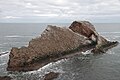
 Bow Fiddle Rock - geograph.org.uk - 2450027.jpg 2,272 × 1,704; 2.26 MB
-
 Bow Fiddle Rock - geograph.org.uk - 2590274.jpg 450 × 600; 76 KB
-
 Bow Fiddle Rock - geograph.org.uk - 4256979.jpg 640 × 423; 390 KB
-
 Bow Fiddle Rock - geograph.org.uk - 4257007.jpg 640 × 427; 421 KB
-
 Bow Fiddle Rock - geograph.org.uk - 4280047.jpg 2,560 × 1,920; 2.74 MB
-
 Bow Fiddle Rock - geograph.org.uk - 4520202.jpg 800 × 450; 190 KB
-
 Bow Fiddle Rock - geograph.org.uk - 4798994.jpg 640 × 427; 67 KB
-
 Bow Fiddle Rock - geograph.org.uk - 6275147.jpg 640 × 427; 323 KB
-
 Bow Fiddle Rock - geograph.org.uk - 6275151.jpg 640 × 427; 351 KB
-
 Bow Fiddle Rock on a benign afternoon - geograph.org.uk - 3630653.jpg 1,439 × 957; 522 KB
-
 Bow Fiddle Rock, Portknockie - geograph.org.uk - 4799001.jpg 1,600 × 1,067; 377 KB
-
 Bow Fiddle Rock, Portknockie - geograph.org.uk - 4799008.jpg 1,600 × 1,067; 350 KB
-
 Bow Fiddle Rock, Portknockie - geograph.org.uk - 4799010.jpg 640 × 427; 68 KB
-
 Bow Fiddle Rock, Portknockie - geograph.org.uk - 6278764.jpg 1,280 × 960; 492 KB
-
 Breaking Waves - geograph.org.uk - 5209848.jpg 640 × 421; 413 KB
-
 Brick Block by the Beach - geograph.org.uk - 4479816.jpg 471 × 640; 432 KB
-
 Bridge over the Burn of Cullen - geograph.org.uk - 3206929.jpg 640 × 427; 157 KB
-
 Bridge over the Core Burn - geograph.org.uk - 4865449.jpg 4,608 × 3,456; 7.96 MB
-

-
 Bridge remains at Drybridge - geograph.org.uk - 6286279.jpg 1,280 × 960; 639 KB
-
 Buckie - geograph.org.uk - 2437006.jpg 1,152 × 864; 746 KB
-
 Buckie Active Station - geograph.org.uk - 2745261.jpg 640 × 480; 89 KB
-
 Buckie Baptist Church - geograph.org.uk - 1997314.jpg 640 × 427; 216 KB
-
 Buckie Fire Station - geograph.org.uk - 3282163.jpg 640 × 480; 88 KB
-
 Buckie Harbour - geograph.org.uk - 3655948.jpg 640 × 480; 161 KB
-
 Buckie Harbour - geograph.org.uk - 6287443.jpg 1,280 × 960; 337 KB
-
 Buckie harbour and the 'Captain Scott' - geograph.org.uk - 2256342.jpg 2,600 × 2,600; 3.58 MB
-
 Buckie harbour and the 'Captain Scott' - geograph.org.uk - 2256379.jpg 3,504 × 1,971; 3.87 MB
-
 Buckie Harbour Lighthouse - geograph.org.uk - 3656021.jpg 425 × 640; 182 KB
-
 Buckie harbour shipyards - geograph.org.uk - 2254999.jpg 3,504 × 1,971; 3.73 MB
-
 Buckie Lifeboat at Station - geograph.org.uk - 2088230.jpg 640 × 427; 87 KB
-
 Buckie Pillbox (1) - geograph.org.uk - 5931705.jpg 1,024 × 683; 785 KB
-
 Buckie Pillbox (2) - geograph.org.uk - 5931707.jpg 1,024 × 683; 919 KB
-
 Buckie Shipyard - geograph.org.uk - 5114865.jpg 4,272 × 2,848; 1.41 MB
-
 Buckie Shipyards - geograph.org.uk - 2576484.jpg 3,456 × 2,304; 977 KB
-
 Buinnach Burn Forklandstripe - geograph.org.uk - 5227202.jpg 640 × 480; 145 KB
-
 Burn of Buckie - geograph.org.uk - 3728233.jpg 1,632 × 1,224; 889 KB
-
 Burn of Buckie enters the sea - geograph.org.uk - 4261455.jpg 2,560 × 1,920; 2.96 MB
-
 Burn of Cullen - geograph.org.uk - 6278754.jpg 938 × 1,280; 336 KB
-
 Burn of Cullen, Seatown, Cullen - geograph.org.uk - 3532478.jpg 5,184 × 3,456; 6.94 MB
-
 Burn of Darbreich - geograph.org.uk - 3728313.jpg 1,632 × 1,224; 890 KB
-
 Burn of Letterfourie - geograph.org.uk - 5229346.jpg 640 × 480; 141 KB
-
 Burn of Letterfourie - geograph.org.uk - 5229819.jpg 640 × 480; 157 KB
-
 Burn of Rathven - geograph.org.uk - 3282158.jpg 640 × 480; 143 KB
-
 Burn of Tynet - geograph.org.uk - 3728196.jpg 1,600 × 1,200; 568 KB
-
 Butterfly - geograph.org.uk - 2025269.jpg 3,456 × 2,304; 3.18 MB
-
 Butterfly - geograph.org.uk - 2025280.jpg 1,930 × 1,287; 1,002 KB
-
 Butterfly - geograph.org.uk - 2025288.jpg 1,607 × 1,127; 1 MB
-
 Butterfly - geograph.org.uk - 2025298.jpg 1,704 × 1,136; 1.13 MB
-
 Butterfly in Longhill Wood - geograph.org.uk - 884539.jpg 640 × 480; 104 KB
-
 Butterfly in the gully - geograph.org.uk - 2025261.jpg 1,838 × 1,226; 784 KB
-
 By Long Head - geograph.org.uk - 5117423.jpg 4,052 × 2,702; 1.71 MB
-
 By the Worries - geograph.org.uk - 5117392.jpg 3,828 × 2,552; 1.5 MB
-
 Caithness Moray High Voltage Direct Current (HVDC) Link - geograph.org.uk - 5145683.jpg 4,896 × 3,672; 3.89 MB
-
 Caithness Moray High Voltage Direct Current (HVDC) Link - geograph.org.uk - 5145691.jpg 4,896 × 3,672; 5.34 MB
-
 Caithness Moray HVDC Construction Site - geograph.org.uk - 5570839.jpg 640 × 427; 365 KB
-
 Calm waters,Portgordon Harbour - geograph.org.uk - 4261081.jpg 2,560 × 1,920; 2.85 MB
-
 Camping now and then - geograph.org.uk - 5570962.jpg 640 × 427; 93 KB
-
 Caravan site, Findochty - geograph.org.uk - 5553269.jpg 1,600 × 1,200; 384 KB
-
 Carlton Terrace East - geograph.org.uk - 3922388.jpg 640 × 310; 254 KB
-
 Carlton Terrace West - geograph.org.uk - 3922394.jpg 640 × 403; 380 KB
-
 Carnoch - geograph.org.uk - 959062.jpg 640 × 427; 240 KB
-
 Carnoch Wood - geograph.org.uk - 959074.jpg 427 × 640; 294 KB
-
 Carrieclerach Long Cairn - geograph.org.uk - 959028.jpg 640 × 427; 285 KB
-
 Carrieclerach or Tarrieclerack Long Cairn - geograph.org.uk - 959025.jpg 640 × 427; 277 KB
-
 Cemetery near Portknockie - geograph.org.uk - 5209852.jpg 640 × 427; 362 KB
-
 Charles Davidson's Fountain - geograph.org.uk - 5570999.jpg 640 × 514; 410 KB
-

-
 Chimney Stack near Mill of Towie - geograph.org.uk - 3206900.jpg 427 × 640; 112 KB
-
 Chinatown Restaurant - geograph.org.uk - 3922355.jpg 640 × 418; 348 KB
-
 Church of Christ - geograph.org.uk - 3922374.jpg 640 × 427; 358 KB
-
 Church of Christ - geograph.org.uk - 4256933.jpg 640 × 445; 359 KB
-
 Church of Christ Hall - geograph.org.uk - 1997321.jpg 640 × 427; 218 KB
-
 Church Street - geograph.org.uk - 4256899.jpg 640 × 403; 294 KB
-
 Church Street, Portknockie - geograph.org.uk - 4263193.jpg 2,961 × 1,974; 656 KB
-
 Claypots Burn Meets the Burn of Cullen - geograph.org.uk - 3206957.jpg 640 × 427; 155 KB
-
 Clean Hill - geograph.org.uk - 958989.jpg 427 × 640; 297 KB
-
 Cleanhill Farm - geograph.org.uk - 958980.jpg 640 × 427; 247 KB
-
 Cliff Terrace - geograph.org.uk - 5209836.jpg 640 × 427; 356 KB
-
 Cliffs at Portknockie - geograph.org.uk - 5209840.jpg 640 × 417; 398 KB
-
 Clochan Community Centre - geograph.org.uk - 5552860.jpg 1,600 × 1,137; 459 KB
-
 Clochan Pumping Station - geograph.org.uk - 5558658.jpg 1,600 × 889; 295 KB
-
 Clochan Sculpture - geograph.org.uk - 3531430.jpg 946 × 720; 449 KB
-
 Clubhouse, Cullen Golf Club - geograph.org.uk - 4266197.jpg 2,560 × 1,920; 2.98 MB
-
 Clune Hill - geograph.org.uk - 2239734.jpg 640 × 427; 403 KB
-
 Clune Hill - geograph.org.uk - 2239742.jpg 640 × 424; 372 KB
-
 Cluny Harbour - geograph.org.uk - 4945003.jpg 640 × 392; 234 KB
-
 Cluny Harbour, Gordonsburgh - geograph.org.uk - 4524046.jpg 1,024 × 768; 165 KB
-
 Cluny Square - geograph.org.uk - 6282998.jpg 640 × 423; 452 KB
-
 Coast at Portknockie - geograph.org.uk - 6276387.jpg 640 × 427; 368 KB
-
 Coast path, Banffshire - geograph.org.uk - 2745137.jpg 640 × 435; 93 KB
-
 Coastal Gully near Portknockie - geograph.org.uk - 4798934.jpg 640 × 427; 73 KB
-
 Coastguard Station, Buckie - geograph.org.uk - 4261432.jpg 2,739 × 1,776; 620 KB
-
 Coastline at Portknockie - geograph.org.uk - 2273588.jpg 640 × 426; 354 KB
-
 Coastline East of Findochty - geograph.org.uk - 4798926.jpg 640 × 427; 70 KB
-
 Commemorative Obelisks - geograph.org.uk - 5570996.jpg 427 × 640; 97 KB
-
 Commemorative Panel - geograph.org.uk - 2273755.jpg 640 × 427; 465 KB
-
 Commemorative Plaque - geograph.org.uk - 2273758.jpg 640 × 427; 488 KB
-
 Commemorative Plaque - geograph.org.uk - 5571002.jpg 480 × 640; 395 KB
-
 Commercial Street - geograph.org.uk - 3922498.jpg 640 × 399; 317 KB
-
 Commercial Street - geograph.org.uk - 3922501.jpg 640 × 427; 360 KB
-
 Common Toadflax (Linaria vulgaris) - geograph.org.uk - 6276382.jpg 427 × 640; 316 KB
-
 Core Burn - geograph.org.uk - 851797.jpg 427 × 640; 286 KB
-
 Core Farm - geograph.org.uk - 1378595.jpg 640 × 427; 226 KB
-
 Core Farm - geograph.org.uk - 851781.jpg 640 × 427; 232 KB
-

-
 Cormorants and gulls on Shitten Craig - geograph.org.uk - 2620792.jpg 3,648 × 2,736; 5.61 MB
-
 Cottages by Findochty Harbour - geograph.org.uk - 4263071.jpg 2,560 × 1,920; 2.75 MB
-
 Cove and Caves near Portknockie - geograph.org.uk - 4798929.jpg 640 × 427; 84 KB
-
 Cove at Tronach Head - geograph.org.uk - 4798927.jpg 640 × 427; 79 KB
-

-
 Craig Head - geograph.org.uk - 4816571.jpg 4,896 × 3,672; 7.72 MB
-
 Craig Head - geograph.org.uk - 4816578.jpg 4,896 × 3,672; 5.3 MB
-
 Craigbo - geograph.org.uk - 2745161.jpg 640 × 480; 115 KB
-
 Craigenroan Rocks - geograph.org.uk - 5115020.jpg 3,869 × 2,580; 1,004 KB
-
 Craigmin Bridge - geograph.org.uk - 1364798.jpg 640 × 427; 107 KB
-
 Craigmin Bridge - geograph.org.uk - 5229308.jpg 640 × 480; 137 KB
-
 Craigmin Bridge - geograph.org.uk - 5229453.jpg 640 × 480; 147 KB
-
 Craigmin Bridge - geograph.org.uk - 5229801.jpg 640 × 480; 137 KB
-
 Craigmin Bridge - geograph.org.uk - 5229827.jpg 640 × 480; 145 KB
-
 Craigmin Bridge - geograph.org.uk - 5230188.jpg 640 × 480; 119 KB
-
 Crisp Maltings - geograph.org.uk - 2543587.jpg 3,456 × 2,304; 945 KB
-
 Cullen Bay - geograph.org.uk - 4256949.jpg 640 × 421; 379 KB
-
 Cullen Bay - geograph.org.uk - 4280414.jpg 1,600 × 901; 295 KB
-
 Cullen Bay - geograph.org.uk - 6287266.jpg 1,280 × 843; 279 KB
-
 Cullen Beach - geograph.org.uk - 5647501.jpg 3,888 × 2,592; 2.26 MB
-
 Cullen Burn - geograph.org.uk - 6276333.jpg 640 × 427; 234 KB
-
 Cullen Burn upstream from bridge - geograph.org.uk - 2614999.jpg 3,264 × 2,448; 4.17 MB
-
 Cullen Golf Club - geograph.org.uk - 3281285.jpg 640 × 480; 129 KB
-
 Cullen Golf Club - geograph.org.uk - 3281332.jpg 640 × 480; 83 KB
-
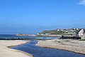
 Cullen Harbour - geograph.org.uk - 5862452.jpg 640 × 357; 66 KB
-
 Cullen House Home Farm - geograph.org.uk - 3206946.jpg 640 × 427; 70 KB
-
 Cullen Sands at High Tide - geograph.org.uk - 4280066.jpg 1,600 × 1,200; 445 KB
-
 Cullen Viaduct - geograph.org.uk - 4266195.jpg 2,560 × 1,920; 2.79 MB
-
 Cullen ^ Seatown - geograph.org.uk - 3532856.jpg 5,184 × 3,456; 6.02 MB
-

-
 Cuttlebrae Cottages, Clochan - geograph.org.uk - 5558648.jpg 1,600 × 1,020; 332 KB
-
 Cuttlebrae Farm, Clochan - geograph.org.uk - 5558624.jpg 1,600 × 934; 352 KB
-
 Cycle Route Waymarker - geograph.org.uk - 6276391.jpg 427 × 640; 381 KB
-
 Davie's Castle - geograph.org.uk - 4865843.jpg 4,896 × 3,672; 5.69 MB
-
 Decorative Manhole Covers - geograph.org.uk - 5570853.jpg 473 × 640; 528 KB
-
 Defaced Campaign Sign - geograph.org.uk - 4159905.jpg 640 × 427; 382 KB
-
 Derelict Building - geograph.org.uk - 981029.jpg 640 × 479; 139 KB
-
 Derelict Tile Factory - geograph.org.uk - 3206908.jpg 640 × 427; 133 KB
-
 Derelict Tile Factory near Mill of Towie - geograph.org.uk - 3206905.jpg 427 × 640; 117 KB
-
 Dismantled Elgin to Tillynaught railway line - geograph.org.uk - 6274336.jpg 1,600 × 1,200; 548 KB
-

-
 Dismantled railway line, near Porttannachy - geograph.org.uk - 4524067.jpg 1,024 × 768; 198 KB
-
 Dolphin doors at Portknockie - geograph.org.uk - 3655985.jpg 480 × 640; 186 KB
-
 Double arched bridge on the former railway - geograph.org.uk - 3630643.jpg 1,439 × 957; 391 KB
-
 Dry stone wall - Home Farm - geograph.org.uk - 4777033.jpg 4,896 × 3,672; 7.72 MB


_-_geograph.org.uk_-_5931705.jpg)
_-_geograph.org.uk_-_5931707.jpg)


_Link_-_geograph.org.uk_-_5145683.jpg)
_Link_-_geograph.org.uk_-_5145691.jpg)


_-_geograph.org.uk_-_6276382.jpg)


&filefrom=East+Cliff+-+geograph.org.uk+-+5116085.jpg#mw-category-media)