Category:Rain gauges in the United States
Jump to navigation
Jump to search
Subcategories
This category has only the following subcategory.
A
Media in category "Rain gauges in the United States"
The following 79 files are in this category, out of 79 total.
-

-
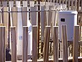
 2006-01-01 Precipitation gauges at the Baker 5W US Climate Reference Network station.jpg 2,816 × 2,112; 2.16 MB
-

-

-
 2008-07-20 Tonopah Airport ASOS heated tipping bucket in Tonopah, Nevada.jpg 3,264 × 2,448; 1.25 MB
-
 2010-02-19 Davis 6152 weather station.jpg 3,660 × 2,440; 2.16 MB
-

-
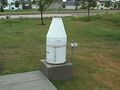
 2011-12-14 Tonopah Airport ASOS automatic heated tipping bucket precipitation gauge.JPG 3,264 × 2,448; 2.03 MB
-
 2011-12-30 Winnemucca Airport ASOS AWPAG precipitation gauge label.JPG 3,264 × 2,448; 1.92 MB
-
 2012-04-26 Ely RAWS closeup.jpg 3,264 × 2,448; 2.88 MB
-
 2012-06-26 Ruby Lake RAWS rain gauge.jpg 2,448 × 3,264; 1.78 MB
-
 2012-06-27 Lamoille number 3 SnoTel precipitation gauge.jpg 2,448 × 3,264; 1.93 MB
-
 2012-10-20 P1010403 Old precipitation gauge just downstream of Angel Lake, Nevada.JPG 3,264 × 2,448; 1.98 MB
-

-

-

-
 2013-09-19 09 26 59 ASOS AWPAG precipitation gauge at Eureka Airport, Nevada.JPG 3,264 × 2,448; 3.76 MB
-
 2013-09-19 09 27 07 ASOS AWPAG precipitation gauge at Eureka Airport, Nevada.JPG 2,448 × 3,264; 2.84 MB
-
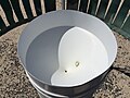
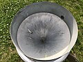
 2013-10-14 12 27 49 National Weather Service Standard Rain Gauge.JPG 2,448 × 3,264; 2.94 MB
-
 2013-10-14 12 27 56 National Weather Service Standard Rain Gauge with funnel on.JPG 3,264 × 2,448; 2.3 MB
-

-
 2013-10-14 13 53 18 Fischer & Porter recording precipitation gauge.JPG 2,448 × 3,264; 2.96 MB
-

-

-
 2014-10-03 17 00 02 Eureka Airport AWOS tipping bucket rain gauge.JPG 2,448 × 3,264; 2.3 MB
-
 2014-10-03 17 00 22 Eureka Airport AWOS tipping bucket rain gauge.JPG 2,448 × 3,264; 2.03 MB
-
 2014-10-03 17 00 23 Eureka Airport AWOS tipping bucket rain gauge.JPG 2,448 × 3,264; 1.72 MB
-

-

-
-

-

-

-

-

-
-

-

-

-

-

-

-

-

-

-

-

-

-

-

-

-

-

-

-
-

-

-

-

-

-

-

-

-

-

-
 Annual report of the Board of Commissioners of the Central Park (1858) (18247681599).jpg 1,982 × 3,758; 652 KB
-
 Chippewa National Forest - Social - 3.jpg 672 × 675; 66 KB
-
 Crews Lake after Tropical Storm Debby; 2012; Current Rain Gauge.JPG 4,000 × 3,000; 2.4 MB
-
 Fire Control Research - Idaho - DPLA - e23a81ab44374783695d3564996e6ae6.jpg 5,109 × 4,069; 2.89 MB
-
 FisherPorter.jpg 640 × 480; 47 KB
-
 HFCA 1607 People Volume 2 296.jpg (56d82d81510a4b3fbc72bdd839d7c81e).jpg 5,142 × 7,841; 2.9 MB
-
 HFCA 1607 People Volume 2 297.jpg (6904ebc0054d4371bf490f5bc25bb382).jpg 5,142 × 7,841; 2.9 MB
-
 HFCA 1607 People Volume 2 300.jpg (f1dee8c70e614169aba1d5eca83f62d0).jpg 5,142 × 7,841; 2.1 MB
-
 Instrumentation- Climatic - North Carolina - DPLA - ca486f5fe39793ca9cd32db15ea5f4d8.jpg 4,976 × 3,997; 1.98 MB
-
 Ketchikan Alaska Rain Gauge.jpg 883 × 1,536; 250 KB
-
 Wea01316 - Flickr - NOAA Photo Library.jpg 1,801 × 1,385; 1.51 MB
-
 Weather station rain gauge on a farm near Bozeman, Montana (25209675928).jpg 3,172 × 2,371; 3.1 MB
-
 Weather station rain gauge on a farm near Bozeman, Montana (38194679785).jpg 2,592 × 3,872; 3.24 MB
-
 Weather station rain gauge.JPG 1,792 × 1,200; 722 KB


.jpg)


_in_Sterling,_Loudoun_County,_Virginia.jpg)

_on_the_Automated_Surface_Observing_System_(ASOS)_at_Ronald_Reagan_Washington_National_Airport_in_Arlington_County,_Virginia.jpg)
_on_the_Automated_Surface_Observing_System_(ASOS)_at_Washington_Dulles_International_Airport_in_Chantilly,_Fairfax_County,_Virginia.jpg)
_on_the_Automated_Surface_Observing_System_(ASOS)_at_Washington_Dulles_International_Airport_in_Chantilly,_Fairfax_County,_Virginia.jpg)


_(18247681599).jpg)


.jpg)
.jpg)
.jpg)


.jpg)
.jpg)
