Category:Rail transport in the London Borough of Barking and Dagenham
Jump to navigation
Jump to search

Subcategories
This category has the following 6 subcategories, out of 6 total.
Media in category "Rail transport in the London Borough of Barking and Dagenham"
The following 17 files are in this category, out of 17 total.
-

-
 Railway across the Beam River valley - geograph.org.uk - 2337991.jpg 640 × 428; 94 KB
-
 Railway east of Chadwell Heath - geograph.org.uk - 3176032.jpg 640 × 480; 124 KB
-
 Railway east of Dagenham Dock - geograph.org.uk - 3175629.jpg 640 × 480; 110 KB
-
 Railway east of Upney station - geograph.org.uk - 2376105.jpg 640 × 480; 121 KB
-
 Railway line to Barking - geograph.org.uk - 3265679.jpg 4,288 × 3,216; 4.74 MB
-
 Railway line to Manor Park - geograph.org.uk - 3265673.jpg 4,288 × 3,216; 5.44 MB
-
 Railway lines at Dagenham Dock - geograph.org.uk - 4976645.jpg 4,082 × 3,110; 1.88 MB
-
 Railway lines at Dagenham East - geograph.org.uk - 1472532.jpg 640 × 480; 56 KB
-
 Railway lines at Upney - geograph.org.uk - 1472453.jpg 640 × 480; 58 KB
-
 Railway lines, East of Dagenham Dock Station - geograph.org.uk - 3394411.jpg 4,288 × 3,216; 4.68 MB
-
 Railway lines, West of Dagenham Dock Station - geograph.org.uk - 3394420.jpg 4,288 × 3,216; 4.73 MB
-
 Railway to London, train to Upminster Station - geograph.org.uk - 3397060.jpg 4,288 × 3,216; 4.86 MB
-
 Railway to Upminster Station - geograph.org.uk - 3397065.jpg 4,288 × 3,216; 5.26 MB
-
 Railway west of Renwick Road bridge - geograph.org.uk - 4997125.jpg 640 × 480; 136 KB
-
 Railway west of Ripple Lane depot - geograph.org.uk - 2349604.jpg 640 × 480; 118 KB
-
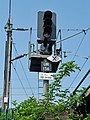 Signal UR156, East Ham - geograph.org.uk - 2376616.jpg 480 × 640; 112 KB


