Category:Rail transport in Warwickshire
Jump to navigation
Jump to search
Ceremonial counties of England: Bedfordshire · Berkshire · Buckinghamshire · Cambridgeshire · Cheshire · Cornwall · Cumbria · Derbyshire · Devon · Dorset · Durham · East Riding of Yorkshire · East Sussex · Essex · Gloucestershire · Greater London · Greater Manchester · Hampshire · Herefordshire · Hertfordshire · Kent · Lancashire · Leicestershire · Lincolnshire · Merseyside · North Yorkshire · Northamptonshire · Northumberland · Nottinghamshire · Oxfordshire · Rutland · Shropshire · Somerset · South Yorkshire · Staffordshire · Suffolk · Surrey · Tyne and Wear · Warwickshire · West Midlands · West Sussex · West Yorkshire · Wiltshire · Worcestershire
City-counties: Bristol · City of London
Former historic counties:
Other former counties:
City-counties: Bristol · City of London
Former historic counties:
Other former counties:
Wikimedia category | |||||
| Upload media | |||||
| Instance of | |||||
|---|---|---|---|---|---|
| Category combines topics | |||||
| Warwickshire | |||||
ceremonial and non-metropolitan county in England, UK     | |||||
| Instance of |
| ||||
| Location |
| ||||
| Capital | |||||
| Legislative body |
| ||||
| Population |
| ||||
| Area |
| ||||
| Different from | |||||
| Said to be the same as | Warwickshire (historic county of England, ceremonial county of England, 1844) | ||||
| official website | |||||
 | |||||
Subcategories
This category has the following 14 subcategories, out of 14 total.
D
E
L
- Long Marston Depot (164 F)
R
- Warwickshire RJD 1914 (6 F)
S
- Signal boxes in Warwickshire (14 F)
T
- Rail tunnels in Warwickshire (1 F)
Media in category "Rail transport in Warwickshire"
The following 69 files are in this category, out of 69 total.
-
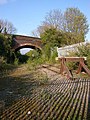
 Below the old railway bridge near Coughton - geograph.org.uk - 51910.jpg 640 × 480; 134 KB
-
 Birmingham & West Mids Passenger Railway Map (no Metro).svg 1,304 × 1,039; 298 KB
-
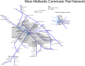 Birmingham & West Mids Passenger Railway Map.svg 1,374 × 1,056; 315 KB
-

-
 Climb to the Walk - geograph.org.uk - 208043.jpg 640 × 480; 137 KB
-
-
-
 Dismantled railway near Birdingbury (2) - geograph.org.uk - 1422699.jpg 543 × 640; 139 KB
-
 Dismantled Railway near Claydon - geograph.org.uk - 1434050.jpg 640 × 480; 105 KB
-
 Disused railway cutting, Stockton - geograph.org.uk - 735384.jpg 640 × 428; 181 KB
-
 Edge Hill Light Railway embankment - geograph.org.uk - 110168.jpg 640 × 480; 79 KB
-

-
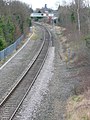
 GWR main line, Leamington Spa - geograph.org.uk - 6184.jpg 640 × 480; 94 KB
-
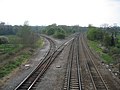 Hatton Junction - geograph.org.uk - 155774.jpg 640 × 480; 265 KB
-
 Hillmorton Lane - geograph.org.uk - 676127.jpg 640 × 480; 75 KB
-

-
 Kingsbury Junction - geograph.org.uk - 603353.jpg 640 × 480; 61 KB
-
 Leamington Railway bridge over the Leam - geograph.org.uk - 1093736.jpg 480 × 640; 135 KB
-

-
 Marton Moor - geograph.org.uk - 17959.jpg 640 × 480; 140 KB
-
 Nuneaton Locomotive Depot 2074346 dece89cd.jpg 640 × 395; 59 KB
-
 Permissive path, Crackley - geograph.org.uk - 585506.jpg 640 × 480; 96 KB
-
 Railway cutting, Crackley - geograph.org.uk - 585512.jpg 480 × 640; 97 KB
-
 Railway track , Kenilworth Warwicks. - geograph.org.uk - 703419.jpg 480 × 640; 102 KB
-
 Rugby (LMR) Locomotive Depot 2075441 9e424739.jpg 640 × 343; 48 KB
-
 Rugby - Clifton Road - geograph.org.uk - 122865.jpg 640 × 480; 131 KB
-
 Rugby to Leamington Railway - geograph.org.uk - 670543.jpg 640 × 480; 90 KB
-
 Rugby-New Bilton - geograph.org.uk - 409625.jpg 480 × 640; 156 KB
-
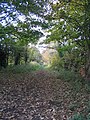 The Kenilworth Greenway - geograph.org.uk - 601861.jpg 480 × 640; 96 KB
-
 Trackwork near Whitacre Junction - geograph.org.uk - 1017140.jpg 640 × 430; 69 KB
-
 Train climbs out of cutting, Myton - geograph.org.uk - 1596851.jpg 640 × 427; 126 KB
-
 TruncatedRemainsOfClosedRugbyToLeamingtonRailway.jpg 640 × 421; 56 KB
-
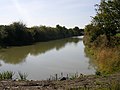
 Underwater railway, Myton - geograph.org.uk - 1215845.jpg 640 × 427; 100 KB
-
 View towards Long Marston rail depot - geograph.org.uk - 4937106.jpg 2,000 × 1,428; 1.3 MB
-
 West Mids Metro and Rail Passenger Railway Map.svg 660 × 432; 315 KB
-
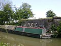
 Willoughby Wharf - geograph.org.uk - 703575.jpg 640 × 480; 88 KB
-
 Wolfhampcote - geograph.org.uk - 438180.jpg 640 × 480; 120 KB
-
 Wolfhampcote - geograph.org.uk - 52500.jpg 640 × 480; 113 KB
-
 Wolfhampcote-Great Central Railway - geograph.org.uk - 399636.jpg 640 × 480; 119 KB
-

-

-
 Brownsover - Newton lane - geograph.org.uk - 65532.jpg 640 × 480; 95 KB
-
 Clifton On Dunsmore - geograph.org.uk - 665404.jpg 640 × 480; 66 KB
-

-
-

-

-
-

-
 Draycote - geograph.org.uk - 190477.jpg 640 × 480; 120 KB
-
 End of the line - geograph.org.uk - 134310.jpg 640 × 480; 128 KB
-
 Entrance to Far Longdon - geograph.org.uk - 92491.jpg 640 × 480; 138 KB
-
 Flecknoe - geograph.org.uk - 52502.jpg 640 × 480; 164 KB
-
 Flecknoe - geograph.org.uk - 52635.jpg 640 × 480; 146 KB
-
 Goldicote Cutting - geograph.org.uk - 117712.jpg 640 × 480; 107 KB
-
 Ham's Hall siding - geograph.org.uk - 211619.jpg 640 × 480; 73 KB
-
 Nr Flecknoe - geograph.org.uk - 106840.jpg 640 × 426; 158 KB
-
 Railway Access Signage - geograph.org.uk - 29368.jpg 640 × 480; 154 KB
-

-
 Rugby - Parkfield Road - geograph.org.uk - 176302.jpg 640 × 480; 175 KB
-
 Rugby - Rainsbrook Valley Railway - geograph.org.uk - 39855.jpg 640 × 480; 167 KB
-
 Rural railway - geograph.org.uk - 221500.jpg 640 × 505; 41 KB
-
 SandMJR towards Fenny Compton - geograph.org.uk - 148203.jpg 640 × 480; 320 KB
-

-
 Stratford and Midland Junction Railway - geograph.org.uk - 147312.jpg 639 × 479; 269 KB
-
 Supply line - geograph.org.uk - 343663.jpg 640 × 480; 127 KB
-
 The Paddy Line, Waste Hill - geograph.org.uk - 110779.jpg 480 × 640; 197 KB
-
 Willoughby - geograph.org.uk - 52495.jpg 640 × 480; 118 KB
-
 Willoughby - geograph.org.uk - 67706.jpg 640 × 480; 77 KB

.svg)


_-_geograph.org.uk_-_1422699.jpg)


_Locomotive_Depot_2075441_9e424739.jpg)


_-_geograph.org.uk_-_1596394.jpg)


