Category:Rail tracks in England
Jump to navigation
Jump to search
Subcategories
This category has the following 4 subcategories, out of 4 total.
G
L
Media in category "Rail tracks in England"
The following 200 files are in this category, out of 297 total.
(previous page) (next page)-
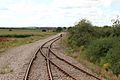
 2 become 1 - Middleton Railway, Leeds UK (23840747032).jpg 4,608 × 3,456; 5.3 MB
-
 2014 Keighley and Worth Valley Railway 01.jpg 4,272 × 2,848; 3.86 MB
-
 2014 Keighley and Worth Valley Railway 02.jpg 4,272 × 2,848; 4.99 MB
-
 2015 at Portishead - end of the old branch.JPG 1,366 × 910; 592 KB
-
 2015 Taunton track renewals - Geismar track lifting units.JPG 1,366 × 910; 579 KB
-
 2015 Taunton track renewals - moving new points into position.JPG 1,366 × 910; 708 KB
-
 2024 at Ponsandane - building new sidings (04).JPG 1,366 × 910; 1.07 MB
-
 500px photo (63092321).jpeg 1,430 × 2,048; 529 KB
-

-
 Along the Railway Line at the Sun Wharf Level Crossing - geograph.org.uk - 2602506.jpg 2,304 × 3,072; 1.44 MB
-
 Along the railway tracks to Leiston - geograph.org.uk - 2010719.jpg 3,072 × 2,304; 1.28 MB
-
 Along the railway tracks to Saxmundham - geograph.org.uk - 2010717.jpg 3,072 × 2,304; 1.29 MB
-
 Along the trackbed towards the viaduct (geograph 6234932).jpg 1,024 × 683; 620 KB
-
 Along to Railway Line at the Sun Wharf Level Crossing - geograph.org.uk - 2602503.jpg 3,072 × 2,304; 1.36 MB
-
 Angerstein Wharf branch railway line - geograph.org.uk - 2360392.jpg 960 × 1,280; 662 KB
-
 Armley Mills, Armley, Leeds - geograph.org.uk - 5157752.jpg 1,230 × 691; 642 KB
-
 At High Lane level crossing - geograph.org.uk - 5086055.jpg 1,280 × 960; 1.15 MB
-
 Balast Pit Yard.jpg 4,160 × 3,120; 3.13 MB
-
 Basingstoke-and-Alton-Light-Railway-track-section.jpg 2,580 × 1,932; 2.1 MB
-
 Birkenhead Dock Branch along Beaufort Road 2020-1.jpg 5,074 × 3,270; 21.35 MB
-
 Birkenhead Dock Branch along Beaufort Road 2020-2.jpg 5,198 × 3,462; 25.27 MB
-
 Birkenhead Dock Branch along Beaufort Road 2020-3.jpg 5,198 × 3,462; 23.98 MB
-
 Birkenhead Dock Branch along Beaufort Road 2020-4.jpg 5,198 × 3,462; 23.72 MB
-
 Birkenhead Dock Branch along Beaufort Road 2020-5.jpg 5,139 × 3,375; 22.62 MB
-
 Birkenhead Dock Branch at Beaufort Road (10).JPG 4,320 × 3,240; 5.56 MB
-
 Birkenhead Dock Branch at Beaufort Road (11).JPG 3,240 × 4,320; 4.96 MB
-
 Birkenhead Dock Branch at Beaufort Road (12).JPG 3,240 × 4,320; 4.6 MB
-
 Birkenhead Dock Branch at Beaufort Road (2).JPG 3,240 × 4,320; 4.31 MB
-
 Birkenhead Dock Branch at Beaufort Road (3).JPG 4,320 × 3,240; 5.52 MB
-
 Birkenhead Dock Branch at Beaufort Road (4).JPG 3,240 × 4,320; 4.96 MB
-
 Birkenhead Dock Branch at Beaufort Road (5).JPG 4,320 × 3,240; 5.15 MB
-
 Birkenhead Dock Branch at Beaufort Road (6).JPG 3,240 × 4,320; 4.8 MB
-
 Birkenhead Dock Branch at Beaufort Road (7).JPG 4,320 × 3,240; 5.14 MB
-
 Birmingham Moor Street - new tracks (5603714690).jpg 2,592 × 1,944; 1.06 MB
-
 Birmingham Moor Street - new tracks - new bridge (5603715408).jpg 2,592 × 1,944; 1.04 MB
-
 Birmingham Moor Street - new tracks - Platforms 3 and 4 (5603713950).jpg 2,592 × 1,944; 916 KB
-
 Birmingham Moor Street Station (4730465711).jpg 3,648 × 2,736; 2.3 MB
-
 Birmingham Moor Street Station (4730470303) (2).jpg 3,648 × 2,736; 2.35 MB
-
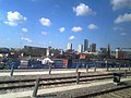
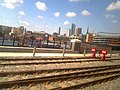
 Birmingham New Street Station (4387691621).jpg 3,648 × 2,736; 2.43 MB
-
 Birmingham New Street Station - Odeon (6970368511).jpg 3,648 × 2,736; 2.38 MB
-
 Boughton junction on NLR.jpg 1,600 × 1,200; 676 KB
-
 Bramley Line - geograph.org.uk - 2576380.jpg 1,600 × 1,200; 832 KB
-
 Brimscombe railway station (site), Gloucestershire (geograph 7098719).jpg 1,600 × 1,200; 702 KB
-
 Bristol Harbour Railway - geograph.org.uk - 2888917.jpg 640 × 480; 212 KB
-
 Bristol Harbour Railway - geograph.org.uk - 2891025.jpg 640 × 480; 178 KB
-
 Bristol MMB 79 Harbour Railway.jpg 2,304 × 1,728; 1.22 MB
-
 Brookwood Cemetery Railway.jpg 1,333 × 1,000; 685 KB
-
 Buckfastleigh - Haytor Tramway track.JPG 1,366 × 910; 932 KB
-
 Castleton East Junction (1).jpg 1,024 × 768; 531 KB
-
 Checking the gauge at Plymouth.JPG 1,366 × 1,024; 1.07 MB
-
 Clifton Down railway station MMB 05.jpg 3,936 × 2,624; 3.5 MB
-
 Crosfields Ground Frame (2322656162).jpg 1,334 × 1,024; 529 KB
-
 Crossing the railway - geograph.org.uk - 2201353.jpg 1,024 × 768; 186 KB
-
 Crossrail-cables 01.jpg 3,072 × 2,304; 4.55 MB
-
 Derailed - The Wisbech to March railway - geograph.org.uk - 2927008.jpg 4,320 × 3,240; 5.63 MB
-
 Disused railway line in Hamble-le-Rice - geograph.org.uk - 3821638.jpg 800 × 557; 146 KB
-
 Disused railway line in Tipton - geograph.org.uk - 5356900.jpg 800 × 600; 130 KB
-
 Disused railway line, Staveley - geograph.org.uk - 2441422.jpg 950 × 713; 299 KB
-
 Disused railway track between Wisbech and March - geograph.org.uk - 2926117.jpg 4,320 × 3,240; 5.96 MB
-
 Docks branch line - geograph.org.uk - 1994546.jpg 1,280 × 960; 483 KB
-
 Dungeness Branch Line - geograph.org.uk - 1978371.jpg 1,024 × 768; 237 KB
-
 Dungeness Branch Line towards Lydd - geograph.org.uk - 2248783.jpg 3,072 × 2,304; 1.73 MB
-
 Easington Quarry Branch Line (geograph 4204734).jpg 5,035 × 3,451; 7.3 MB
-
 East Coast Main Line - geograph.org.uk - 2446613.jpg 640 × 427; 112 KB
-
 East Grinstead Bluebell Railway Northern Extension 15.jpg 4,000 × 3,000; 2.15 MB
-
 Electrified Railway to Ilkley - geograph.org.uk - 1344597.jpg 414 × 640; 59 KB
-

-

-

-
-

-
 Exmouth Junction, a pile of old track - geograph.org.uk - 832394.jpg 640 × 480; 122 KB
-
 Felled trees beside the Middleton Railway, Leeds (25976978042).jpg 4,608 × 3,456; 5.56 MB
-
 Flax Bourton railway station MMB 07.jpg 2,304 × 1,728; 679 KB
-
 Footpath crossing Lavender Line - geograph.org.uk - 4226103.jpg 4,000 × 3,000; 3.95 MB
-
 Footpath level crossing near Fox Hill - geograph.org.uk - 3456690.jpg 2,048 × 1,536; 601 KB
-
 Former Aldeburgh Branch Line - geograph.org.uk - 4517001.jpg 3,648 × 2,736; 2.97 MB
-
 Former Ardingly Branch line - geograph.org.uk - 1955720.jpg 1,600 × 1,200; 774 KB
-
 Former colliery railway - geograph.org.uk - 2441014.jpg 950 × 713; 322 KB
-
 Former High Royds Hospital Railway trackbed with commemorative section of track.jpg 2,700 × 1,800; 4.73 MB
-
-
 Fosseway Level Crossing and Signal Box - 31340839334.jpg 5,472 × 3,648; 10.11 MB
-
 Fosseway Level Crossing and Signal Box - 31371886063.jpg 5,472 × 3,648; 2.77 MB
-
 Fosseway Level Crossing and Signal Box - 32144080716.jpg 4,271 × 3,067; 2.28 MB
-
 Gallansay - geograph.org.uk - 1635627.jpg 480 × 640; 87 KB
-
 Gap in the track - geograph.org.uk - 5721297.jpg 640 × 427; 282 KB
-
 Gate on the far side - geograph.org.uk - 2715344.jpg 1,024 × 683; 220 KB
-
 Getting the low down on the Middleton Railway (28126965308).jpg 4,282 × 3,211; 4.05 MB
-
 2018 at Gobowen station - the junction and sidings.JPG 1,366 × 910; 781 KB
-
 GOC Letchworth to Ickleford & Arlesey 089 Railway (51276860034).jpg 4,608 × 3,456; 5.38 MB
-
 Going round the bend - The Bramley Line - geograph.org.uk - 2324616.jpg 2,848 × 2,136; 3.11 MB
-
 Hall Green Station - snow (6822405313).jpg 3,648 × 2,736; 2.35 MB
-
 Hall Green Station - snow - Stratford Road (6822409959).jpg 3,648 × 2,736; 2.41 MB
-
 Hall Royd Junction (2421232611).jpg 1,024 × 768; 770 KB
-
 Hastings miniature railway (1).jpg 3,488 × 2,616; 2.23 MB
-
 Hatton Junction - geograph.org.uk - 155774.jpg 640 × 480; 265 KB
-
 Holbrooks Railway Line.jpg 3,072 × 2,304; 1.97 MB
-
 Holding sidings in MOD Bicester - geograph.org.uk - 3647138.jpg 1,500 × 999; 343 KB
-
 Hope there is nothing behind me, take the shot quick. (3591924685).jpg 3,495 × 1,263; 990 KB
-
 Kent ^ East Sussex Railway - Tenterden - geograph.org.uk - 3003362.jpg 1,600 × 1,200; 592 KB
-
 King's Lynn Dereham Railway track 2.jpg 7,360 × 4,912; 4.27 MB
-
 Kings Norton Station - Cotteridge (3907158191).jpg 2,816 × 2,112; 1.07 MB
-
 Kings Norton Station - Cotteridge (3907937804).jpg 2,816 × 2,112; 1.15 MB
-
 Kirkstall Abbey Light Railway - geograph.org.uk - 359614.jpg 467 × 640; 155 KB
-
 Leeds Middleton railway - geograph.org.uk - 1018389.jpg 621 × 406; 124 KB
-
 Lengths of flat-bottomed rail IMG 2659.jpg 4,272 × 2,848; 5.65 MB
-
 Lengths of flat-bottomed rail IMG 2661.jpg 4,272 × 2,848; 5.68 MB
-
 Lengths of flat-bottomed rail IMG 2662.jpg 4,272 × 2,848; 4.79 MB
-

-
 Line closed - geograph.org.uk - 3021893.jpg 1,280 × 960; 395 KB
-
 Line to Didcot - geograph.org.uk - 2613291.jpg 1,024 × 683; 207 KB
-
 London Midland trains at Tyseley (6132884300).jpg 2,592 × 1,944; 832 KB
-
 London Midland trains at Tyseley (6132884672).jpg 2,592 × 1,944; 960 KB
-
 London Midland trains at Tyseley (6132884990).jpg 2,592 × 1,944; 862 KB
-
 London MMB «W1 Stratford High Street.jpg 3,756 × 2,379; 3.65 MB
-
 London Transport Museum Acton depot, 7 August 2011 (05).jpg 4,000 × 3,000; 4.71 MB
-
 London Transport Museum Acton depot, 7 August 2011 (07).jpg 4,000 × 3,000; 4.5 MB
-
 London Underground track - geograph.org.uk - 1466505.jpg 640 × 480; 120 KB
-
 Longbridge Station (6921871088) (2).jpg 3,648 × 2,736; 2.4 MB
-
 Longbridge Station (6921875826).jpg 3,648 × 2,736; 2.31 MB
-
 Longbridge Station (7067939671).jpg 3,648 × 2,736; 2.48 MB
-
 Longbridge Station - footbridge (6921865220).jpg 3,648 × 2,736; 2.29 MB
-
 Longbridge Station - London Midland 323212 (7067941031).jpg 3,648 × 2,736; 2.33 MB
-
-
 Looking along the railway line to Barnby - geograph.org.uk - 2851155.jpg 3,072 × 2,304; 1.43 MB
-
 Looking along the railway line to Beccles - geograph.org.uk - 2851167.jpg 3,072 × 2,304; 1.4 MB
-
 Looking down the line from King Street Level Crossing - geograph.org.uk - 2446956.jpg 4,000 × 3,000; 4.11 MB
-
 Looking down the track. - geograph.org.uk - 1716473.jpg 480 × 640; 93 KB
-
 Looking south-east from Womersley level crossing - geograph.org.uk - 3793972.jpg 1,280 × 960; 349 KB
-
 MacDonnell plate track.jpg 800 × 600; 270 KB
-
 Middleton Rail Branch.jpg 4,224 × 3,168; 5.14 MB
-
 Middleton Rail Tunnel 1.jpg 4,224 × 3,168; 4.11 MB
-
 Middleton Rail Tunnel 2.jpg 4,224 × 3,168; 3.57 MB
-
 Middleton Railway - under the M621 (geograph 4579510).jpg 640 × 614; 99 KB
-
 Middleton Railway Leeds (29263403426).jpg 3,447 × 4,595; 5.36 MB
-
 Middleton Railway Leeds GB (31725243102).jpg 4,478 × 3,456; 4.77 MB
-
 Middleton Railway Line - Beza Street - geograph.org.uk - 1230472.jpg 640 × 480; 360 KB
-
 Middleton Railway, Leeds (34091106942).jpg 4,608 × 3,456; 5.17 MB
-
-
 Mineral Railway Line, Seaton Delaval (geograph 6529491).jpg 1,600 × 1,200; 867 KB
-
 Mineral Railway towards Hoo Junction - geograph.org.uk - 1566651.jpg 640 × 427; 91 KB
-
 Montpelier railway station stringberd 1.jpg 800 × 1,065; 1.09 MB
-
 Multi fuel unloading point - geograph.org.uk - 5648119.jpg 4,103 × 2,460; 1.88 MB
-
 New Bridge Lane railway crossing, Wisbech - geograph.org.uk - 1975633.jpg 2,848 × 2,136; 3.11 MB
-
 North mersey Branch 1.jpg 1,488 × 1,984; 617 KB
-
 North mersey Branch 2.jpg 1,488 × 1,984; 655 KB
-
 Northampton 2013 (14).jpg 1,746 × 866; 404 KB
-
 Northampton 2013 (15).jpg 1,744 × 1,214; 643 KB
-
 Northern end of Rowsley South station - geograph.org.uk - 3102455.jpg 1,024 × 768; 148 KB
-
 Norton Fitzwarren - Orchard Junction.JPG 1,366 × 910; 592 KB
-
 Oakham station 11.jpg 4,272 × 2,848; 5.82 MB
-
 Oakham station 18.jpg 4,272 × 2,848; 6.3 MB
-

-
 Old Railway Track - geograph.org.uk - 3036744.jpg 900 × 675; 350 KB
-
 Old Royston Railway - geograph.org.uk - 491132.jpg 480 × 640; 102 KB
-
 On the train into Moor Street Station (5623952009).jpg 2,592 × 1,944; 1.13 MB
-
 On the train into Moor Street Station (5623952691).jpg 2,592 × 1,944; 1.23 MB
-
 On the train into Moor Street Station (5623953239) (2).jpg 2,592 × 1,944; 1.01 MB
-

-

-
 Pedestrain level crossing near Wardour, Wiltshire 05.JPG 2,816 × 2,112; 1.49 MB
-
 Proceed with caution - geograph.org.uk - 558868.jpg 640 × 480; 106 KB
-
 Rail (122766765).jpg 640 × 480; 60 KB
-
 Rail service interruption - geograph.org.uk - 5703298.jpg 683 × 1,024; 305 KB
-
 Rail track viewed from Grosvenor Bridge - geograph.org.uk - 3047329.jpg 1,600 × 1,200; 681 KB
-
 Rail Track, West Wharf - geograph.org.uk - 415378.jpg 640 × 480; 142 KB
-

-
 Railway at Level Crossing in Hagley. - geograph.org.uk - 3580797.jpg 3,648 × 2,736; 2.82 MB
-
 Railway crossing - geograph.org.uk - 2099071.jpg 640 × 480; 113 KB
-
 Railway crossing on Foxcovert Road near Werrington - geograph.org.uk - 3589995.jpg 4,000 × 3,000; 2.65 MB
-
 Railway heading north - geograph.org.uk - 4244251.jpg 640 × 480; 96 KB
-

-
 Railway line - geograph.org.uk - 3114315.jpg 640 × 480; 105 KB
-
 Railway line - Streetsbrook Road, Solihull (6844143634).jpg 3,648 × 2,736; 2.43 MB
-
 Railway line - Streetsbrook Road, Solihull (6990270483).jpg 3,648 × 2,736; 2.43 MB
-

-
 Railway Line at Intwood Road Crossing - geograph.org.uk - 4161998.jpg 3,072 × 2,304; 1.86 MB
-
 Railway Line at Palgrave Level Crossing - geograph.org.uk - 4265723.jpg 3,072 × 2,304; 2.02 MB
-
 Railway line at Three Oaks - geograph.org.uk - 3018566.jpg 4,320 × 3,240; 4.84 MB
-
 Railway line from Park Street, going under Moor Street Station (5131095789).jpg 3,648 × 2,736; 2.46 MB
-
 Railway line from Park Street, going under Moor Street Station (5131100039) (2).jpg 3,648 × 2,736; 2.4 MB
-
 Railway line from Park Street, going under Moor Street Station (5131695184).jpg 3,648 × 2,736; 2.38 MB
-
 Railway line from Park Street, going under Moor Street Station (5131699800).jpg 3,648 × 2,736; 2.43 MB
-
 Railway line near Frogham - geograph.org.uk - 3027604.jpg 4,320 × 3,240; 4.77 MB
-
 Railway line to Barrington Cement Works - geograph.org.uk - 80442.jpg 640 × 479; 101 KB
-

-

-
 Railway Line towards Collingham - geograph.org.uk - 3110847.jpg 2,256 × 1,504; 1 MB
-

-
 Railway lines near March Junction South - geograph.org.uk - 3108762.jpg 4,320 × 3,240; 5.86 MB
-
 Railway near Crowthorne Berkshire.jpg 3,264 × 2,448; 2.23 MB
-
 Railway Siding at Rushenden Pier - geograph.org.uk - 634317.jpg 640 × 480; 77 KB
-

-
 Railway through Chipstead Bottom - geograph.org.uk - 5870652.jpg 1,024 × 678; 1,018 KB
-
 Railway towards West Croydon - geograph.org.uk - 3103625.jpg 1,024 × 768; 284 KB
-
 Railway Trackbed - geograph.org.uk - 2020885.jpg 800 × 531; 165 KB
-
 Railway tracks - Welney Road Level Crossing, Manea - geograph.org.uk - 3302277.jpg 4,320 × 3,240; 5.6 MB
-
 Railway tracks at Upwell Road, March - geograph.org.uk - 3111259.jpg 4,320 × 3,240; 5.54 MB
-
 Railway tracks heading to Spalding - geograph.org.uk - 3092872.jpg 4,320 × 3,240; 5.88 MB
-
 Railway tracks in Bournemouth.jpg 3,556 × 2,738; 4.07 MB
.jpg)


.JPG)
.jpeg)


.jpg)


.JPG)
.JPG)
.JPG)
.JPG)
.JPG)
.JPG)
.JPG)
.JPG)
.JPG)
.jpg)
.jpg)
.jpg)
.jpg)
_(2).jpg)
.jpg)
.jpg)


,_Gloucestershire_(geograph_7098719).jpg)


.jpg)


.jpg)


.jpg)


.jpg)
.jpg)
.jpg)
.jpg)
.jpg)

.jpg)


.jpg)

.jpg)

.jpg)
.jpg)
.jpg)
.jpg)


.jpg)
.jpg)


.jpg)
.jpg)
.jpg)


_(2).jpg)
.jpg)
.jpg)
.jpg)
.jpg)
_and_signs_Electric_trains_No_access_to_Rover_plant_Down_goods_(6921863878)_(2).jpg)


.jpg)
.jpg)
.jpg)

.jpg)
.jpg)


.jpg)
.jpg)


.jpg)
.jpg)
_(2).jpg)
.jpg)
.jpg)


.jpg)


_(14574156398).jpg)


.jpg)
.jpg)


.jpg)
_(2).jpg)
.jpg)
.jpg)


.jpg)
.jpg)
.jpg)
.jpg)