Category:Radar images of volcanoes
Jump to navigation
Jump to search
Subcategories
This category has the following 10 subcategories, out of 10 total.
Media in category "Radar images of volcanoes"
The following 34 files are in this category, out of 34 total.
-
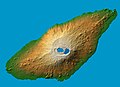 Ambae island 3D pic.jpg 1,234 × 899; 123 KB
-
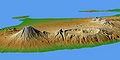 Bali Mts Agung and Batur.jpg 1,400 × 704; 106 KB
-
 Cool lava in Africa's Great Rift Valley.jpg 3,030 × 4,171; 7.48 MB
-
 Cool lava in Africa’s Great Rift Valley ESA237110.tiff 3,030 × 4,171; 33.98 MB
-
 Cotopaxi Volcano dem.jpg 1,200 × 1,200; 1.27 MB
-
 Dem aetna vergleich hires.jpg 1,488 × 850; 1.86 MB
-
 Dem eya hires.jpg 1,640 × 1,139; 2.21 MB
-
 Ecuador's highlands.jpg 6,023 × 5,196; 18.66 MB
-
 Eyjafjallajökull after eruption on 2010-03-20 seen by TerraSAR-X.jpg 2,673 × 2,005; 6.75 MB
-
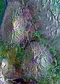
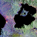
 Galeras volcano.jpg 3,930 × 2,880; 3.27 MB
-
 Ground Deformation from Chilean Volcanic Eruption Shown by Satellite Radar Image.png 2,881 × 1,729; 13.81 MB
-
 Kilauea-falsecolor.jpg 1,440 × 862; 137 KB
-
 Mount Hood, Oregon map.png 1,755 × 931; 2.07 MB
-
 NEO cotopaxi big.jpg 800 × 800; 240 KB
-
 Nevado del Ruiz - radar image from space.jpg 1,886 × 1,414; 1.25 MB
-
 Nevado Del Ruiz, Colombia (2023-11-16-14-40-31 UMBRA-04).tiff 15,461 × 18,329, 7 pages; 376.27 MB
-
 Piton de la Fournaise - Furnace Peak - radar image by TerraSAR-X.jpg 7,157 × 6,279; 40.22 MB
-
 Puyehue-Cordón Caulle region on the radar image acquired by TerraSAR-X on 6 July 2011.jpg 2,149 × 2,914; 3.31 MB
-
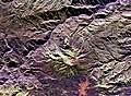
 Ruiz volcano.jpg 3,997 × 3,408; 3.33 MB
-
 Sakura-jima from space.jpg 3,000 × 3,716; 3.15 MB
-
 SAR Kilauea topo interferogram.jpg 577 × 577; 152 KB
-
 SAR Kilauea.jpg 1,000 × 1,000; 333 KB
-
 Sentinel-1 (IW-VVVH) image on 2020-09-21.jpg 944 × 314; 163 KB
-
 SIR-C X-SAR Kliuchevskoi Volcano.jpg 1,202 × 835; 392 KB
-
 SIR-C X-SAR Long Valley, California.jpg 1,383 × 1,540; 553 KB
-
 SIR-C X-SAR of Mount Pinatubo.jpg 2,395 × 2,435; 1.53 MB
-
 Taal Volcano-Pansipit River satellite image.gif 252 × 252; 54 KB
-
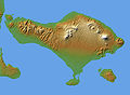 Topography of Bali.jpg 1,669 × 1,217; 498 KB
-
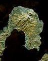 Unzen volcano.jpg 512 × 649; 77 KB
-
 Uran-Togoo Tulga Uul Natural Monument Topography.tif 461 × 600; 1.01 MB
-
 Volcanic uplift.jpg 1,366 × 992; 1.23 MB
-
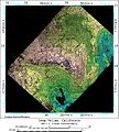
 Верхняя Донгай.jpg 4,064 × 3,637; 2.76 MB
-
 Дахт-и-Навар.jpg 3,261 × 3,911; 2.96 MB
-
 Торонгпронг.jpg 4,042 × 3,659; 3.39 MB


_image_on_2020-09-21.jpg)