Category:RAF West Malling
Jump to navigation
Jump to search
| Object location | | View all coordinates using: OpenStreetMap |
|---|
UK Royal Air Force airbase .jpg) | |||||
| Upload media | |||||
| Instance of |
| ||||
|---|---|---|---|---|---|
| Location | West Malling, Tonbridge and Malling, Kent, South East England, England | ||||
| Operator | |||||
| Dissolved, abolished or demolished date |
| ||||
| Elevation above sea level |
| ||||
| IATA airport code |
| ||||
| ICAO airport code |
| ||||
 | |||||
Subcategories
This category has only the following subcategory.
R
- RAF West Malling Control Tower (16 F)
Media in category "RAF West Malling"
The following 39 files are in this category, out of 39 total.
-
 Barrack Blocks, RAF West Malling (49901264168).jpg 4,896 × 3,672; 6.27 MB
-
 Barrack Blocks, RAF West Malling (49901268898).jpg 4,893 × 3,670; 4.97 MB
-
 Barrack Blocks, RAF West Malling (49901781876).jpg 4,896 × 3,672; 6.7 MB
-
 Barrack Blocks, RAF West Malling (49901783641).jpg 4,896 × 3,672; 5.53 MB
-
 Barrack Blocks, RAF West Malling (49901786536).jpg 4,896 × 3,672; 6.49 MB
-
 Barrack Blocks, RAF West Malling (49901787721).jpg 4,896 × 3,672; 6.24 MB
-
 Barrack Blocks, RAF West Malling (49902089807).jpg 4,896 × 3,672; 6.14 MB
-
 Barrack Blocks, RAF West Malling (49902093347).jpg 3,672 × 4,896; 6.08 MB
-
 Barrack Blocks, RAF West Malling (49902101337).jpg 3,672 × 4,896; 6.89 MB
-
 Battle HQ, RAF West Malling (49901326503).jpg 4,833 × 3,625; 6.93 MB
-
 Battle HQ, RAF West Malling (49901354253).jpg 4,876 × 3,657; 3.95 MB
-
 Battle HQ, RAF West Malling (49901831376).jpg 4,896 × 3,672; 6.11 MB
-
 Battle HQ, RAF West Malling (49901848711).jpg 4,876 × 3,657; 4 MB
-
 Battle HQ, RAF West Malling (49901853126).jpg 4,844 × 3,633; 3.84 MB
-
 Battle HQ, RAF West Malling (49902138477).jpg 4,896 × 3,672; 5.88 MB
-
 Battle HQ, RAF West Malling (49902140687).jpg 4,896 × 3,672; 6.15 MB
-
 Battle HQ, RAF West Malling (49902145872).jpg 4,801 × 3,601; 6.38 MB
-
 Battle HQ, RAF West Malling (49902150417).jpg 3,608 × 4,811; 5.32 MB
-
 Battle HQ, RAF West Malling (49902158012).jpg 3,578 × 4,771; 3.4 MB
-
 Battle HQ, RAF West Malling (49902170682).jpg 3,205 × 4,273; 2.21 MB
-
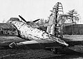
 Cessna 140 G-ALOD at West Malling 1990 (27316874738).jpg 1,759 × 1,163; 369 KB
-
-
 DSC07432 (49901823631).jpg 4,896 × 3,672; 5.95 MB
-
 Gibson Building.jpg 4,080 × 2,295; 2.8 MB
-
 RAF West Malling - GWAD - August 31 1987 (composite).jpg 800 × 327; 342 KB
-
 RAF West Malling Bofors Tower (49901364648).jpg 3,874 × 2,181; 8.84 MB
-
 RAF West Malling Bofors Tower (49901875776).jpg 4,000 × 6,000; 12.65 MB
-
 RAF West Malling Bofors Tower (49901879746).jpg 4,000 × 6,000; 14.74 MB
-
 RAF West Malling Bofors Tower (49902184392).jpg 3,705 × 2,086; 9.06 MB
-

-

-
 Sergeants Mess, RAF West Malling (49901792301).jpg 4,896 × 3,672; 4.15 MB
-
 Sergeants Mess, RAF West Malling (49902107607).jpg 4,896 × 3,672; 4.88 MB
-
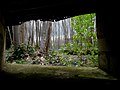
 Type 24 Pillbox, RAF West Malling (49901301398).jpg 4,896 × 3,672; 6.08 MB
-
 Type 24 Pillbox, RAF West Malling (49901309523).jpg 4,896 × 3,672; 6.17 MB
-
 Type 24 Pillbox, RAF West Malling (49902121537).jpg 4,896 × 3,672; 7.78 MB
-
 Type 24 Pillbox, RAF West Malling (49902126817).jpg 4,896 × 3,672; 7.15 MB
-

-
.jpg)
.jpg)
.jpg)
.jpg)
.jpg)
.jpg)
.jpg)
.jpg)
.jpg)
.jpg)
.jpg)
.jpg)
.jpg)
.jpg)
.jpg)
.jpg)
.jpg)
.jpg)
.jpg)
.jpg)
.jpg)
,_1944_CE136.jpg)
.jpg)

.jpg)
.jpg)
.jpg)
.jpg)
,_1943-1944._CH13468.jpg)
,_1943-1944._CH18183.jpg)
.jpg)
.jpg)
.jpg)
.jpg)
.jpg)
.jpg)
.png)
