Category:RAF Charmy Down
Jump to navigation
Jump to search
| Object location | | View all coordinates using: OpenStreetMap |
|---|
ex RAF station  | |||||
| Upload media | |||||
| Instance of |
| ||||
|---|---|---|---|---|---|
| Part of |
| ||||
| Location | Swainswick, Bath and North East Somerset, Somerset, South West England, England | ||||
| Operator | |||||
| Inception |
| ||||
| Dissolved, abolished or demolished date |
| ||||
| Elevation above sea level |
| ||||
 | |||||
Media in category "RAF Charmy Down"
The following 16 files are in this category, out of 16 total.
-
-
 Charmy Down - geograph.org.uk - 118865.jpg 640 × 480; 49 KB
-
 Charmy Down - geograph.org.uk - 755386.jpg 640 × 512; 61 KB
-
 Charmydown-20oct1943.jpg 600 × 429; 60 KB
-
 Control Tower, Charmy Down near Bath.jpg 1,754 × 1,221; 347 KB
-
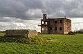 Derelict building at RAF Charmy Down (geograph 5680136).jpg 640 × 423; 313 KB
-
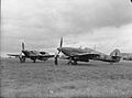
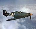 Hurricane IIC 87 Sqn RAF in flight 1942.jpg 702 × 570; 211 KB
-
-
 Old airfield building, Charmy Down - geograph.org.uk - 480202.jpg 640 × 427; 102 KB
-
 Old airfield buildings, Charmy Down - geograph.org.uk - 479028.jpg 640 × 480; 92 KB
-
 RAF Charmy Down - 4 December 1943.jpg 1,462 × 814; 398 KB
-
 Telecoms mast, Charmy Down - geograph.org.uk - 479576.jpg 640 × 480; 88 KB
-
 Track to Charmy Down - geograph.org.uk - 756804.jpg 640 × 469; 97 KB
-

-
 World War Two Building Charmy Down.jpg 2,288 × 1,712; 862 KB
-
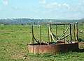 Cattle feeder on Charmy Down - geograph.org.uk - 756966.jpg 640 × 470; 85 KB


.jpg)


_-_geograph.org.uk_-_1036435.jpg)

