Category:RAF Brize Norton
Jump to navigation
Jump to search
| Object location | | View all coordinates using: OpenStreetMap |
|---|
Main Wikipedia article: RAF Brize Norton.
Royal Air Force main operating base in Oxfordshire, England  | |||||
| Upload media | |||||
| Instance of |
| ||||
|---|---|---|---|---|---|
| Location | Oxfordshire, South East England, England | ||||
| Owned by | |||||
| Operator | |||||
| Date of official opening |
| ||||
| Elevation above sea level |
| ||||
| IATA airport code |
| ||||
| ICAO airport code |
| ||||
| official website | |||||
 | |||||
Subcategories
This category has the following 5 subcategories, out of 5 total.
Media in category "RAF Brize Norton"
The following 39 files are in this category, out of 39 total.
-

-
 4626 Aeromedical Evacuation Squadron honours and awards ceremony.jpg 1,000 × 707; 850 KB
-
 Aerial ballet - geograph.org.uk - 879225.jpg 640 × 480; 37 KB
-
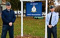
 Air Mobility Force change of command 2020 (cropped).jpg 230 × 230; 33 KB
-
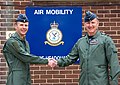
 Air Mobility Force change of command 2020.jpg 1,360 × 863; 254 KB
-
 British Army Apache AH64E Arrival.jpg 4,869 × 3,061; 3 MB
-
-
 De-Icing an RAF C-17 Globemaster Aircraft.jpg 1,000 × 834; 130 KB
-
 EGVN - Short SC7 Skyvan 3-100 - G-PIGY (46256388275).jpg 5,098 × 3,032; 6.36 MB
-
 Nazanin Zaghari-Ratcliffe lands at Brize Norton (51941900342).jpg 2,668 × 4,000; 4 MB
-
 Nazanin Zaghari-Ratcliffe lands at Brize Norton (51941907602).jpg 8,012 × 5,344; 17.13 MB
-
 Nazanin Zaghari-Ratcliffe lands at Brize Norton (51942892891).jpg 8,192 × 5,464; 16.27 MB
-
 Nazanin Zaghari-Ratcliffe lands at Brize Norton (51942895131).jpg 4,000 × 2,668; 2.97 MB
-
 Nazanin Zaghari-Ratcliffe lands at Brize Norton (51942896626).jpg 4,000 × 2,668; 3.32 MB
-
 Nazanin Zaghari-Ratcliffe lands at Brize Norton (51942973658).jpg 7,845 × 5,233; 18.99 MB
-
 Nazanin Zaghari-Ratcliffe lands at Brize Norton (51943500955).jpg 8,192 × 5,464; 17.41 MB
-
 Op Ruman-medical support equipment MOD 45163187.jpg 3,600 × 2,399; 1.61 MB
-
 Paratroop Training at Brize Norton, 24 June 1943 TR1047.jpg 800 × 635; 55 KB
-
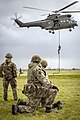
 Paratroopers Learn Helicopter Roping Skills MOD 45168137.jpg 5,126 × 3,418; 6.47 MB
-
 Paratroopers Learn Helicopter Roping Skills MOD 45168138.jpg 8,192 × 5,464; 1.72 MB
-
 Paratroopers Learn Helicopter Roping Skills MOD 45168149.jpg 2,874 × 4,311; 5.01 MB
-
 Paratroopers Learn Helicopter Roping Skills MOD 45168150.jpg 6,167 × 4,113; 9.37 MB
-
 Paratroopers Learn Helicopter Roping Skills MOD 45168151.jpg 3,378 × 2,252; 1.08 MB
-
 Paratroopers Learn Helicopter Roping Skills MOD 45168152.jpg 4,522 × 3,015; 1.43 MB
-
 Paratroopers Learn Helicopter Roping Skills MOD 45168155.jpg 4,560 × 3,040; 907 KB
-
 RAF Air Mobility Force change of command.jpg 3,507 × 2,480; 2.54 MB
-
 RAF Atlas preparing for Mali.jpg 3,600 × 2,400; 2.47 MB
-
 RAF Brize Norton (30493182934).jpg 2,705 × 2,353; 1.04 MB
-
 RAF Brize Norton - geograph.org.uk - 294628.jpg 640 × 427; 80 KB
-
 RAF-Op Ruman MOD 45166186.jpg 3,508 × 2,480; 7.8 MB
-
 RAF-Op Ruman MOD 45166187.jpg 4,961 × 3,307; 12.42 MB
-
 RAF-Op Ruman MOD 45166189.jpg 3,508 × 2,480; 9.29 MB
-
 RAF-Op Ruman MOD 45166190.jpg 4,961 × 3,307; 12.83 MB
-
 Road's End, Carterton - geograph.org.uk - 294620.jpg 640 × 427; 56 KB
-

-
 Towards RAF Brize Norton - geograph.org.uk - 1702611.jpg 1,024 × 683; 244 KB
-
 UK Aid Awaiting Transport by Air to Iraq MOD 45157989.jpg 3,000 × 1,662; 3.09 MB
-
 VC10 - geograph.org.uk - 445596.jpg 640 × 424; 94 KB
-
 Vespina.jpg 3,599 × 2,158; 1.98 MB
.jpg)


.jpg)


.jpg)
.jpg)
.jpg)
.jpg)
.jpg)
.jpg)
.jpg)
.jpg)


.jpg)


.jpg)


