Category:Pwll
Jump to navigation
Jump to search
village in Carmarthenshire, Wales  | |||||
| Upload media | |||||
| Instance of | |||||
|---|---|---|---|---|---|
| Location | Carmarthenshire, Wales | ||||
 | |||||
English: Pwll is a small coastal village, located between Llanelli and Burry Port. It has a local shop, Post Office, a few pubs, a school and local football and cricket teams.
Media in category "Pwll"
The following 21 files are in this category, out of 21 total.
-

-
 Black 5 near Pwll (geograph 6259787).jpg 4,588 × 3,441; 5.81 MB
-
 Burial ground, Holy Trinity Church, Pwll - geograph.org.uk - 3540152.jpg 1,024 × 768; 226 KB
-
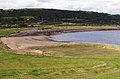 Coastline East of Burry Port - geograph.org.uk - 56779.jpg 640 × 424; 93 KB
-
 Colliers Arms, Pwll - geograph.org.uk - 6830361.jpg 2,048 × 1,536; 1.06 MB
-
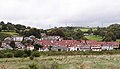
 Cwmbach - geograph.org.uk - 319057.jpg 640 × 480; 67 KB
-
 Gorsedd Circle, Millennium Park - geograph.org.uk - 278259.jpg 640 × 480; 77 KB
-

-
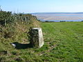 Lletty R-Ychen trig - geograph.org.uk - 248260.jpg 640 × 480; 140 KB
-
-
 Road Junction - geograph.org.uk - 319771.jpg 640 × 480; 78 KB
-
 The Blue Anchor, Pwll - geograph.org.uk - 3544209.jpg 1,280 × 960; 938 KB
-
 War memorial, Pwll - geograph.org.uk - 3540112.jpg 1,280 × 960; 1.69 MB
-
 Farm track leading to farm - geograph.org.uk - 319773.jpg 640 × 480; 68 KB
-
 Footpath to Millennium Quay - geograph.org.uk - 278269.jpg 640 × 480; 47 KB
-
 Landscape between Pwll and Llanelli - geograph.org.uk - 77417.jpg 640 × 428; 100 KB
-
 Millennium Park - geograph.org.uk - 281022.jpg 640 × 384; 32 KB
-
 Narrow country road - geograph.org.uk - 319029.jpg 640 × 480; 95 KB
-
 Narrow country road - geograph.org.uk - 319782.jpg 640 × 480; 68 KB
-
 Waun Twmpath Motte - geograph.org.uk - 319775.jpg 640 × 480; 76 KB
-


.jpg)


