Category:Punjabi-language SVG maps
Jump to navigation
Jump to search
SVG maps in Punjabi Language
Subcategories
This category has only the following subcategory.
Media in category "Punjabi-language SVG maps"
The following 29 files are in this category, out of 29 total.
-
 African quadripoint-pa.svg 512 × 512; 46 KB
-
 Assam-districts-2001-pa.svg 631 × 530; 169 KB
-
 Central Asia - political map - 2000-pa.svg 995 × 790; 153 KB
-
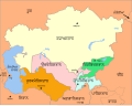 Central Asia - political map 2008-pa.svg 996 × 790; 156 KB
-
 Delhi Municipalities-pa.svg 600 × 600; 11 KB
-
 Haryana 2011 administrative-pa.svg 829 × 672; 558 KB
-
 India Union Territories FR-pa.svg 1,500 × 1,615; 1.65 MB
-
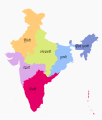
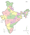 India-map-pa.svg 1,519 × 1,773; 275 KB
-
 Karnataka 1956 Reorg-pa.svg 693 × 748; 295 KB
-
 Lincoln Sea map-pa.svg 1,000 × 913; 197 KB
-
 Maharashtra Divisions-pa.svg 3,106 × 2,453; 245 KB
-
 MANIPUR district map-pa.svg 640 × 715; 233 KB
-
 Map Gulf of Finland-pa.svg 1,400 × 800; 132 KB
-
 Map of Sealand with territorial waters-pa.svg 600 × 613; 130 KB
-
 Meghalaya 2012-pa.svg 807 × 434; 161 KB
-
 Nagaland district map-pa.svg 768 × 680; 607 KB
-
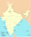 Naval bases of India-pa.svg 1,486 × 1,734; 459 KB
-
 Orissa State map-pa.svg 2,184 × 1,769; 1.76 MB
-
 Partition of India 1947-pa.svg 1,189 × 1,170; 216 KB
-
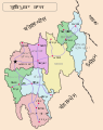
 Puducherry District - Local bodies-pa.svg 979 × 1,057; 43 KB
-
 Punjab 2012 administrativ-pa.svg 900 × 600; 277 KB
-
 SevenSisterStates-pa.svg 606 × 615; 1.05 MB
-
 Simple vector map-pa.svg 250 × 200; 7 KB
-
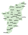 Tamil Nadu district map-pa.svg 1,640 × 2,032; 91 KB
-
 Tripura-district-map-pa.svg 545 × 688; 234 KB
-
 Up-subregions2-pa.svg 2,400 × 2,515; 240 KB
-
 Uttar Pradesh administrative divisions-pa.svg 1,500 × 1,500; 121 KB
-
 UttarakhandDistricts numbered-pa.svg 1,250 × 1,125; 145 KB
-
 Zonal Councils-pa.svg 1,594 × 1,868; 225 KB


