Category:Pulford
Jump to navigation
Jump to search
English: Pulford is a village and former civil parish in the unitary authority of Cheshire West and Chester and the ceremonial county of Cheshire, England. It is situated on the B5445 road, to the south west of Chester and on the border with Wales. It is believed that the name of the village is derived from the Welsh words Pwll "marsh" and Ffordd "crossing". According to the 2001 Census, the population of the entire parish was 395.
Français : Pulford est un village du comté de Cheshire, en Angleterre. Il se situe sur la frontière avec le Pays de Galles. Il compte 395 habitants en 2001.
village in Cheshire, UK  | |||||
| Upload media | |||||
| Instance of | |||||
|---|---|---|---|---|---|
| Location | Poulton and Pulford, Cheshire West and Chester, Cheshire, North West England, England | ||||
 | |||||
Subcategories
This category has the following 5 subcategories, out of 5 total.
G
- Grosvenor Pulford Hotel and Spa (13 F)
M
- St Mary's, Pulford (10 F)
P
- Pulford Castle (1 F)
- Pulford War Memorial (3 F)
V
- Pulford Village Hall (4 F)
Media in category "Pulford"
The following 33 files are in this category, out of 33 total.
-
 Approaching Pulford - geograph.org.uk - 187743.jpg 640 × 480; 108 KB
-
 Bridge over Pulford Brook - geograph.org.uk - 968803.jpg 640 × 480; 99 KB
-
 Broadoak Level Crossing - geograph.org.uk - 1508433.jpg 640 × 480; 81 KB
-

-
 England Ahead - geograph.org.uk - 1356747.jpg 640 × 480; 82 KB
-
 Field gate and Darland Golf Course - geograph.org.uk - 1465832.jpg 640 × 480; 130 KB
-
 Garden of the Grosvenor Pulford Hotel - geograph.org.uk - 968801.jpg 640 × 480; 81 KB
-
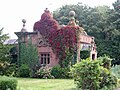 Lodge at Pulford.jpg 2,797 × 2,092; 889 KB
-
 Nags Head Darland - geograph.org.uk - 187714.jpg 640 × 480; 99 KB
-
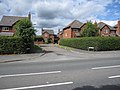
 Old Lane, Poulton - geograph.org.uk - 205905.jpg 640 × 480; 116 KB
-
 Old Milepost by the B5445 in Pulford (geograph 5622733).jpg 1,536 × 2,048; 667 KB
-

-
 Private Road - geograph.org.uk - 1380345.jpg 480 × 640; 107 KB
-
 Pulford Bridge and Darland Golf Course - geograph.org.uk - 1465751.jpg 640 × 480; 151 KB
-
 Pulford Brook - geograph.org.uk - 272932.jpg 640 × 480; 192 KB
-

-

-
 Pulford Brook in England - geograph.org.uk - 1465681.jpg 640 × 480; 192 KB
-
 Pulford from above.jpg 4,000 × 3,000; 2.01 MB
-
 Stop valve markers by Pulford Bridge - geograph.org.uk - 1465670.jpg 640 × 480; 246 KB
-

-
 Belgrave Bridge - east side - geograph.org.uk - 1477926.jpg 640 × 480; 198 KB
-
 Belgrave Bridge - west side - geograph.org.uk - 1477981.jpg 640 × 480; 208 KB
-
 Bridge at Pulford - geograph.org.uk - 187749.jpg 640 × 480; 135 KB
-
 Bridge over Pulford Brook - geograph.org.uk - 1465643.jpg 640 × 480; 149 KB
-
 Castle Hill, Pulford - geograph.org.uk - 1466010.jpg 640 × 480; 143 KB
-
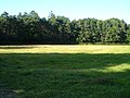
 Farmland Pulford - geograph.org.uk - 187725.jpg 640 × 480; 108 KB
-
 Field boundary hedges - geograph.org.uk - 274464.jpg 640 × 480; 207 KB
-
 Field near Poulton - geograph.org.uk - 205906.jpg 640 × 480; 95 KB
-
 Hedges - geograph.org.uk - 187717.jpg 640 × 480; 89 KB
-
 Ornamental Pond, Pulford - geograph.org.uk - 187747.jpg 640 × 480; 109 KB
-
 Sandstone Bridge over Pulford Brook - geograph.org.uk - 283417.jpg 640 × 480; 235 KB
-
 Sluice Mechanism - geograph.org.uk - 314072.jpg 640 × 480; 212 KB


.jpg)


