Category:Puerto del Hambre
Jump to navigation
Jump to search
| Object location | | View all coordinates using: OpenStreetMap |
|---|
human settlement  | |||||
| Upload media | |||||
| Instance of |
| ||||
|---|---|---|---|---|---|
| Location | Punta Arenas, Magallanes Province, Magellan and the Chilean Antarctic Region, Chile | ||||
 | |||||
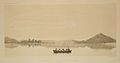
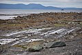
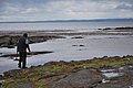
English: Ciudad del Rey Don Felipe, also known as Puerto del Hambre (Port Famine), is a historic settlement site at Buena Bay (locally known as Mansa Bay) on the north shore of the Strait of Magellan approximately 58 km (36 mi) south of Punta Arenas in the Región de Magallanes y la Antártica Chilena, Patagonia, Chile.
Español: Puerto del Hambre o Ciudad del Rey Felipe fue el primer intento no aborigen de poblar la ribera norte del Estrecho de Magallanes, cercana a la actual ciudad de Punta Arenas, en la Región de Magallanes y de la Antártica Chilena, en el sur de Chile.
Media in category "Puerto del Hambre"
The following 68 files are in this category, out of 68 total.
-
 MULHALL(1878) p099 VIEW OF PORT FAMINE.jpg 1,605 × 1,059; 1.16 MB
-
 Atlas pittoresque pl 002.jpg 3,040 × 2,112; 2.83 MB
-
 Atlas pittoresque pl 003.jpg 2,640 × 1,624; 1.54 MB
-
 Atlas pittoresque pl 005.jpg 2,736 × 1,432; 772 KB
-
 CL Puerto del Hambre 1202 (1) (17203267086).jpg 800 × 535; 92 KB
-
 CL Puerto del Hambre 1202 (10) (17021785437).jpg 800 × 535; 84 KB
-
 CL Puerto del Hambre 1202 (11) (17041435868).jpg 800 × 535; 108 KB
-
 CL Puerto del Hambre 1202 (12) (17021785007).jpg 800 × 535; 97 KB
-
 CL Puerto del Hambre 1202 (13) (16606770474).jpg 800 × 535; 103 KB
-
 CL Puerto del Hambre 1202 (14) (17043030199).jpg 800 × 535; 89 KB
-
 CL Puerto del Hambre 1202 (15) (17227366372).jpg 800 × 535; 114 KB
-
 CL Puerto del Hambre 1202 (16) (17227492552).jpg 800 × 535; 100 KB
-
 CL Puerto del Hambre 1202 (17) (17043029859).jpg 800 × 535; 79 KB
-
 CL Puerto del Hambre 1202 (18) (17203263736).jpg 800 × 535; 125 KB
-
 CL Puerto del Hambre 1202 (19) (16609004623).jpg 800 × 535; 125 KB
-
 CL Puerto del Hambre 1202 (2) (17203266856).jpg 800 × 535; 91 KB
-
 CL Puerto del Hambre 1202 (20) (17041434058).jpg 800 × 535; 98 KB
-
 CL Puerto del Hambre 1202 (20) (20072230484).jpg 800 × 535; 105 KB
-
 CL Puerto del Hambre 1202 (21) (16606768984).jpg 800 × 535; 121 KB
-
 CL Puerto del Hambre 1202 (21) (20694803245).jpg 800 × 535; 128 KB
-
 CL Puerto del Hambre 1202 (22) (17228648411).jpg 800 × 535; 105 KB
-
 CL Puerto del Hambre 1202 (22) (20508070839).jpg 800 × 535; 113 KB
-
 CL Puerto del Hambre 1202 (23) (17043028219).jpg 800 × 535; 123 KB
-
 CL Puerto del Hambre 1202 (23) (20701352811).jpg 800 × 535; 130 KB
-
 CL Puerto del Hambre 1202 (24) (17228647871).jpg 800 × 535; 123 KB
-
 CL Puerto del Hambre 1202 (25) (17228647631).jpg 800 × 535; 124 KB
-
 CL Puerto del Hambre 1202 (26) (17043027389).jpg 800 × 535; 133 KB
-
 CL Puerto del Hambre 1202 (27) (17021781587).jpg 800 × 535; 136 KB
-
 CL Puerto del Hambre 1202 (28) (17228646651).jpg 800 × 535; 81 KB
-
 CL Puerto del Hambre 1202 (29) (17043026599).jpg 800 × 535; 85 KB
-
 CL Puerto del Hambre 1202 (3) (16609008213).jpg 800 × 535; 112 KB
-
 CL Puerto del Hambre 1202 (30) (17228646281).jpg 800 × 535; 88 KB
-
 CL Puerto del Hambre 1202 (33) (17228646051).jpg 800 × 535; 119 KB
-
 CL Puerto del Hambre 1202 (34) (16606641694).jpg 800 × 535; 117 KB
-
 CL Puerto del Hambre 1202 (35) (17043025849).jpg 800 × 535; 112 KB
-
 CL Puerto del Hambre 1202 (36) (17228645481).jpg 800 × 535; 107 KB
-
 CL Puerto del Hambre 1202 (4) (17203266426).jpg 800 × 535; 92 KB
-
 CL Puerto del Hambre 1202 (5) (17203266216).jpg 800 × 535; 101 KB
-
 CL Puerto del Hambre 1202 (6) (17043032129).jpg 800 × 535; 91 KB
-
 CL Puerto del Hambre 1202 (7) (17041669840).jpg 800 × 535; 120 KB
-
 CL Puerto del Hambre 1202 (8) (16606771654).jpg 800 × 535; 137 KB
-
 CL Puerto del Hambre 1202 (9) (17043031329).jpg 800 × 535; 116 KB
-
 Costa al sur del Puerto del Hambre.jpg 800 × 600; 178 KB
-
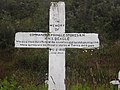 Cruz homenaje a Pringle Stokes.jpg 2,304 × 1,728; 1.24 MB
-
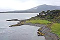
 Estrecho de Magallanes - panoramio.jpg 2,288 × 1,712; 2.65 MB
-
 Iglesia de la ciudad del Rey Felipe.jpg 800 × 600; 376 KB
-
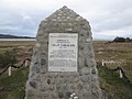 Monolito Homenaje a Phillip Parker King.jpg 2,304 × 1,728; 1.01 MB
-
 Port Famine etc. accountofvoyages01hawk 0063.jpg 3,645 × 2,250; 647 KB
-
 Puerto del Hambre - El Cabrito.jpg 855 × 456; 582 KB
-
 Puerto del Hambre 01.jpg 4,128 × 2,636; 9.55 MB
-
 Puerto del Hambre 02.jpg 4,140 × 2,740; 9.72 MB
-
 Puerto del Hambre 03.jpg 4,080 × 2,728; 7.72 MB
-
 Puerto del Hambre 04.jpg 2,848 × 4,288; 11.63 MB
-
 Puerto del Hambre 05.jpg 4,288 × 2,848; 8.64 MB
-
 Puerto del Hambre 06.jpg 4,288 × 2,760; 9.5 MB
-
 Puerto del Hambre 07.jpg 4,288 × 2,804; 9.96 MB
-
 Puerto del Hambre 08.jpg 4,288 × 2,452; 8.52 MB
-
 Puerto del Hambre 09.jpg 4,180 × 2,700; 8.94 MB
-
 Puerto del Hambre 1.jpg 800 × 600; 227 KB
-
 Puerto del Hambre 10.jpg 2,807 × 3,965; 9.44 MB
-
 Puerto del Hambre 11.jpg 2,848 × 4,115; 10.26 MB
-
 Puerto del Hambre 2.jpg 800 × 600; 236 KB
-
 Puerto del Hambre 5.jpg 800 × 600; 294 KB
-
 Puerto del Hambre.jpg 1,200 × 800; 782 KB
-
 Puertohambre1.jpg 400 × 221; 79 KB
-
 Puertohambre2.jpg 400 × 221; 81 KB
-
 PuntaSantaAna.svg 632 × 406; 20 KB
-
 Tumba de Pringles Stokes.jpg 800 × 600; 235 KB
_p099_VIEW_OF_PORT_FAMINE.jpg)


_(17203267086).jpg)
_(17021785437).jpg)
_(17041435868).jpg)
_(17021785007).jpg)
_(16606770474).jpg)
_(17043030199).jpg)
_(17227366372).jpg)
_(17227492552).jpg)
_(17043029859).jpg)
_(17203263736).jpg)
_(16609004623).jpg)
_(17203266856).jpg)
_(17041434058).jpg)
_(20072230484).jpg)
_(16606768984).jpg)
_(20694803245).jpg)
_(17228648411).jpg)
_(20508070839).jpg)
_(17043028219).jpg)
_(20701352811).jpg)
_(17228647871).jpg)
_(17228647631).jpg)
_(17043027389).jpg)
_(17021781587).jpg)
_(17228646651).jpg)
_(17043026599).jpg)
_(16609008213).jpg)
_(17228646281).jpg)
_(17228646051).jpg)
_(16606641694).jpg)
_(17043025849).jpg)
_(17228645481).jpg)
_(17203266426).jpg)
_(17203266216).jpg)
_(17043032129).jpg)
_(17041669840).jpg)
_(16606771654).jpg)
_(17043031329).jpg)


