Category:Public transport maps of the Netherlands
Jump to navigation
Jump to search
Countries of Europe: Austria · Azerbaijan‡ · Belarus · Belgium · Bosnia and Herzegovina · Bulgaria · Croatia · Czech Republic · Denmark · Estonia · Finland · France‡ · Georgia‡ · Germany · Greece · Hungary · Republic of Ireland · Italy · Kazakhstan‡ · Latvia · Liechtenstein · Lithuania · Luxembourg · Malta · Moldova · Netherlands‡ · Norway · Poland · Portugal‡ · Romania · Russia‡ · Serbia · Slovakia · Slovenia · Spain‡ · Sweden · Switzerland · Turkey‡ · Ukraine · United Kingdom
Specific status: Faroe Islands – Limited recognition: Kosovo
‡: partly located in Europe
Specific status: Faroe Islands – Limited recognition: Kosovo
‡: partly located in Europe
Subcategories
This category has the following 10 subcategories, out of 10 total.
A
E
G
H
R
U
Media in category "Public transport maps of the Netherlands"
The following 20 files are in this category, out of 20 total.
-
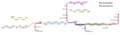
 Arnhem Trolley 2013.png 4,110 × 2,926; 191 KB
-
 Concessiekaart van nederland.png 400 × 468; 170 KB
-
 Kaart GooischeTram.PNG 532 × 338; 67 KB
-
 Kaartje vervoerders nl per 1-1-2007.gif 1,763 × 2,016; 40 KB
-
 Noordelijke Nevenlijnen.png 8,903 × 2,625; 419 KB
-
 OBusLeitungsplanArnhem2019.png 6,848 × 4,978; 1.23 MB
-
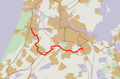 Outline map Zuidtangent.PNG 694 × 456; 182 KB
-
 OV Gemeente Beesel1.png 1,397 × 837; 280 KB
-
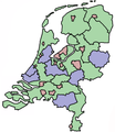 OV-autoriteiten2003.png 270 × 311; 42 KB
-
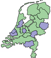 OV-autoriteiten2004.png 270 × 311; 38 KB
-
 Ov-autoriteiten2009.jpg 350 × 407; 70 KB
-
 Overzicht HOV DAV.jpg 7,823 × 3,137; 1.92 MB
-

-
 ParkShuttle Map OpenStreetMap.png 666 × 586; 423 KB
-
 Plattegronden van de gehele stad. Arnhem.jpg 3,378 × 3,342; 2.66 MB
-
 Qlink lijnen.JPG 4,320 × 3,240; 5.39 MB
-
 Trolleynet-Arnhem.png 1,199 × 848; 137 KB
-
 TrolleynetArnhem.png 870 × 650; 24 KB
-
 TrolleynetNijmegen.png 380 × 365; 10 KB
-
 Zones.svg 100 × 100; 1 KB


