Category:Public footpaths in the London Borough of Hounslow
Jump to navigation
Jump to search

Subcategories
This category has the following 5 subcategories, out of 5 total.
A
F
G
L
Media in category "Public footpaths in the London Borough of Hounslow"
The following 128 files are in this category, out of 128 total.
-

-

-
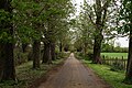
 Avenue to Osterley House - geograph.org.uk - 2361560.jpg 1,024 × 768; 492 KB
-
 Bedfont Lakes Country Park - geograph.org.uk - 4628587.jpg 2,000 × 1,333; 2.62 MB
-
 Bedfont Lakes Country Park - geograph.org.uk - 4628912.jpg 2,000 × 1,333; 3.31 MB
-
 Bedfont Lakes Country Park - geograph.org.uk - 4630168.jpg 2,000 × 1,333; 2.63 MB
-
 Bedford Lakes Country Park - geograph.org.uk - 4104011.jpg 1,632 × 918; 527 KB
-
 Byway through Syon Park - geograph.org.uk - 5434126.jpg 640 × 426; 72 KB
-
 Byway, Syon Park - geograph.org.uk - 5434125.jpg 640 × 426; 81 KB
-
 Chiswick House Gardens - geograph.org.uk - 2272463.jpg 480 × 640; 102 KB
-
 Chiswick House Gardens - geograph.org.uk - 2272651.jpg 640 × 480; 114 KB
-
 Chiswick House, view from the avenue.jpg 5,000 × 3,334; 4.42 MB
-
 Chiswick, Avenue of Trees Across the Park - geograph.org.uk - 8969.jpg 640 × 480; 325 KB
-
 Chiswick, Paths into Duke's Meadows - geograph.org.uk - 3281138.jpg 3,456 × 2,304; 4.67 MB
-
 Community Garden Information Board at Gunnersbury Park.jpg 4,592 × 3,448; 18.53 MB
-
 Crane Park river walk - geograph.org.uk - 62804.jpg 640 × 426; 356 KB
-
 Footpath along the edge of Osterley Park - geograph.org.uk - 4079088.jpg 4,000 × 3,000; 4.33 MB
-

-

-
 Footpath in Osterley Park - geograph.org.uk - 4079064.jpg 4,000 × 3,000; 3.95 MB
-
 Footpath in Osterley Park - geograph.org.uk - 4079084.jpg 4,000 × 3,000; 4.23 MB
-
 Footpath off the Thames Path , Barnes - geograph.org.uk - 2112969.jpg 640 × 430; 189 KB
-
 Footpath on track at Osterley Park - geograph.org.uk - 5513742.jpg 640 × 427; 124 KB
-
 Footpath over Osterley Fields - geograph.org.uk - 5214373.jpg 4,000 × 3,000; 4.94 MB
-

-
 Footpath through Osterley Park - geograph.org.uk - 1919697.jpg 480 × 640; 81 KB
-
 Footpath through Osterley Park - geograph.org.uk - 4079086.jpg 4,000 × 3,000; 4.09 MB
-
 Footpath to Grove Park - geograph.org.uk - 3304953.jpg 3,216 × 4,288; 7.95 MB
-
 Footpath to Norwood Green - geograph.org.uk - 3066010.jpg 640 × 480; 182 KB
-
 Footpath to River Thames near Barnes Bridge - geograph.org.uk - 3304954.jpg 4,288 × 3,216; 6.47 MB
-

-
 Footpath, Gunnersbury Park - geograph.org.uk - 4049180.jpg 640 × 415; 72 KB
-
 Footpath, Syon Park - geograph.org.uk - 5437783.jpg 640 × 426; 62 KB
-
 Gate and stile, Bedfont Lakes - geograph.org.uk - 4628605.jpg 2,000 × 1,333; 3.53 MB
-

-
 Gunnersbury Park - geograph.org.uk - 2627280.jpg 640 × 480; 223 KB
-
 Gunnersbury Park - geograph.org.uk - 2627311.jpg 640 × 480; 220 KB
-
 Gunnersbury Park - geograph.org.uk - 2627380.jpg 640 × 480; 189 KB
-
 Gunnersbury Park - geograph.org.uk - 2628709.jpg 480 × 640; 161 KB
-
 Gunnersbury Park - geograph.org.uk - 2628711.jpg 640 × 480; 123 KB
-
 Gunnersbury Park - geograph.org.uk - 2628737.jpg 640 × 480; 170 KB
-
 Gunnersbury Park - geograph.org.uk - 4049198.jpg 640 × 430; 89 KB
-
 Hanworth Roundabout - geograph.org.uk - 785538.jpg 640 × 480; 88 KB
-
 Hounslow Heath - geograph.org.uk - 3717999.jpg 2,560 × 1,920; 2.02 MB
-
 In Carville Hall Park - geograph.org.uk - 2515383.jpg 4,000 × 3,000; 4.09 MB
-
 In Syon Park - geograph.org.uk - 2676570.jpg 4,000 × 3,000; 4.06 MB
-
 Lampton Park - geograph.org.uk - 4545568.jpg 640 × 436; 215 KB
-
 Lampton Park - geograph.org.uk - 4547343.jpg 640 × 420; 114 KB
-
 Lampton Park - geograph.org.uk - 4547386.jpg 640 × 480; 165 KB
-
 Lampton Park, London Borough of Hounslow, TW3 (7985047851).jpg 3,968 × 2,232; 3.77 MB
-
 London LOOP across Hounslow Heath - geograph.org.uk - 2438551.jpg 1,280 × 960; 629 KB
-
 Ornaments Lining Avenue to Rear of Chiswick House 01.JPG 2,592 × 1,944; 2.17 MB
-
 Ornaments Lining Avenue to Rear of Chiswick House 02.JPG 2,592 × 1,944; 2.07 MB
-
 Ornaments Lining Avenue to Rear of Chiswick House 03.JPG 2,592 × 1,944; 2.27 MB
-
 Osterley Lane - geograph.org.uk - 2361948.jpg 1,024 × 768; 503 KB
-
 Osterley Lane - geograph.org.uk - 2694540.jpg 480 × 640; 192 KB
-
 Osterley Lane - geograph.org.uk - 2694543.jpg 640 × 480; 216 KB
-
 Osterley Lane - geograph.org.uk - 3449310.jpg 4,320 × 3,240; 5.53 MB
-
 Osterley Park - geograph.org.uk - 2693474.jpg 640 × 480; 209 KB
-
 Osterley Park - geograph.org.uk - 2694597.jpg 480 × 640; 234 KB
-
 Osterley Park - geograph.org.uk - 2694603.jpg 640 × 480; 193 KB
-
 Osterley Park - geograph.org.uk - 2694613.jpg 480 × 640; 187 KB
-
 Osterley Park - geograph.org.uk - 2694616.jpg 480 × 640; 228 KB
-
 Osterley Park - geograph.org.uk - 2694633.jpg 640 × 480; 216 KB
-
 Osterley Park - geograph.org.uk - 2694880.jpg 640 × 480; 250 KB
-
 Osterley Park - geograph.org.uk - 4599420.jpg 2,000 × 1,333; 3 MB
-
 Osterley Park - geograph.org.uk - 4910894.jpg 3,959 × 2,639; 7.19 MB
-
 Osterley Park - geograph.org.uk - 4911058.jpg 4,000 × 2,666; 7.65 MB
-
 Osterley Park - geograph.org.uk - 4911096.jpg 4,000 × 2,666; 7.45 MB
-
 Osterley Park - geograph.org.uk - 4911574.jpg 3,973 × 2,648; 7.84 MB
-
 Osterley Park - geograph.org.uk - 4911582.jpg 3,959 × 2,639; 7.65 MB
-
 Osterley Park - geograph.org.uk - 4911617.jpg 4,000 × 2,666; 7.53 MB
-
 Osterley Park - geograph.org.uk - 4911633.jpg 4,000 × 2,666; 6.84 MB
-
 Osterley Park - geograph.org.uk - 4911653.jpg 3,973 × 2,648; 6.67 MB
-
 Osterley Park drive - geograph.org.uk - 2507157.jpg 640 × 480; 157 KB
-
 Osterley Park House - geograph.org.uk - 4487892.jpg 1,600 × 1,200; 470 KB
-

-

-
 Osterley Park House, Isleworth - geograph.org.uk - 4320570.jpg 1,238 × 825; 1.02 MB
-
 Osterley Park, Isleworth - geograph.org.uk - 4320563.jpg 1,238 × 825; 1.13 MB
-
 Osterley Park, Isleworth - geograph.org.uk - 4320657.jpg 1,238 × 825; 1.28 MB
-
 Osterley Park, Isleworth - geograph.org.uk - 4320723.jpg 1,238 × 825; 1.03 MB
-
 Osterley Park, Isleworth - geograph.org.uk - 4320964.jpg 1,238 × 929; 1.39 MB
-
 Osterley Park, Isleworth - geograph.org.uk - 4320967.jpg 1,238 × 883; 1.34 MB
-
 Osterley Park, Isleworth - geograph.org.uk - 4966769.jpg 640 × 480; 93 KB
-
 Parallel paths, Bedfont Lakes - geograph.org.uk - 4628915.jpg 2,000 × 1,333; 3.34 MB
-
 Path around the Clockhouse Lake - geograph.org.uk - 4628961.jpg 2,000 × 1,333; 3.59 MB
-
 Path at Lampton Park - geograph.org.uk - 4547410.jpg 640 × 480; 177 KB
-
 Path at Lampton Park - geograph.org.uk - 4547412.jpg 480 × 640; 127 KB
-
 Path by the Clockhouse Lake - geograph.org.uk - 4628594.jpg 2,000 × 1,333; 3.46 MB
-
 Path by the stables, Osterley House - geograph.org.uk - 620902.jpg 480 × 640; 336 KB
-
 Path in Chiswick Gardens - geograph.org.uk - 5973369.jpg 1,280 × 1,920; 1.86 MB
-
 Path in Chiswick Gardens - geograph.org.uk - 5973370.jpg 1,920 × 1,280; 1.72 MB
-
 Path in Hanworth Park - geograph.org.uk - 4908942.jpg 3,264 × 1,840; 1.92 MB
-
 Path in Osterley Park - geograph.org.uk - 4487863.jpg 1,600 × 1,200; 729 KB
-
 Path in Osterley Park, Isleworth - geograph.org.uk - 4966707.jpg 480 × 640; 137 KB
-
 Path in the Southeast of Gunnersbury Park.jpg 4,592 × 3,448; 18.47 MB
-
 Path through Gunnersbury Park - geograph.org.uk - 1579739.jpg 640 × 480; 79 KB
-

-
 Path, Feltham Park - geograph.org.uk - 4123194.jpg 640 × 480; 140 KB
-
 Path, Hounslow Heath - geograph.org.uk - 3131575.jpg 640 × 480; 189 KB
-
 Paths, Bedfont Lakes Country Park - geograph.org.uk - 4630189.jpg 2,000 × 1,333; 3.34 MB
-
-
 Pathway by the river, Strand on the Green - geograph.org.uk - 4026722.jpg 2,304 × 1,728; 817 KB
-

-
 Riverside Walk, Osterley Park, Isleworth - geograph.org.uk - 4320822.jpg 1,238 × 825; 1.43 MB
-
 Road to Osterley Park House, Isleworth - geograph.org.uk - 4966775.jpg 640 × 480; 100 KB
-
 Side View of Osterley Park House - geograph.org.uk - 4487886.jpg 1,600 × 1,200; 657 KB
-
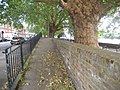
 Strand on the Green - geograph.org.uk - 1417944.jpg 640 × 480; 102 KB
-
 Strand on the Green - geograph.org.uk - 437002.jpg 640 × 480; 217 KB
-
 Strand on the Green, Chiswick - geograph.org.uk - 2210739.jpg 1,600 × 1,200; 580 KB
-
 Street on the riverbank - panoramio.jpg 2,272 × 1,704; 1.96 MB
-
 Syon Park - geograph.org.uk - 2676580.jpg 4,000 × 3,000; 4.13 MB
-
 Thames Path and sunset over Mortlake - geograph.org.uk - 3304934.jpg 4,288 × 3,216; 5.7 MB
-
 Thames Path in Brentford - geograph.org.uk - 2325118.jpg 1,280 × 960; 626 KB
-
 Thames Path toward Barnes Bridge - geograph.org.uk - 3304927.jpg 4,288 × 3,216; 6.12 MB
-
 The approach to Chiswick House - geograph.org.uk - 5966084.jpg 1,918 × 1,278; 1.95 MB
-
 The approach to Chiswick House in Chiswick Park - geograph.org.uk - 4944515.jpg 4,608 × 3,456; 3.34 MB
-

-
 The avenue leading to Duke's Avenue Gate - geograph.org.uk - 2308115.jpg 800 × 600; 548 KB
-
 The avenue, Osterley Park - geograph.org.uk - 5711740.jpg 763 × 1,024; 289 KB
-
 The Italian Garden, Chiswick House - geograph.org.uk - 2272642.jpg 622 × 466; 141 KB
-
 The long path, Bedfont Lakes - geograph.org.uk - 4630566.jpg 2,000 × 1,333; 2.78 MB
-
 The Long Walk, Osterley Park, Isleworth - geograph.org.uk - 4320802.jpg 683 × 1,024; 1,013 KB
-
 Towpath, North Bank of the River Thames, Kew - geograph.org.uk - 2407423.jpg 1,024 × 768; 397 KB
-
 Towpath, North Bank of The Thames at Kew - geograph.org.uk - 2407420.jpg 1,024 × 768; 283 KB
-
 Trees, Gunnersbury Park - geograph.org.uk - 4049189.jpg 640 × 430; 117 KB
-
 Turnham Green, London Borough of Hounslow, W4 (2445299278).jpg 1,280 × 960; 335 KB


.jpg)


.jpg)