Category:Public footpaths in Acaster Malbis CP
Jump to navigation
Jump to search
Media in category "Public footpaths in Acaster Malbis CP"
The following 15 files are in this category, out of 15 total.
-
 A footpath to Acaster Malbis - geograph.org.uk - 2514345.jpg 800 × 600; 257 KB
-
 Footpath heading towards Stub Wood - geograph.org.uk - 6225447.jpg 5,184 × 3,456; 6.45 MB
-
 Footpath junction at the west side of Stub Wood - geograph.org.uk - 5458449.jpg 1,600 × 1,200; 531 KB
-
 Footpath leading to the River Ouse - geograph.org.uk - 4107031.jpg 1,600 × 1,064; 576 KB
-
 Footpath towards Bishopthorpe - geograph.org.uk - 5458800.jpg 1,600 × 1,200; 681 KB
-

-
 Riverside Footpath Acaster Malbis - geograph.org.uk - 3383642.jpg 4,000 × 3,000; 2.89 MB
-
 Riverside path at Acaster Malbis - geograph.org.uk - 4107170.jpg 1,600 × 1,064; 617 KB
-
 Riverside path at Thomas Dike - geograph.org.uk - 4105596.jpg 1,600 × 1,064; 634 KB
-
 Riverside path leaves Mill Lane at Acaster Malbis - geograph.org.uk - 4107276.jpg 1,600 × 1,064; 750 KB
-
 Riverside path towards Mill Lane, Acaster Malbis - geograph.org.uk - 4107268.jpg 1,600 × 1,064; 919 KB
-
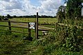
 Stile near Moreby Ings - geograph.org.uk - 4105634.jpg 1,600 × 1,064; 744 KB
-
 Stile north of Hales Hill Farm - geograph.org.uk - 4105648.jpg 1,600 × 1,064; 780 KB
-
 Stile on the riverside path, south of Naburn Bridge - geograph.org.uk - 4107048.jpg 1,600 × 1,064; 913 KB
-
 The Riverside path at Acaster Malbis - geograph.org.uk - 4107264.jpg 1,600 × 1,064; 911 KB


