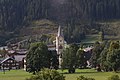
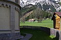
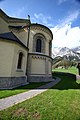
Category:Protestant Church (Ramsau am Dachstein)
Jump to navigation
Jump to search
| Object location | | View all coordinates using: OpenStreetMap |
|---|
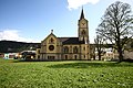
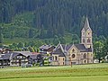
church building in Ramsau am Dachstein, Austria  | |||||
| Upload media | |||||
| Instance of | |||||
|---|---|---|---|---|---|
| Location | Ramsau am Dachstein, Expositur Gröbming, Liezen District, Styria, Austria | ||||
| Street address |
| ||||
| Heritage designation | |||||
 | |||||
Subcategories
This category has the following 2 subcategories, out of 2 total.
F
- Friedhof Ramsau (4 F)
Media in category "Protestant Church (Ramsau am Dachstein)"
The following 37 files are in this category, out of 37 total.
-
 Ev.kirche-ramsau 2153 13-09-22.JPG 3,888 × 2,592; 5.41 MB
-
 Evang kirche ramsau dachstein3679.JPG 3,888 × 2,592; 5.77 MB
-
 Evang kirche ramsau dachstein3681.JPG 2,390 × 3,585; 5.05 MB
-
 Evang kirche ramsau dachstein3683.JPG 2,592 × 3,888; 4.4 MB
-
 Evang kirche ramsau dachstein3684.JPG 2,592 × 3,888; 7.12 MB
-
 Evang kirche ramsau dachstein3685.JPG 2,592 × 3,888; 7.1 MB
-
 Evang kirche ramsau dachstein3688.JPG 3,888 × 2,592; 5.1 MB
-
 Evang kirche ramsau dachstein3690.JPG 2,592 × 3,888; 6.83 MB
-
 Evang kirche ramsau dachstein3691.JPG 2,592 × 3,888; 8.04 MB
-
 Evang kirche ramsau dachstein3698.JPG 2,592 × 3,888; 8.42 MB
-
 Evang kirche ramsau dachstein3699.JPG 2,592 × 3,888; 7.32 MB
-
 Evang kirche ramsau dachstein3700.JPG 2,592 × 3,888; 8.69 MB
-
 Evang kirche ramsau dachstein3702.JPG 2,592 × 3,888; 6.93 MB
-
 Evang kirche ramsau dachstein3703.JPG 2,592 × 3,888; 6.37 MB
-
 Evang kirche ramsau dachstein3704.JPG 3,888 × 2,592; 3.36 MB
-
 Evang kirche ramsau dachstein3708.JPG 3,888 × 2,592; 3.51 MB
-
 Evang kirche ramsau dachstein3715.JPG 2,592 × 3,888; 3.57 MB
-
 Evang kirche ramsau dachstein3731.JPG 3,888 × 2,592; 6.75 MB
-
 Evang kirche ramsau dachstein3732.JPG 2,592 × 3,888; 6.94 MB
-
 Evang kirche ramsau dachstein3733.JPG 3,888 × 2,592; 5.14 MB
-
 Evang kirche ramsau dachstein3735.JPG 2,592 × 3,888; 5.98 MB
-
 Evang kirche ramsau dachstein3736.JPG 3,888 × 2,592; 7.83 MB
-
 Evang kirche ramsau dachstein3740.JPG 2,592 × 3,888; 6.05 MB
-
 Evang kirche ramsau dachstein3741.JPG 2,592 × 3,888; 4.16 MB
-
 Evang kirche ramsau dachstein3742.JPG 2,592 × 3,888; 5.92 MB
-
 Evang kirche ramsau dachstein3744.JPG 3,888 × 2,592; 5.41 MB
-
 Evang kirche ramsau dachstein3745.JPG 3,888 × 2,592; 5.33 MB
-
 Evang. Pfarrkirche, Ramsau am Dachstein.jpg 4,288 × 2,848; 2.11 MB
-
 Evangelische Kirche Ramsau 1.jpg 3,000 × 4,000; 3.71 MB
-
 Evangelische Kirche Ramsau 2.jpg 4,000 × 3,000; 2 MB
-
 Evangelische Pfarrkirche Ramsau am Dachstein.jpg 4,000 × 3,000; 2.62 MB
-
 Luftaufnahme .jpg 640 × 480; 68 KB
-
 Ramsau am Dachstein.jpg 621 × 955; 84 KB
-
 St-Ramsau-Ort-Kirche-1.jpg 3,648 × 2,736; 1.63 MB
-
 St-Ramsau-Ort-Kirche-2.jpg 3,648 × 2,736; 1.66 MB
-
 St-Ramsau-Ort-Kirche-3.jpg 3,366 × 4,488; 2.05 MB
-
 St-Ramsau-Ort-Kirche-4.jpg 3,492 × 2,619; 1.36 MB


