Category:Propsthof Maria Saal
Jump to navigation
Jump to search
| Object location | | View all coordinates using: OpenStreetMap |
|---|
building in Maria Saal, Austria  | |||||
| Upload media | |||||
| Instance of | |||||
|---|---|---|---|---|---|
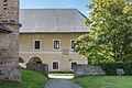
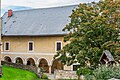
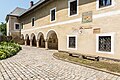
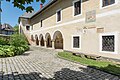
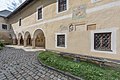
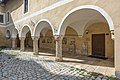
| Location | Maria Saal, Klagenfurt-Land District, Carinthia, Austria | ||||
| Street address |
| ||||
| Heritage designation | |||||
 | |||||
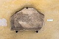
| This category shows the protected monument with the number 12906 in Austria. (Commons, de, Wikidata) |
Subcategories
This category has only the following subcategory.
P
Media in category "Propsthof Maria Saal"
The following 38 files are in this category, out of 38 total.
-
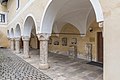
 Maria Saal Domplatz 3 ehem. Propsthof S-Seite Arkaden 27052008 6015.jpg 2,464 × 1,632; 710 KB
-
 Maria Saal Domplatz 3 ehem. Propsthof Süd-Teilansicht 10052022 2542.jpg 7,360 × 4,912; 24.47 MB
-
 Maria Saal Domplatz 3 ehem. Propsthof Süd-Teilansicht 10052022 2544.jpg 7,360 × 4,912; 19.94 MB
-
-
 Maria Saal Domplatz 3 Propsthof Ost-Teilansicht 13052022 2601.jpg 7,360 × 4,912; 22.64 MB
-
 Maria Saal Domplatz 3 Propsthof S-Seite Arkaden 13052022 2602.jpg 7,360 × 4,912; 20.56 MB
-
 Maria Saal Domplatz 3 Propsthof S-Seite Arkaden 19102023 0083.jpg 4,928 × 3,280; 13.63 MB
-
 Maria Saal Domplatz 3 Propsthof S-Seite Arkaden 24062017 9759.jpg 7,360 × 4,912; 21.67 MB
-
 Maria Saal Domplatz 3 Propsthof S-Seite Arkaden 28052015 4210.jpg 7,360 × 4,912; 22.2 MB
-
 Maria Saal Domplatz 3 Propsthof S-Seite Arkaden 28082022 2911.jpg 7,360 × 4,912; 20.22 MB
-
 Maria Saal Domplatz 3 Propsthof S-Seite Arkaden 28082022 2913.jpg 7,360 × 4,912; 17.21 MB
-
 Maria Saal Domplatz 3 Propsthof S-Wand Bauinschrift und Schreiberrelief 19102023 0091.jpg 4,928 × 3,280; 12.44 MB
-
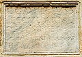
 Maria Saal Domplatz 3 Propsthof S-Wand Bauinschrift von 1550 19102023 0094.jpg 3,883 × 3,207; 10.97 MB
-
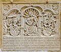 Maria Saal Domplatz 3 Propsthof S-Wand Bauinschrift von 1550 30082020 7706.jpg 3,757 × 3,193; 9.89 MB
-
-

-
 Maria Saal Domplatz 3 Propsthof S-Wand Grabinschrift für Sextus und Bonis 19102023 0093.jpg 3,998 × 3,214; 11.43 MB
-
 Maria Saal Domplatz 3 Propsthof S-Wand Grabinschrift für Sextus und Bonis 30082020 7709.jpg 4,087 × 3,202; 11.17 MB
-
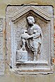
 Maria Saal Domplatz 3 Propsthof S-Wand Schreiberrelief 03072017 5281.jpg 2,890 × 4,180; 9.53 MB
-
 Maria Saal Domplatz 3 Propsthof S-Wand Schreiberrelief 06012014 5082.jpg 3,264 × 4,928; 12.07 MB
-
 Maria Saal Domplatz 3 Propsthof S-Wand Schreiberrelief 19102023 0095.jpg 3,280 × 4,928; 12.24 MB
-
 Maria Saal Domplatz 3 Propsthof S-Wand Schreiberrelief 28052015 0994.jpg 2,885 × 4,264; 9.77 MB
-

-
-

-
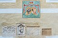
 Maria Saal Domplatz 3 Propsthof S-Wand Wappenfresko und Reliefsteine 28052015 0998.jpg 4,101 × 3,091; 8.45 MB
-
 Maria Saal Domplatz 3 Propsthof SW-Ansicht 10052022 2558.jpg 7,360 × 4,912; 20.46 MB
-
 Maria Saal Domplatz 3 Propsthof SW-Ansicht 24062017 9776.jpg 7,360 × 4,912; 22.76 MB
-
 Maria Saal Domplatz 3 Propsthof SW-Ansicht 31102018 5280.jpg 4,912 × 7,360; 20.67 MB
-
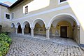 Maria Saal Domplatz 7 ehemaliger Propsthof Arkaden mit Lapidarium 13092011 2675.jpg 4,256 × 2,832; 3.02 MB
-
 Maria Saal Domplatz 7 ehemaliger Propsthof Arkaden mit Lapidarium 18102015 8168.jpg 7,360 × 4,912; 17.71 MB
-
 Maria Saal Domplatz 7 Propsthof Arkaden Lapidarium 28052015 4212.jpg 7,360 × 4,912; 17.75 MB
-
 Maria Saal Domplatz 7 Propsthof Bauinschrift von 1550 13092016 4309.jpg 3,795 × 3,280; 8.77 MB
-
 Maria Saal Domplatz 7 Propsthof Bauinschrift von 1550 28052015 0993.jpg 3,551 × 3,007; 8.36 MB
-
 Maria Saal Domplatz 7 Propsthof Bauinschrift von 1550 S-Wand 03072017 5282.jpg 3,814 × 3,153; 10.47 MB
-
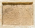 Maria Saal Domplatz 7 Propsthof S-Wand Grabinschrift für Sextus und Bonis 03072017 5284.jpg 3,800 × 3,095; 13.07 MB
-
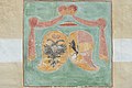 Maria Saal Domplatz 7 Propsthof S-Wand Kaiser-und Kaerntner Wappen 28052015 0997.jpg 4,824 × 3,217; 11.55 MB
-
 Maria Saal Propsteigebaeude S-Wand Kaiser-und Kaerntner Wappen 06012014 117.jpg 4,866 × 3,222; 11.53 MB


