Category:Project Mowrossih-India
Jump to navigation
Jump to search
Media in category "Project Mowrossih-India"
The following 200 files are in this category, out of 786 total.
(previous page) (next page)-
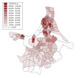
 2011 Kolkata literacy rate by Wards (bn).svg 512 × 479; 184 KB
-
 2011 Kolkata literacy rate by Wards (en).svg 512 × 479; 172 KB
-
 2011 Kolkata population density by Wards (bn).svg 512 × 479; 223 KB
-
 2011 Kolkata population density by Wards (en).svg 512 × 479; 187 KB
-
 2021 Kolkata Municipal Corporation election results (bn).svg 512 × 479; 194 KB
-
 2021 Kolkata Municipal Corporation election results (en).svg 512 × 479; 229 KB
-
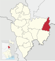
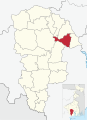
 Alipore Sadar (subdivision) in South 24 Parganas (West Bengal).svg 512 × 656; 728 KB
-
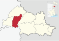
 Alipurduar (subdivision) in Alipurduar (West Bengal).svg 512 × 312; 356 KB
-
 Alipurduar Subdivision Map (bn).svg 512 × 311; 82 KB
-
 Alipurduar Subdivision Map (en).svg 512 × 311; 59 KB
-
 Alipurduar Tehsil Map (bn).svg 512 × 311; 71 KB
-
 Alipurduar Tehsil Map (en).svg 512 × 311; 54 KB
-
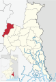
 Alipurduar-I in Alipurduar (West Bengal).svg 512 × 312; 376 KB
-
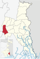
 Alipurduar-II in Alipurduar (West Bengal).svg 512 × 312; 376 KB
-
 Amdanga in North 24 Parganas (West Bengal).svg 512 × 747; 517 KB
-
 Amta-I in Howrah (West Bengal).svg 512 × 551; 406 KB
-
 Amta-II in Howrah (West Bengal).svg 512 × 551; 406 KB
-
 Arambag (subdivision) in Hooghly (West Bengal).svg 512 × 373; 385 KB
-
 Arambag in Hooghly (West Bengal).svg 512 × 373; 430 KB
-
 Arsha in Purulia (West Bengal).svg 512 × 521; 427 KB
-
 Asansol Sadar (subdvision) in Paschim Bardhaman (West Bengal).svg 512 × 488; 347 KB
-
 Ausgram-I in Purba Bardhaman (West Bengal).svg 512 × 531; 438 KB
-
 Ausgram-II in Purba Bardhaman (West Bengal).svg 512 × 531; 438 KB
-
 Baduria in North 24 Parganas (West Bengal).svg 512 × 747; 517 KB
-
 Bagdah in North 24 Parganas (West Bengal).svg 512 × 747; 517 KB
-
 Baghmundi in Purulia (West Bengal).svg 512 × 521; 427 KB
-
 Bagnan-I in Howrah (West Bengal).svg 512 × 551; 406 KB
-
 Bagnan-II in Howrah (West Bengal).svg 512 × 551; 406 KB
-
 Balagarh in Hooghly (West Bengal).svg 512 × 373; 430 KB
-
 Balarampur in Purulia (West Bengal).svg 512 × 521; 427 KB
-
 Bally Jagachha in Howrah (West Bengal).svg 512 × 551; 406 KB
-
 Ballygunge Vidhan Sabha constituency in Kolkata district.svg 512 × 499; 66 KB
-
 Balurghat in Dakshin Dinajpur (West Bengal).svg 512 × 353; 425 KB
-
 Balurghat Sadar (subdivision) in Dakshin Dinajpur (West Bengal).svg 512 × 353; 397 KB
-
 Bamangola in Malda (West Bengal).svg 512 × 561; 421 KB
-
 Banarhat in Jalpaiguri (West Bengal).svg 512 × 593; 459 KB
-
 Bankura Sadar (subdivision) in Bankura (West Bengal).svg 512 × 499; 356 KB
-
 Bankura Subdivision Map (bn).svg 512 × 499; 169 KB
-
 Bankura Subdivision Map (en).svg 512 × 499; 116 KB
-
 Bankura Tehsil Map (bn).svg 512 × 499; 146 KB
-
 Bankura Tehsil Map (en).svg 512 × 499; 108 KB
-
 Bankura-I in Bankura (West Bengal).svg 512 × 499; 395 KB
-
 Bankura-II in Bankura (West Bengal).svg 512 × 499; 395 KB
-
 Bansihari in Dakshin Dinajpur (West Bengal).svg 512 × 353; 425 KB
-
 Barabani in Paschim Bardhaman (West Bengal).svg 512 × 488; 361 KB
-
 Barabazar in Purulia (West Bengal).svg 512 × 521; 427 KB
-
 Barasat Sadar (subdivision) in North 24 Parganas (West Bengal).svg 512 × 747; 492 KB
-
 Barasat-I in North 24 Parganas (West Bengal).svg 512 × 747; 517 KB
-
 Barasat-II in North 24 Parganas (West Bengal).svg 512 × 747; 517 KB
-
 Bardhaman Sadar North (subdivision) in Purba Bardhaman (West Bengal).svg 512 × 531; 377 KB
-
 Bardhaman Sadar South (subdivision) in Purba Bardhaman (West Bengal).svg 512 × 531; 377 KB
-
 Bardhaman-I in Purba Bardhaman (West Bengal).svg 512 × 531; 438 KB
-
 Bardhaman-II in Purba Bardhaman (West Bengal).svg 512 × 531; 438 KB
-
 Barhait in Sahibganj (Jharkhand).svg 512 × 653; 793 KB
-
 Barharwa in Sahibganj (Jharkhand).svg 512 × 653; 793 KB
-
 Barjora in Bankura (West Bengal).svg 512 × 499; 395 KB
-
 Barrackpore (subdivision) in North 24 Parganas (West Bengal).svg 512 × 747; 492 KB
-
 Barrackpore-I in North 24 Parganas (West Bengal).svg 512 × 747; 517 KB
-
 Barrackpore-II in North 24 Parganas (West Bengal).svg 512 × 747; 517 KB
-
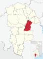
 Baruipur (subdivision) in South 24 Parganas (West Bengal).svg 512 × 656; 728 KB
-
 Baruipur in South 24 Parganas (West Bengal).svg 512 × 656; 771 KB
-
 Basant Rai in Godda (Jharkhand).svg 512 × 687; 729 KB
-
 Basanti in South 24 Parganas (West Bengal).svg 512 × 656; 771 KB
-
 Basirhat (subdivision) in North 24 Parganas (West Bengal).svg 512 × 747; 492 KB
-
 Basirhat-I in North 24 Parganas (West Bengal).svg 512 × 747; 517 KB
-
 Basirhat-II in North 24 Parganas (West Bengal).svg 512 × 747; 517 KB
-
 Behala East Vidhan Sabha constituency in Kolkata district.svg 512 × 499; 66 KB
-
 Behala West Vidhan Sabha constituency in Kolkata district.svg 512 × 499; 66 KB
-
 Beldanga-I in Murshidabad.svg 512 × 629; 418 KB
-
 Beldanga-II in Murshidabad.svg 512 × 629; 418 KB
-
 Beliaghata Vidhan Sabha constituency in Kolkata district.svg 512 × 499; 66 KB
-
 Berhampore (subdivision) in Murshidabad.svg 512 × 629; 372 KB
-
 Berhampore in Murshidabad.svg 512 × 629; 418 KB
-
 Bhagabanpur-I in Purba Medinipur (West Bengal).svg 512 × 639; 475 KB
-
 Bhagabanpur-II in Purba Medinipur (West Bengal).svg 512 × 639; 475 KB
-
 Bhagawangola-I in Murshidabad.svg 512 × 629; 418 KB
-
 Bhagawangola-II in Murshidabad.svg 512 × 629; 418 KB
-
 Bhangar-I in South 24 Parganas (West Bengal).svg 512 × 656; 771 KB
-
 Bhangar-II in South 24 Parganas (West Bengal).svg 512 × 656; 771 KB
-
 Bharatpur-I in Murshidabad.svg 512 × 629; 418 KB
-
 Bharatpur-II in Murshidabad.svg 512 × 629; 418 KB
-
 Bhatar in Purba Bardhaman (West Bengal).svg 512 × 531; 438 KB
-
 Bhowanipore Vidhan Sabha constituency in Kolkata district.svg 512 × 499; 66 KB
-
 Bidhannagar (subdivision) in North 24 Parganas (West Bengal).svg 512 × 747; 492 KB
-
 Binpur-I in Jhargram (West Bengal).svg 512 × 723; 379 KB
-
 Binpur-II in Jhargram (West Bengal).svg 512 × 723; 379 KB
-
 Birbhum Subdivision Map (bn).svg 512 × 642; 193 KB
-
 Birbhum Subdivision Map (en).svg 512 × 642; 147 KB
-
 Birbhum Tehsil Map (bn).svg 512 × 642; 170 KB
-
 Birbhum Tehsil Map (en).svg 512 × 642; 132 KB
-
 Bishnupur (subdivision) in Bankura (West Bengal).svg 512 × 499; 356 KB
-
 Bishnupur in Bankura (West Bengal).svg 512 × 499; 395 KB
-
 Bishnupur-I in South 24 Parganas (West Bengal).svg 512 × 656; 771 KB
-
 Bishnupur-II in South 24 Parganas (West Bengal).svg 512 × 656; 771 KB
-
 Boarijor in Godda (Jharkhand).svg 512 × 687; 729 KB
-
 Bolpur (subdivision) in Birbhum (West Bengal).svg 512 × 642; 413 KB
-
 Bolpur Sriniketan in Birbhum (West Bengal).svg 512 × 642; 462 KB
-
 Bongaon (subdivision) in North 24 Parganas (West Bengal).svg 512 × 747; 492 KB
-
 Bongaon in North 24 Parganas (West Bengal).svg 512 × 747; 517 KB
-
 Borio in Sahibganj (Jharkhand).svg 512 × 653; 793 KB
-
 Borough 1 in Kolkata Municipal Corporation.svg 512 × 479; 417 KB
-
 Borough 1 Wards, Kolkata Municipal Corporation (bn).svg 512 × 362; 87 KB
-
 Borough 1 Wards, Kolkata Municipal Corporation (en).svg 512 × 362; 82 KB
-
 Borough 10 in Kolkata Municipal Corporation.svg 512 × 479; 417 KB
-
 Borough 10 Wards, Kolkata Municipal Corporation (bn).svg 512 × 362; 108 KB
-
 Borough 10 Wards, Kolkata Municipal Corporation (en).svg 512 × 362; 92 KB
-
 Borough 11 in Kolkata Municipal Corporation.svg 512 × 479; 417 KB
-
 Borough 11 Wards, Kolkata Municipal Corporation (bn).svg 512 × 362; 93 KB
-
 Borough 11 Wards, Kolkata Municipal Corporation (en).svg 512 × 362; 85 KB
-
 Borough 12 in Kolkata Municipal Corporation.svg 512 × 479; 417 KB
-
 Borough 12 Wards, Kolkata Municipal Corporation (bn).svg 512 × 362; 94 KB
-
 Borough 12 Wards, Kolkata Municipal Corporation (en).svg 512 × 362; 87 KB
-
 Borough 13 in Kolkata Municipal Corporation.svg 512 × 479; 417 KB
-
 Borough 13 Wards, Kolkata Municipal Corporation (bn).svg 512 × 362; 91 KB
-
 Borough 13 Wards, Kolkata Municipal Corporation (en).svg 512 × 362; 82 KB
-
 Borough 14 in Kolkata Municipal Corporation.svg 512 × 479; 417 KB
-
 Borough 14 Wards, Kolkata Municipal Corporation (bn).svg 512 × 362; 94 KB
-
 Borough 14 Wards, Kolkata Municipal Corporation (en).svg 512 × 362; 86 KB
-
 Borough 15 in Kolkata Municipal Corporation.svg 512 × 479; 417 KB
-
 Borough 15 Wards, Kolkata Municipal Corporation (bn).svg 512 × 362; 100 KB
-
 Borough 15 Wards, Kolkata Municipal Corporation (en).svg 512 × 362; 88 KB
-
 Borough 16 in Kolkata Municipal Corporation.svg 512 × 479; 417 KB
-
 Borough 16 Wards, Kolkata Municipal Corporation (bn).svg 512 × 362; 101 KB
-
 Borough 16 Wards, Kolkata Municipal Corporation (en).svg 512 × 362; 90 KB
-
 Borough 2 in Kolkata Municipal Corporation.svg 512 × 479; 417 KB
-
 Borough 2 Wards, Kolkata Municipal Corporation (bn).svg 512 × 362; 86 KB
-
 Borough 2 Wards, Kolkata Municipal Corporation (en).svg 512 × 362; 78 KB
-
 Borough 3 in Kolkata Municipal Corporation.svg 512 × 479; 417 KB
-
 Borough 3 Wards, Kolkata Municipal Corporation (bn).svg 512 × 362; 90 KB
-
 Borough 3 Wards, Kolkata Municipal Corporation (en).svg 512 × 362; 82 KB
-
 Borough 4 in Kolkata Municipal Corporation.svg 512 × 479; 417 KB
-
 Borough 4 Wards, Kolkata Municipal Corporation (bn).svg 512 × 362; 89 KB
-
 Borough 4 Wards, kolkata Municipal Corporation (en).svg 512 × 362; 81 KB
-
 Borough 5 in Kolkata Municipal Corporation.svg 512 × 479; 417 KB
-
 Borough 5 Wards, Kolkata Municipal Corporation (bn).svg 512 × 362; 97 KB
-
 Borough 5 Wards, Kolkata Municipal Corporation (en).svg 512 × 362; 83 KB
-
 Borough 6 in Kolkata Municipal Corporation.svg 512 × 479; 417 KB
-
 Borough 6 Wards, Kolkata Municipal Corporation (bn).svg 512 × 362; 92 KB
-
 Borough 6 Wards, Kolkata Municipal Corporation (en).svg 512 × 362; 83 KB
-
 Borough 7 in Kolkata Municipal Corporation.svg 512 × 479; 417 KB
-
 Borough 7 Wards, Kolkata Municipal Corporation (bn).svg 512 × 362; 97 KB
-
 Borough 7 Wards, Kolkata Municipal Corporation (en).svg 512 × 362; 89 KB
-
 Borough 8 in Kolkata Municipal Corporation.svg 512 × 479; 417 KB
-
 Borough 8 Wards, Kolkata Municipal Corporation (bn).svg 512 × 362; 95 KB
-
 Borough 8 Wards, Kolkata Municipal Corporation (en).svg 512 × 362; 85 KB
-
 Borough 9 in Kolkata Municipal Corporation.svg 512 × 479; 417 KB
-
 Borough 9 Wards, Kolkata Municipal Corporation (bn).svg 512 × 362; 93 KB
-
 Borough 9 Wards, Kolkata Municipal Corporation (en).svg 512 × 362; 84 KB
-
 Budge Budge-I in South 24 Parganas (West Bengal).svg 512 × 656; 771 KB
-
 Budge Budge-II in South 24 Parganas (West Bengal).svg 512 × 656; 771 KB
-
 Bundwan in Purulia (West Bengal).svg 512 × 521; 427 KB
-
 Burwan in Murshidabad.svg 512 × 629; 418 KB
-
 Canning (subdivision) in South 24 Parganas (West Bengal).svg 512 × 656; 728 KB
-
 Canning-I in South 24 Parganas (West Bengal).svg 512 × 656; 771 KB
-
 Canning-II in South 24 Parganas (West Bengal).svg 512 × 656; 771 KB
-
 Chakdah (prior 2018) in Nadia (West Bengal).svg 512 × 662; 452 KB
-
 Chakdah in Nadia (West Bengal).svg 512 × 663; 426 KB
-
 Chanchal (subdivision) in Malda (West Bengal).svg 512 × 561; 380 KB
-
 Chanchal-I in Malda (West Bengal).svg 512 × 561; 421 KB
-
 Chanchal-II in Malda (West Bengal).svg 512 × 561; 421 KB
-
 Chandannagar (subdivision) in Hooghly (West Bengal).svg 512 × 373; 385 KB
-
 Chandipur in Purba Medinipur (West Bengal).svg 512 × 639; 475 KB
-
 Chanditala-I in Hooghly (West Bengal).svg 512 × 373; 430 KB
-
 Chanditala-II in Hooghly (West Bengal).svg 512 × 373; 430 KB
-
 Chandrakona-I in Paschim Medinipur (West Bengal).svg 512 × 709; 434 KB
-
 Chandrakona-II in Paschim Medinipur (West Bengal).svg 512 × 709; 434 KB
-
 Chapra in Nadia (West Bengal).svg 512 × 663; 426 KB
-
 Chhatna in Bankura (West Bengal).svg 512 × 499; 395 KB
-
 Chinsurah Mogra in Hooghly (West Bengal).svg 512 × 373; 430 KB
-
 Chinsurah Sadar (subdivision) in Hooghly (West Bengal).svg 512 × 373; 385 KB
-
 Chopra in Uttar Dinajpur (West Bengal).svg 512 × 668; 464 KB
-
 Chowrangee Vidhan Sabha constituency in Kolkata district.svg 512 × 499; 66 KB
-
 Contai (subdivision) in Purba Medinipur (West Bengal).svg 512 × 639; 420 KB
-
 Contai-I in Purba Medinipur (West Bengal).svg 512 × 639; 475 KB
-
 Contai-III in Purba Medinipur (West Bengal).svg 512 × 639; 475 KB
-
 Cooch Behar Sadar (subdivision) in Cooch Behar (West Bengal).svg 512 × 320; 446 KB
-
 Cooch Behar Subdivision Map (bn).svg 512 × 320; 164 KB
-
 Cooch Behar Subdivision Map (en).svg 512 × 320; 113 KB
-
 Cooch Behar Tehsil Map (bn).svg 512 × 320; 122 KB
-
 Cooch Behar Tehsil Map (en).svg 512 × 320; 97 KB
-
 Cooch Behar-I in Cooch Behar (West Bengal).svg 512 × 320; 462 KB
-
 Cooch Behar-II in Cooch Behar (West Bengal).svg 512 × 320; 462 KB
-

-
 Dakshin Dinajpur Subdivision Map (bn).svg 512 × 352; 111 KB
-
 Dakshin Dinajpur Subdivision Map (en).svg 512 × 352; 89 KB
-
 Dakshin Dinajpur Tehsil Map (bn).svg 512 × 352; 93 KB
-
 Dakshin Dinajpur Tehsil Map (en).svg 512 × 352; 80 KB
-
 Dantan-I in Paschim Medinipur (West Bengal).svg 512 × 709; 434 KB
-
 Dantan-II in Paschim Medinipur (West Bengal).svg 512 × 709; 434 KB
-
 Darjeeling (subdivision) in Darjeeling (West Bengal).svg 512 × 668; 378 KB
-
 Darjeeling Pulbazar in Darjeeling (West Bengal).svg 512 × 668; 388 KB
-
 Darjeeling Subdivision Map (bn).svg 512 × 669; 110 KB
-
 Darjeeling Subdivision Map (en).svg 512 × 669; 77 KB
-
 Darjeeling Subdivision Map (ne).svg 512 × 669; 123 KB
-
 Darjeeling Tehsil Map (bn).svg 512 × 669; 95 KB
-
 Darjeeling Tehsil Map (en).svg 512 × 669; 69 KB
-
 Darjeeling Tehsil Map (ne).svg 512 × 669; 104 KB
-
 Daspur-I in Paschim Medinipur (West Bengal).svg 512 × 709; 434 KB
-
 Daspur-II in Paschim Medinipur (West Bengal).svg 512 × 709; 434 KB
-
 Debra in Paschim Medinipur (West Bengal).svg 512 × 709; 434 KB
.svg)
.svg)
.svg)
.svg)
.svg)
.svg)
_in_South_24_Parganas_(West_Bengal).svg)
_in_Alipurduar_(West_Bengal).svg)
.svg)
.svg)
.svg)
.svg)
.svg)
.svg)
.svg)
.svg)
.svg)
_in_Hooghly_(West_Bengal).svg)
.svg)
.svg)
_in_Paschim_Bardhaman_(West_Bengal).svg)
.svg)
.svg)
.svg)
.svg)
.svg)
.svg)
.svg)
.svg)
.svg)
.svg)

.svg)
_in_Dakshin_Dinajpur_(West_Bengal).svg)
.svg)
.svg)
_in_Bankura_(West_Bengal).svg)
.svg)
.svg)
.svg)
.svg)
.svg)
.svg)
.svg)
.svg)
.svg)
_in_North_24_Parganas_(West_Bengal).svg)
.svg)
.svg)
_in_Purba_Bardhaman_(West_Bengal).svg)
_in_Purba_Bardhaman_(West_Bengal).svg)
.svg)
.svg)
.svg)
.svg)
.svg)
_in_North_24_Parganas_(West_Bengal).svg)
.svg)
.svg)
_in_South_24_Parganas_(West_Bengal).svg)
.svg)
.svg)
.svg)
_in_North_24_Parganas_(West_Bengal).svg)
.svg)
.svg)


_in_Murshidabad.svg)

.svg)
.svg)


.svg)
.svg)


.svg)

_in_North_24_Parganas_(West_Bengal).svg)
.svg)
.svg)
.svg)
.svg)
.svg)
.svg)
_in_Bankura_(West_Bengal).svg)
.svg)
.svg)
.svg)
.svg)
_in_Birbhum_(West_Bengal).svg)
.svg)
_in_North_24_Parganas_(West_Bengal).svg)
.svg)
.svg)

.svg)
.svg)

.svg)
.svg)

.svg)
.svg)

.svg)
.svg)

.svg)
.svg)

.svg)
.svg)

.svg)
.svg)

.svg)
.svg)

.svg)
.svg)

.svg)
.svg)

.svg)
.svg)

.svg)
.svg)

.svg)
.svg)

.svg)
.svg)

.svg)
.svg)

.svg)
.svg)
.svg)
.svg)
.svg)

_in_South_24_Parganas_(West_Bengal).svg)
.svg)
.svg)
_in_Nadia_(West_Bengal).svg)
.svg)
_in_Malda_(West_Bengal).svg)
.svg)
.svg)
_in_Hooghly_(West_Bengal).svg)
.svg)
.svg)
.svg)
.svg)
.svg)
.svg)
.svg)
.svg)
_in_Hooghly_(West_Bengal).svg)
.svg)

_in_Purba_Medinipur_(West_Bengal).svg)
.svg)
.svg)
_in_Cooch_Behar_(West_Bengal).svg)
.svg)
.svg)
.svg)
.svg)
.svg)
.svg)

.svg)
.svg)
.svg)
.svg)
.svg)
.svg)
_in_Darjeeling_(West_Bengal).svg)
.svg)
.svg)
.svg)
.svg)
.svg)
.svg)
.svg)
.svg)
.svg)
.svg)