Category:Princethorpe
Jump to navigation
Jump to search
village in United Kingdom | |||||
| Upload media | |||||
| Pronunciation audio | |||||
|---|---|---|---|---|---|
| Instance of | |||||
| Location | Rugby, Warwickshire, West Midlands, England | ||||
| Population |
| ||||
| Area |
| ||||
 | |||||
English: Princethorpe is a village and civil parish in the Rugby district of Warwickshire, England. In 2001 the parish had a population of 382.

Subcategories
This category has the following 2 subcategories, out of 2 total.
S
Media in category "Princethorpe"
The following 102 files are in this category, out of 102 total.
-
 A423 at Princethorpe - geograph.org.uk - 4591478.jpg 1,920 × 1,200; 485 KB
-
 Accommodation Block Woodhouse Hotel - geograph.org.uk - 3101216.jpg 640 × 480; 133 KB
-
 Allotments north of Princethorpe (1) - geograph.org.uk - 1572066.jpg 640 × 426; 105 KB
-
 Allotments north of Princethorpe (2) - geograph.org.uk - 1572069.jpg 640 × 426; 119 KB
-

-
 B4455 Fosse Way heading north - geograph.org.uk - 6237966.jpg 1,024 × 684; 406 KB
-
 B4455 towards Leicester - geograph.org.uk - 3155045.jpg 640 × 480; 65 KB
-
 Barn Lane - geograph.org.uk - 5440327.jpg 640 × 480; 104 KB
-
-

-
 Barn Lane meets A423 Oxford Road - geograph.org.uk - 5440332.jpg 640 × 480; 137 KB
-
 Barn Lane past Stoneyford Barn - geograph.org.uk - 5440331.jpg 640 × 480; 124 KB
-
 Barn Lane, Princethorpe - geograph.org.uk - 3744371.jpg 1,280 × 856; 375 KB
-
 Bluebells in Old Nun Wood - geograph.org.uk - 2948436.jpg 2,000 × 1,333; 327 KB
-
 Coffin Walk, off Sheep Dip Lane - geograph.org.uk - 2080009.jpg 640 × 480; 101 KB
-

-

-
 Entrance to Old Nun Wood off Burnthurst Lane - geograph.org.uk - 2948410.jpg 2,000 × 1,333; 338 KB
-
 Farmland off Barn Lane - geograph.org.uk - 3155053.jpg 640 × 480; 67 KB
-
 Farmland off the Fosse Way - geograph.org.uk - 3155041.jpg 640 × 480; 90 KB
-
 Farmland, Southfield - geograph.org.uk - 3155064.jpg 640 × 480; 77 KB
-

-
 Fields west of Princethorpe - geograph.org.uk - 2699792.jpg 1,280 × 856; 217 KB
-
 Flowers by the Fosse - geograph.org.uk - 1257489.jpg 640 × 477; 120 KB
-

-
 Fosse north of Princethorpe - geograph.org.uk - 1257492.jpg 640 × 482; 88 KB
-
 Fosse Way near Park Farm, Princethorpe - geograph.org.uk - 1572082.jpg 600 × 405; 124 KB
-
 Fosse Way north of Princethorpe - geograph.org.uk - 1572078.jpg 640 × 426; 124 KB
-
 Fosse Way northbound meets the A423 - geograph.org.uk - 2080005.jpg 640 × 480; 55 KB
-
 Fosse Way towards Princethorpe - geograph.org.uk - 3737909.jpg 1,280 × 856; 379 KB
-
-
-
 Heading north from Princethorpe - geograph.org.uk - 5677624.jpg 1,600 × 900; 487 KB
-
 Hill Top Park Princethorpe - geograph.org.uk - 1552862.jpg 640 × 480; 52 KB
-
 Hill Top Park, Princethorpe - geograph.org.uk - 2804174.jpg 800 × 600; 73 KB
-

-
 Ivy-clad trees on a frosty morning - geograph.org.uk - 4751954.jpg 1,996 × 1,467; 532 KB
-

-
 Maize Field near Princethorpe - geograph.org.uk - 3514655.jpg 640 × 480; 122 KB
-
 Mast near Princethorpe - geograph.org.uk - 1257496.jpg 640 × 529; 88 KB
-

-

-
 Oxford Road (A423) - geograph.org.uk - 3155059.jpg 640 × 480; 59 KB
-
 Oxford Road (A423) - geograph.org.uk - 3155072.jpg 640 × 480; 77 KB
-
 Oxford Road heading north - geograph.org.uk - 3155066.jpg 640 × 480; 65 KB
-
 Pond at Old Nun Wood - geograph.org.uk - 5781391.jpg 800 × 600; 221 KB
-
 Pond in Old Nun Wood - geograph.org.uk - 2948424.jpg 2,000 × 1,333; 591 KB
-
 Postbox near Princethorpe crossroads - geograph.org.uk - 1417823.jpg 640 × 434; 93 KB
-

-
 Power poles to Princethorpe - geograph.org.uk - 1421635.jpg 512 × 640; 112 KB
-
 Princethorpe - geograph.org.uk - 341683.jpg 640 × 480; 129 KB
-
 Princethorpe - geograph.org.uk - 494184.jpg 640 × 480; 122 KB
-
 Princethorpe - geograph.org.uk - 507693.jpg 640 × 480; 154 KB
-
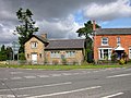
 Princethorpe College - geograph.org.uk - 3501684.jpg 1,024 × 768; 154 KB
-
Princethorpe en gb.ogg 1.7 s; 43 KB
-
 Princethorpe Farmland - geograph.org.uk - 3546974.jpg 1,024 × 768; 235 KB
-
 Princethorpe-Hightown - geograph.org.uk - 2118648.jpg 640 × 454; 57 KB
-
 Princethorpe-Park Farm - geograph.org.uk - 809365.jpg 640 × 480; 140 KB
-
 Princethorpe-The Woodhouse Hotel - geograph.org.uk - 2617429.jpg 640 × 480; 108 KB
-
 Priory Court, Princethorpe - geograph.org.uk - 1257520.jpg 640 × 466; 94 KB
-
 Priory Farm - geograph.org.uk - 3514607.jpg 640 × 480; 67 KB
-
 River Leam near Eathorpe - geograph.org.uk - 3155036.jpg 640 × 480; 92 KB
-
 Rugby Road, Princethorpe - geograph.org.uk - 4591534.jpg 1,920 × 1,440; 398 KB
-
 Sewage pump, Princethorpe - geograph.org.uk - 1257504.jpg 579 × 640; 163 KB
-

-

-

-
 Substation, Princethorpe - geograph.org.uk - 1257498.jpg 640 × 460; 93 KB
-
 The converted barn in Barn Lane - geograph.org.uk - 1421632.jpg 640 × 422; 121 KB
-
 The Fosse Way at Princethorpe - geograph.org.uk - 2804161.jpg 800 × 600; 75 KB
-
 The Lodge at Princethorpe College - geograph.org.uk - 2948515.jpg 2,000 × 1,432; 330 KB
-
 The Poplars, Eathorpe - geograph.org.uk - 156332.jpg 640 × 480; 282 KB
-
 Track to Park Farm - geograph.org.uk - 3155076.jpg 640 × 480; 114 KB
-
 Track to Southfield - geograph.org.uk - 3155065.jpg 640 × 480; 95 KB
-
 View from entrance to Princethorpe College - geograph.org.uk - 2948553.jpg 2,000 × 1,333; 235 KB
-
 Woodhouse Hotel - geograph.org.uk - 3101369.jpg 640 × 480; 121 KB
-
 Woodhouse Hotel - geograph.org.uk - 3101374.jpg 640 × 480; 79 KB
-
 Woodhouse Hotel - geograph.org.uk - 3101397.jpg 640 × 480; 87 KB
-
 Woodhouse Hotel - geograph.org.uk - 3101405.jpg 640 × 480; 106 KB
-
 Woodhouse Hotel Princethorpe (1) - geograph.org.uk - 3101183.jpg 640 × 480; 108 KB
-
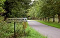 Approaching Wappenbury from the east - geograph.org.uk - 1427463.jpg 640 × 408; 140 KB
-
 Byway from Frankton - geograph.org.uk - 37582.jpg 640 × 480; 96 KB
-
 Cottages, Hightown, Princethorpe - geograph.org.uk - 1417809.jpg 640 × 416; 94 KB
-
 Eathorpe - geograph.org.uk - 11970.jpg 640 × 480; 115 KB
-
-
 Entrance to Princethorpe College - geograph.org.uk - 34749.jpg 640 × 480; 83 KB
-

-

-

-

-
 Gathering storm clouds - geograph.org.uk - 156295.jpg 640 × 480; 316 KB
-
 Hunningham Hill - geograph.org.uk - 9342.jpg 640 × 480; 105 KB
-
 Hunningham House - geograph.org.uk - 11956.jpg 640 × 480; 63 KB
-
 Hunningham village - geograph.org.uk - 156291.jpg 640 × 480; 272 KB
-
 Lane to Eathorpe - geograph.org.uk - 156328.jpg 640 × 480; 295 KB
-
 Park Farm - geograph.org.uk - 37591.jpg 640 × 480; 94 KB
-
 Princethorpe - geograph.org.uk - 341697.jpg 640 × 480; 118 KB
-
 Princethorpe - geograph.org.uk - 37588.jpg 640 × 480; 71 KB
-
 Princethorpe from Wappenbury Barn - geograph.org.uk - 11973.jpg 640 × 480; 75 KB
-
 The Woodhouse Hotel - geograph.org.uk - 34753.jpg 640 × 480; 83 KB
-
 Unclassified road - geograph.org.uk - 11950.jpg 640 × 480; 123 KB
-
 Woodcote - geograph.org.uk - 5929.jpg 640 × 480; 51 KB


_-_geograph.org.uk_-_1572066.jpg)
_-_geograph.org.uk_-_1572069.jpg)


_-_geograph.org.uk_-_1427528.jpg)


_-_geograph.org.uk_-_3155059.jpg)
_-_geograph.org.uk_-_3155072.jpg)


_-_geograph.org.uk_-_1422678.jpg)


_-_geograph.org.uk_-_3101183.jpg)


_-_geograph.org.uk_-_1427521.jpg)


