Category:Prestolee
Jump to navigation
Jump to search
English: Prestolee is a small village within the Metropolitan Borough of Bolton, in Greater Manchester, England. It lies on the River Irwell and is one of a cluster of villages between Bolton and Kearsley, which includes Stoneclough and Ringley.

village in United Kingdom  | |||||
| Upload media | |||||
| Instance of | |||||
|---|---|---|---|---|---|
| Location | Bolton, Greater Manchester, North West England, England | ||||
 | |||||
Media in category "Prestolee"
The following 41 files are in this category, out of 41 total.
-
 A footbridge with ambitions to become an aqueduct - geograph.org.uk - 4357802.jpg 3,949 × 2,628; 5.89 MB
-
 Canal at Prestolee - geograph.org.uk - 4212580.jpg 2,500 × 1,797; 4.75 MB
-
 Canal near Prestolee road Bridge - geograph.org.uk - 4414590.jpg 1,024 × 768; 242 KB
-

-
 Footbridge over Canal at Prestolee - geograph.org.uk - 416477.jpg 640 × 480; 108 KB
-
 Holy Trinity Church, Prestolee - geograph.org.uk - 1753640.jpg 1,991 × 2,654; 1.24 MB
-
 Holy Trinity Church, Prestolee - geograph.org.uk - 1753655.jpg 1,854 × 2,472; 1.17 MB
-
 Holy Trinity Church, Prestolee - geograph.org.uk - 3396514.jpg 1,024 × 682; 508 KB
-
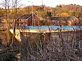
 Kearsley Mill at Prestolee - geograph.org.uk - 6014811.jpg 5,184 × 2,920; 1.23 MB
-
 Kearsley Mill, Prestolee - geograph.org.uk - 638450.jpg 640 × 424; 97 KB
-
 Looking down from the aqueduct - geograph.org.uk - 4361050.jpg 4,451 × 2,963; 7.18 MB
-
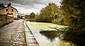
 Manchester, Bolton and Bury Canal, Prestolee - geograph.org.uk - 4449643.jpg 1,024 × 576; 255 KB
-
 Market Street Tavern - geograph.org.uk - 1753598.jpg 2,816 × 2,112; 1.08 MB
-

-

-
 Orchidaceae at Nob End, Bolton (103-0346).jpg 1,200 × 1,600; 312 KB
-
 Pond on Oak Hill - geograph.org.uk - 2857439.jpg 4,000 × 3,000; 5.22 MB
-
 Pack horse bridge stoneclough.jpg 3,040 × 960; 530 KB
-
 Prestolee (Kearsley) Mill - geograph.org.uk - 3444724.jpg 640 × 481; 604 KB
-
 Prestolee - geograph.org.uk - 1753719.jpg 2,816 × 2,112; 2.61 MB
-
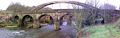
 Prestolee Bridge(s) - geograph.org.uk - 2162366.jpg 800 × 600; 365 KB
-
 Prestolee Locks.jpg 6,357 × 3,468; 23.43 MB
-
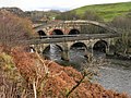
 Prestolee New Bridge - geograph.org.uk - 1753711.jpg 1,801 × 1,351; 762 KB
-
 Prestolee Pack Bridge - geograph.org.uk - 2162385.jpg 800 × 600; 420 KB
-
 Prestolee Road - geograph.org.uk - 2164801.jpg 800 × 600; 332 KB
-
 Prestolee Road - geograph.org.uk - 2969059.jpg 640 × 481; 641 KB
-
 Prestolee Road - geograph.org.uk - 3255544.jpg 640 × 480; 720 KB
-
 Prestolee-Kearsley Mill - geograph.org.uk - 2163228.jpg 800 × 600; 355 KB
-
 Prestolee-Kearsley Mill - geograph.org.uk - 2165116.jpg 800 × 600; 244 KB
-
 River Irwell - geograph.org.uk - 1753615.jpg 2,816 × 2,112; 1.61 MB
-
 River Irwell - geograph.org.uk - 1753663.jpg 2,816 × 2,112; 1.12 MB
-
 Santa Ramble, Nob End Nature Reserve - geograph.org.uk - 3256153.jpg 640 × 480; 600 KB
-
 Sewer Pipe Bridge, Prestolee - geograph.org.uk - 2162395.jpg 800 × 600; 287 KB
-
 Sewer pipe bridge, Prestolee - geograph.org.uk - 4776030.jpg 1,024 × 576; 127 KB
-
 The Grapes - geograph.org.uk - 1753698.jpg 2,554 × 1,916; 611 KB
-
 The Hare and Hounds - geograph.org.uk - 1753685.jpg 2,625 × 1,969; 1.19 MB
-
 The River Irwell at Prestolee - geograph.org.uk - 3396454.jpg 1,024 × 682; 535 KB
-
 View From Nob End Locks - geograph.org.uk - 2937149.jpg 640 × 480; 517 KB
-
 Volunteers at work on the Prestolee Flight - geograph.org.uk - 4391573.jpg 1,600 × 1,200; 799 KB
-
 Wilson Bridge - geograph.org.uk - 4343277.jpg 1,024 × 576; 182 KB
-
 Wilson's bridge over the River Irwell - geograph.org.uk - 4414616.jpg 1,024 × 768; 276 KB


_Mill_-_geograph.org.uk_-_3729963.jpg)


.jpg)

_Mill_-_geograph.org.uk_-_3444724.jpg)

_-_geograph.org.uk_-_2162366.jpg)


