Category:Preesall
Jump to navigation
Jump to search
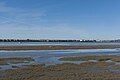
English: Preesall (until 1910 known as Preesall with Hackensall) is a town and civil parish in Lancashire, England. The parish covers the eastern bank of the estuary of the River Wyre, including Knott End-on-Sea, Pilling Lane and the village of Preesall itself. The parish of Preesall had a population of 5,314 recorded in the 2001 census, (→Preesall)
Nederlands: Preesall is een plaats en civil parish in het bestuurlijke gebied Wyre, in het Engelse graafschap Lancashire met 5.314 inwoners. (→Preesall)
Polski: Preesall – wieś w Anglii, w hrabstwie Lancashire, w dystrykcie Wyre. Leży 70 km na północny zachód od miasta Manchester i 329 km na północny zachód od Londynu. W 2001 miejscowość liczyła 5314 mieszkańców. (→Preesall)
village in the United Kingdom .jpg) | |||||
| Upload media | |||||
| Instance of | |||||
|---|---|---|---|---|---|
| Location | Wyre, Lancashire, North West England, England | ||||
 | |||||
Subcategories
This category has the following 4 subcategories, out of 4 total.
Media in category "Preesall"
The following 200 files are in this category, out of 542 total.
(previous page) (next page)-
 "Wyre Rose" ferry at Knott End-on-Sea - geograph.org.uk - 2850038.jpg 1,024 × 710; 161 KB
-
 A damp evening at Knott End - geograph.org.uk - 2515329.jpg 800 × 600; 84 KB
-
 A field of maize - geograph.org.uk - 5922684.jpg 4,115 × 2,417; 7.83 MB
-

-

-
 A588 at Church Bridge - geograph.org.uk - 3293104.jpg 640 × 480; 66 KB
-
 A588 near Park Farm - geograph.org.uk - 2296607.jpg 1,600 × 1,170; 274 KB
-
 Abandoned tribute - geograph.org.uk - 4660557.jpg 640 × 640; 187 KB
-
 Access onto Preesall Sands - geograph.org.uk - 2585588.jpg 4,320 × 3,240; 2.82 MB
-
 Access road to sewage works - geograph.org.uk - 873268.jpg 640 × 425; 63 KB
-
 Acres Lane, Preesall - geograph.org.uk - 3731780.jpg 4,608 × 3,456; 6.19 MB
-
 Across the Wyre - geograph.org.uk - 5100410.jpg 1,000 × 750; 450 KB
-
 Agglebys Road - geograph.org.uk - 2636526.jpg 4,320 × 3,240; 4.47 MB
-
 Agglebys Road off Back Lane - geograph.org.uk - 2306166.jpg 1,024 × 768; 117 KB
-
 Another car wreck in sand off Fluke Hall - geograph.org.uk - 2308938.jpg 2,304 × 3,072; 1.29 MB
-
 Approaching evening at Knott End-on-sea - geograph.org.uk - 3471768.jpg 4,608 × 3,456; 4.94 MB
-
 Approaching Knott End - geograph.org.uk - 5199254.jpg 1,000 × 750; 513 KB
-
 Approaching Park Cottage - geograph.org.uk - 3732082.jpg 4,608 × 3,456; 2.78 MB
-
 Arriving at Knott End - geograph.org.uk - 5100596.jpg 1,000 × 1,000; 658 KB
-
-
 Ashleigh Farm buildings - geograph.org.uk - 195007.jpg 640 × 480; 92 KB
-
 B5270 heading west - geograph.org.uk - 3974387.jpg 640 × 480; 114 KB
-
 B5270 Sandy Lane, Preesall - geograph.org.uk - 3293385.jpg 640 × 480; 33 KB
-
 B5377 Park Lane looking north - geograph.org.uk - 3293110.jpg 640 × 480; 43 KB
-
 Back Lane - geograph.org.uk - 3974366.jpg 640 × 480; 79 KB
-
 Back Lane - geograph.org.uk - 3974369.jpg 640 × 480; 79 KB
-
 Back Lane, Preesall - geograph.org.uk - 3731776.jpg 4,608 × 3,456; 6.61 MB
-

-
 Barn at Town Foot - geograph.org.uk - 3234996.jpg 4,320 × 3,240; 5.01 MB
-

-
 Barnaby's Sands nature reserve - geograph.org.uk - 873241.jpg 640 × 425; 93 KB
-
 Barton Square - geograph.org.uk - 5102219.jpg 1,000 × 593; 449 KB
-
 Barton Square, Knott End - geograph.org.uk - 4899922.jpg 640 × 427; 77 KB
-
 Beach Road - geograph.org.uk - 3235085.jpg 4,320 × 3,240; 4.59 MB
-

-
 Besieged in Preesall - geograph.org.uk - 4106234.jpg 640 × 427; 62 KB
-
 Bethel United Reformed Church - geograph.org.uk - 1131411.jpg 640 × 426; 111 KB
-

-
 Bibby's farm - geograph.org.uk - 5936538.jpg 4,001 × 2,385; 7.84 MB
-
 Bird watching by Pilling Sands - geograph.org.uk - 2853109.jpg 659 × 800; 125 KB
-

-
 Boarding the Wyre Rose - geograph.org.uk - 5101193.jpg 1,000 × 646; 482 KB
-
 Boats at anchor - geograph.org.uk - 5010581.jpg 1,280 × 960; 911 KB
-
 Boats by the Wyre near Knott End - geograph.org.uk - 2515307.jpg 480 × 640; 109 KB
-
 Boats on the river taking advantage of the flooding tide - geograph.org.uk - 5923413.jpg 4,484 × 2,984; 6.88 MB
-
 Bourbles Farm - geograph.org.uk - 1176297.jpg 640 × 426; 117 KB
-
 Bourne Arms - geograph.org.uk - 5101692.jpg 1,000 × 750; 643 KB
-
 Bourne Arms at Knott End - geograph.org.uk - 4900932.jpg 640 × 417; 46 KB
-
 Breakwater at Knott End - geograph.org.uk - 1758473.jpg 640 × 480; 80 KB
-
 Bridleway Junction - geograph.org.uk - 1176344.jpg 640 × 426; 135 KB
-
 Bridleway sign at Five Lane Ends - geograph.org.uk - 3731790.jpg 4,608 × 3,456; 2.48 MB
-
 Bridleway to Preesall - geograph.org.uk - 1176169.jpg 400 × 600; 153 KB
-
 Bridleway to Preesall - geograph.org.uk - 3235027.jpg 4,320 × 3,240; 4.76 MB
-
 Brine Well and pond - geograph.org.uk - 220781.jpg 640 × 480; 86 KB
-
 Brine Well Head - geograph.org.uk - 109708.jpg 640 × 480; 170 KB
-
 Brine Wells near Preesall - geograph.org.uk - 109704.jpg 640 × 480; 80 KB
-
 Buoy 16 - geograph.org.uk - 6299390.jpg 1,280 × 960; 1.01 MB
-
 Buoy ^20 - geograph.org.uk - 5199183.jpg 1,000 × 669; 483 KB
-
 Burned House Lane (A588) - geograph.org.uk - 3974413.jpg 640 × 480; 83 KB
-
 Burned House Lane - geograph.org.uk - 3732177.jpg 4,608 × 3,456; 6.31 MB
-
 Burned House Lane - geograph.org.uk - 5934949.jpg 4,592 × 3,056; 7.93 MB
-
 Burned House Lane, Preesall - geograph.org.uk - 3732541.jpg 4,608 × 3,456; 6.21 MB
-
 Canshe Bank - geograph.org.uk - 5101206.jpg 1,000 × 621; 460 KB
-
 Canshe Bank and Fleetwood - geograph.org.uk - 6371034.jpg 5,152 × 3,864; 6.73 MB
-
 Canshe Hole, 80 minutes before low tide - geograph.org.uk - 5452525.jpg 1,024 × 768; 109 KB
-
 Car Park Fluke Hall - geograph.org.uk - 1161473.jpg 640 × 426; 97 KB
-
 Car wreck in sand off Fluke Hall - geograph.org.uk - 2308921.jpg 1,600 × 1,200; 436 KB
-
 Caravan Site on Pilling Lane Preesall - geograph.org.uk - 995264.jpg 640 × 428; 92 KB
-
 Caravan site, Knott End - geograph.org.uk - 2296490.jpg 1,600 × 1,200; 580 KB
-
 Caravan Site, Pilling lane, Preesall - geograph.org.uk - 995288.jpg 640 × 418; 67 KB
-
 Cart Gate, Preesall - geograph.org.uk - 3731370.jpg 4,476 × 3,272; 1.86 MB
-
 Cat and Dog Kennels - geograph.org.uk - 1161530.jpg 640 × 426; 132 KB
-
 Cat in field, Town Foot, Preesall - geograph.org.uk - 2515128.jpg 640 × 505; 116 KB
-
 Catching the sun - geograph.org.uk - 1576973.jpg 640 × 405; 68 KB
-
 Catching the sun - geograph.org.uk - 1577024.jpg 640 × 417; 76 KB
-
 Cemetery Lane - geograph.org.uk - 3731833.jpg 4,608 × 3,456; 6.56 MB
-
 Cemetery Lane - geograph.org.uk - 3732062.jpg 4,608 × 3,456; 6.35 MB
-
 Channel out to sea - geograph.org.uk - 2730363.jpg 1,500 × 988; 167 KB
-
 Channel to the sea - geograph.org.uk - 4156536.jpg 1,500 × 989; 195 KB
-
 Clock in Knott End - geograph.org.uk - 4165838.jpg 1,500 × 997; 191 KB
-
-
 Clock, Knott End - geograph.org.uk - 4660572.jpg 640 × 640; 240 KB
-
 Close-up - geograph.org.uk - 1934378.jpg 640 × 480; 88 KB
-
-

-
 Coastal Defences at Knott End on Sea - geograph.org.uk - 2585714.jpg 4,320 × 3,240; 3.41 MB
-
 Coastal farmland - geograph.org.uk - 4262831.jpg 640 × 480; 56 KB
-
-
 Coastal Footpath - geograph.org.uk - 1291470.jpg 640 × 479; 104 KB
-
 Coastal Path near Pilling Lane - geograph.org.uk - 2585700.jpg 4,320 × 3,240; 3.25 MB
-
 Coastal Path near Pilling Lane - geograph.org.uk - 618968.jpg 640 × 480; 60 KB
-
 Coastal Path, Knott End - geograph.org.uk - 2296498.jpg 640 × 480; 74 KB
-
 Coastal Path, Preesall - geograph.org.uk - 2296471.jpg 1,600 × 1,200; 583 KB
-
 Coastguard lookout, Knott End - geograph.org.uk - 3544714.jpg 640 × 480; 113 KB
-
 Cocker's Dyke (drain) - geograph.org.uk - 3974399.jpg 640 × 480; 106 KB
-
 Cocker's Dyke And Pumping Station - geograph.org.uk - 3364702.jpg 3,072 × 2,304; 4.27 MB
-
 Cocker's Dyke runs out to Pilling Sands - geograph.org.uk - 2853151.jpg 800 × 600; 161 KB
-
 Cockers Dyke - geograph.org.uk - 1081406.jpg 640 × 425; 72 KB
-
 Cockers Dyke flows to the sea - geograph.org.uk - 2296452.jpg 2,560 × 1,920; 2.75 MB
-
 Cottages at Town Foot, Preesall - geograph.org.uk - 2515122.jpg 640 × 480; 84 KB
-
 Cottages by the Wyre Estuary - geograph.org.uk - 3234946.jpg 4,320 × 3,240; 4.76 MB
-

-
 Curwens Hill Farm - geograph.org.uk - 1131384.jpg 640 × 426; 116 KB
-
 Danger flying balls - geograph.org.uk - 873274.jpg 640 × 425; 112 KB
-
 Descending south from Curwens Hill - geograph.org.uk - 2515116.jpg 640 × 480; 82 KB
-
 Distressed Buildings by Hackensall Hall - geograph.org.uk - 2635843.jpg 4,320 × 3,240; 4.08 MB
-
 Dredger off Knott End on Sea - geograph.org.uk - 5728912.jpg 1,280 × 960; 858 KB
-
 Driveway to Hackensall Hall - geograph.org.uk - 873278.jpg 640 × 425; 126 KB
-
 Embankment by Barnaby's Sands - geograph.org.uk - 2635855.jpg 4,320 × 3,240; 2 MB
-
 Embankment, Pilling Sands - geograph.org.uk - 3572624.jpg 640 × 480; 86 KB
-
 Embankment, Pilling Sands - geograph.org.uk - 3572630.jpg 640 × 480; 69 KB
-
 Esplanade looking east, Knott End-on-Sea - geograph.org.uk - 2849968.jpg 1,024 × 670; 170 KB
-
 Esplanade, Knott End-on-Sea - geograph.org.uk - 4106208.jpg 640 × 427; 50 KB
-
 Farm buildings at Green Lane Farm - geograph.org.uk - 1081409.jpg 640 × 420; 67 KB
-

-
 Ferry approaching Knott End - on - Sea - geograph.org.uk - 4064170.jpg 4,000 × 3,000; 3.57 MB
-
 Ferry from Fleetwood - geograph.org.uk - 6386470.jpg 1,024 × 768; 364 KB
-
 Ferry ramp, Knott End - geograph.org.uk - 3544717.jpg 640 × 480; 60 KB
-
 Ferry Slip and Ferry at Knott End - geograph.org.uk - 3293129.jpg 640 × 480; 44 KB
-
 Ferry slip, Knott End - geograph.org.uk - 3314703.jpg 2,592 × 1,944; 1.32 MB
-
 Ferry slipway at Knott End - geograph.org.uk - 1758483.jpg 640 × 427; 77 KB
-
 Ferry Slipway at Knott End - geograph.org.uk - 6386494.jpg 1,024 × 768; 387 KB
-
 Ferry Slipway at Knott End on Sea - geograph.org.uk - 2588152.jpg 4,012 × 3,215; 2.52 MB
-
 Ferry slipway, Knott End - on - Sea - geograph.org.uk - 4064154.jpg 4,000 × 3,000; 3.55 MB
-
 Field entrance off Fluke Hall Lane - geograph.org.uk - 4262838.jpg 640 × 480; 86 KB
-
 Field entrance, Five Lane Ends - geograph.org.uk - 3731793.jpg 4,608 × 3,456; 6.27 MB
-
 Fire station, Preesall - geograph.org.uk - 3974379.jpg 640 × 480; 53 KB
-
 First fairway at Knott End Golf Club - geograph.org.uk - 4899910.jpg 640 × 414; 37 KB
-
 Fishing Pond at Bourbles Farm - geograph.org.uk - 1176287.jpg 640 × 426; 107 KB
-
 Fleetwood Ferry - geograph.org.uk - 3189627.jpg 3,648 × 2,736; 4.07 MB
-
 Fleetwood ferry at Knott End - geograph.org.uk - 3572641.jpg 640 × 480; 55 KB
-
 Fleetwood from across the water - geograph.org.uk - 3736632.jpg 640 × 427; 140 KB
-
 Fleetwood from Knott End - geograph.org.uk - 4900443.jpg 640 × 418; 58 KB
-
 Fleetwood from Knott End - geograph.org.uk - 6326342.jpg 5,184 × 2,920; 5.36 MB
-
 Fleetwood from Preesall Sands - geograph.org.uk - 3471735.jpg 1,024 × 768; 251 KB
-
 Fleetwood Lifeboat - geograph.org.uk - 4064165.jpg 4,000 × 3,000; 4.81 MB
-
 Fleetwood to Knott End - geograph.org.uk - 3581854.jpg 2,736 × 3,648; 4.58 MB
-
 Fleetwood to Knott End Ferry - geograph.org.uk - 3544716.jpg 640 × 480; 60 KB
-
 Floodgate at Cockers Dyke, Preesall - geograph.org.uk - 995300.jpg 419 × 640; 87 KB
-
 Fluke Hall Lane - geograph.org.uk - 2585111.jpg 4,320 × 3,240; 4.54 MB
-
 Fluke Hall Lane - geograph.org.uk - 4262835.jpg 640 × 480; 49 KB
-
 Fluke Hall Lane - geograph.org.uk - 4262841.jpg 640 × 480; 124 KB
-
 Fluke Hall Lane near the sea - geograph.org.uk - 4165732.jpg 1,500 × 999; 325 KB
-
 Fluke Hall Lane to Pilling - geograph.org.uk - 4165790.jpg 1,500 × 999; 243 KB
-
 Fluke Hall Sands - geograph.org.uk - 1291483.jpg 640 × 479; 72 KB
-
 Fluke Hall Sands - geograph.org.uk - 4262829.jpg 640 × 480; 73 KB
-
 Footbridge - geograph.org.uk - 1161542.jpg 640 × 426; 118 KB
-
 Footbridge and Path to School - geograph.org.uk - 1176226.jpg 640 × 426; 122 KB
-

-
 Footpath Across the Moss - geograph.org.uk - 1176217.jpg 640 × 426; 102 KB
-
 Footpath along the Esplanade - geograph.org.uk - 3139824.jpg 1,500 × 996; 123 KB
-
 Footpath to Moss Side Farm - geograph.org.uk - 1190918.jpg 640 × 426; 130 KB
-
 Footpath to Pilling Lane - geograph.org.uk - 1161497.jpg 640 × 426; 114 KB
-
 Foreshore at Knott End - geograph.org.uk - 4660567.jpg 640 × 452; 203 KB
-
 Furness and Morecambe Bay - geograph.org.uk - 5113806.jpg 5,152 × 3,864; 7.58 MB
-
 Game Bird Rearing - geograph.org.uk - 1176318.jpg 640 × 426; 103 KB
-
 Gauters Lane - geograph.org.uk - 5935141.jpg 4,076 × 2,599; 7.96 MB
-
 Golfing hedgehog, Knott End Golf Course - geograph.org.uk - 2515298.jpg 480 × 640; 107 KB
-

-
 Grange Pool - geograph.org.uk - 3732564.jpg 4,608 × 3,456; 6.52 MB
-
 Grange Pool Tidal Channel - geograph.org.uk - 2636533.jpg 4,320 × 3,240; 3.87 MB
-
 Grazing and woodland - geograph.org.uk - 3974368.jpg 640 × 480; 63 KB
-
 Grazing off Back Lane - geograph.org.uk - 3974365.jpg 640 × 480; 86 KB
-
 Grazing, Muffy's Platt - geograph.org.uk - 3974396.jpg 640 × 480; 67 KB
-
 Grazing, Pilling Lane - geograph.org.uk - 3974389.jpg 640 × 480; 87 KB
-
 Grazing, Pilling Lane - geograph.org.uk - 3974392.jpg 640 × 480; 89 KB
-
 Grazing, Syke's Fold Farm - geograph.org.uk - 3974412.jpg 640 × 480; 59 KB
-
 Great Knott Mussel Beds - geograph.org.uk - 5189981.jpg 4,608 × 3,456; 7.86 MB
-
 Green at Knott End golf club - geograph.org.uk - 873332.jpg 640 × 425; 58 KB
-
 Green Dick's Lane - geograph.org.uk - 3974397.jpg 640 × 480; 95 KB
-
 Green Dick's Lane at Muffy's Platt - geograph.org.uk - 2853507.jpg 640 × 480; 85 KB
-
 Green Lane - geograph.org.uk - 1190991.jpg 640 × 426; 134 KB
-
 Groyne At Knott End - geograph.org.uk - 995251.jpg 640 × 415; 86 KB
-
 H. M. Coastguard station - geograph.org.uk - 5010583.jpg 1,280 × 1,002; 941 KB
-
 H.M. Coastguard station Knott End - geograph.org.uk - 4900827.jpg 640 × 427; 46 KB
-
 Hackensall tidal flap - geograph.org.uk - 873229.jpg 425 × 640; 86 KB
-
 Hackenstall Tidal Flap - geograph.org.uk - 5923391.jpg 4,212 × 2,681; 7.93 MB
-
 Hackenstall Tidal Flap - sign - geograph.org.uk - 5925411.jpg 3,696 × 2,684; 7.87 MB
-
 Hall Gate Lane by Preesall Park - geograph.org.uk - 4170344.jpg 1,500 × 999; 132 KB
-
 Head Dyke Lane (A588) - geograph.org.uk - 3974409.jpg 640 × 480; 68 KB
-

-
 Head Dyke Lane passes Head Dyke Farm - geograph.org.uk - 4165821.jpg 1,500 × 999; 107 KB
-

-
 Heysham Nuclear Power Station - geograph.org.uk - 5903002.jpg 4,612 × 3,076; 2.38 MB
-
 Heysham Nuclear Power Station - geograph.org.uk - 5913693.jpg 4,545 × 3,025; 4.68 MB
-
 Heysham Nuclear Power Station - geograph.org.uk - 5920995.jpg 4,342 × 2,890; 6.01 MB
-
 High tide at Knott End - geograph.org.uk - 5957769.jpg 1,536 × 1,536; 919 KB
-
 Horse Stables - geograph.org.uk - 1176202.jpg 640 × 426; 115 KB
-
 Houses on Head Dyke Lane - geograph.org.uk - 3974410.jpg 640 × 480; 74 KB
-
 Houses on The Esplanade - geograph.org.uk - 5010565.jpg 1,280 × 945; 764 KB
-
 Incoming Tide Pilling sands - geograph.org.uk - 3555390.jpg 640 × 425; 247 KB
-
 Incoming Tide Pilling sands - geograph.org.uk - 3555413.jpg 640 × 425; 237 KB
-
 Jetty at low water - geograph.org.uk - 6192682.jpg 3,735 × 2,816; 2.04 MB
-
 Jubilee Park, Knott End - on - Sea - geograph.org.uk - 4064162.jpg 2,666 × 1,998; 2.65 MB
-
 Junction of Back Lane and Cemetery Lane - geograph.org.uk - 3731808.jpg 4,608 × 3,456; 2.57 MB
-
 Junction on Back Lane - geograph.org.uk - 3731825.jpg 3,180 × 2,309; 1,008 KB
-
 Keeping back the sea - geograph.org.uk - 1102399.jpg 640 × 480; 57 KB
-
 Knott End - geograph.org.uk - 1343970.jpg 640 × 457; 292 KB
-
 Knott End - geograph.org.uk - 1344264.jpg 640 × 457; 258 KB
-
 Knott End - geograph.org.uk - 1344278.jpg 640 × 468; 109 KB


_-_geograph.org.uk_-_3974413.jpg)


_-_geograph.org.uk_-_3974399.jpg)


_-_geograph.org.uk_-_3974409.jpg)


