Category:Prauthoy
Jump to navigation
Jump to search
former commune in Haute-Marne, France .jpg) .svg)  | |||||
| Upload media | |||||
| Instance of |
| ||||
|---|---|---|---|---|---|
| Location |
| ||||
| Dissolved, abolished or demolished date |
| ||||
| Population |
| ||||
| Area |
| ||||
| Replaced by | |||||
 | |||||
Subcategories
This category has the following 2 subcategories, out of 2 total.
C
E
Media in category "Prauthoy"
The following 12 files are in this category, out of 12 total.
-
 52405 - Blason - Prauthoy.png 500 × 550; 114 KB
-
 Blason de la ville de Prauthoy (52).svg 600 × 660; 163 KB
-
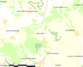 Map commune FR insee code 52405.png 756 × 605; 37 KB
-
 Population - Municipality code 52405.svg 475 × 355; 13 KB
-
 Prauthoy (52) Lavoir.jpg 2,100 × 1,400; 1.23 MB
-
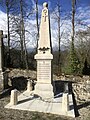 Prauthoy (Haute-Marne) Monument aux morts de la guerre de 1870-71 (1).jpg 2,950 × 3,936; 3.71 MB
-
 Prauthoy (Haute-Marne) Monument aux morts de la guerre de 1870-71 (2).jpg 2,141 × 2,946; 1.99 MB
-
 Prauthoy (Haute-Marne) Monument aux morts de la guerre de 1870-71 (3).jpg 2,916 × 3,724; 2.87 MB
-
 Prauthoy (Haute-Marne) Monument aux morts de la guerre de 1870-71 (4).jpg 3,010 × 3,005; 1.8 MB
-
 Prauthoy (Haute-Marne) Monument aux morts de la guerre de 1870-71.jpg 2,982 × 3,976; 3.27 MB
-
 Prauthoy 60567.jpg 1,548 × 1,005; 401 KB
-
 Prauthoy FR (march 2008).jpg 2,048 × 1,536; 1.15 MB


_Lavoir.jpg)
_Monument_aux_morts_de_la_guerre_de_1870-71_(1).jpg)
_Monument_aux_morts_de_la_guerre_de_1870-71_(2).jpg)
_Monument_aux_morts_de_la_guerre_de_1870-71_(3).jpg)
_Monument_aux_morts_de_la_guerre_de_1870-71_(4).jpg)
_Monument_aux_morts_de_la_guerre_de_1870-71.jpg)
