Category:Prüll (Landkreis Bayreuth)
Jump to navigation
Jump to search
unincorporated area in Germany   | |||||
| Upload media | |||||
| Instance of |
| ||||
|---|---|---|---|---|---|
| Location | Bayreuth, Upper Franconia, Bavaria, Germany | ||||
| Population |
| ||||
| Area |
| ||||
| Different from | |||||
 | |||||
Media in category "Prüll (Landkreis Bayreuth)"
The following 2 files are in this category, out of 2 total.
-
 Digitales Orthofoto von Prüll (Bayerische Vermessungsverwaltung).tif 10,000 × 7,500; 145.32 MB
-
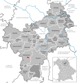 Prüll in BT.svg 734 × 785; 793 KB