Category:Pontesbury
Jump to navigation
Jump to search
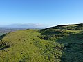
English: Pontesbury is a large village and civil parish in Shropshire and is approximately eight miles southwest of the county town of Shrewsbury. The village of Minsterley is just over a mile further southwest. The A488 road runs through the village, on its way from Shrewsbury to Bishop's Castle. The Rea Brook flows close by to the north with the village itself nestling on the northern edge of the Shropshire Hills AONB.
village and civil parish in Shropshire, United Kingdom  | |||||
| Upload media | |||||
| Instance of | |||||
|---|---|---|---|---|---|
| Location | Shropshire, West Midlands, England | ||||
 | |||||
Subcategories
This category has the following 9 subcategories, out of 9 total.
C
- Cruckmeole (14 F)
G
- St George's Church, Pontesbury (10 F)
H
- Habberley, Shropshire (36 F)
L
- Lea, Pontesbury (1 F)
P
S
- Shorthill (3 F)
- Snailbeach District Railways (5 F)
T
Media in category "Pontesbury"
The following 200 files are in this category, out of 239 total.
(previous page) (next page)-
 A boggy bridleway junction - geograph.org.uk - 2236592.jpg 1,152 × 864; 617 KB
-
 A dried lake, and a footpath - geograph.org.uk - 2786391.jpg 979 × 734; 473 KB
-

-
 A small hill - geograph.org.uk - 4427660.jpg 640 × 426; 34 KB
-
 A view down Oak Tree Wall - geograph.org.uk - 1278511.jpg 480 × 640; 133 KB
-
 A488 approaching Minsterley Road - geograph.org.uk - 3677489.jpg 640 × 480; 59 KB
-
 A488 at Lee Cross - geograph.org.uk - 5902743.jpg 1,024 × 695; 118 KB
-
 A488 at Lee Cross boundary - geograph.org.uk - 5902738.jpg 1,024 × 797; 126 KB
-
 A488 at Little Halston Farm - geograph.org.uk - 3677438.jpg 640 × 508; 50 KB
-
 A488 at Pontesbury village boundary - geograph.org.uk - 5902728.jpg 1,024 × 718; 107 KB
-
 A488 at Poulton - geograph.org.uk - 3677511.jpg 640 × 480; 48 KB
-
 A488 at The Nag's Head, Pontesbury - geograph.org.uk - 5902732.jpg 1,024 × 762; 260 KB
-
 A488 railway bridge - geograph.org.uk - 4272297.jpg 1,024 × 768; 129 KB
-
 A488, Malehurst Bank - geograph.org.uk - 5060620.jpg 640 × 480; 423 KB
-
 Abandoned bridge of an abandoned railway - geograph.org.uk - 2384260.jpg 640 × 480; 103 KB
-
 Along the bridleway towards Moat Hall - geograph.org.uk - 2787654.jpg 1,142 × 857; 372 KB
-
 Along the lane towards Habberley - geograph.org.uk - 3555618.jpg 1,044 × 783; 357 KB
-
 Another view of Pontesbury Library - geograph.org.uk - 1197236.jpg 640 × 480; 64 KB
-
 Approaching Cruckton - geograph.org.uk - 1338047.jpg 640 × 480; 52 KB
-

-

-
 Arscott Golf Club - geograph.org.uk - 5876623.jpg 1,024 × 576; 380 KB
-

-
 Asterley Primitive Methodist Chapel (geograph 6927911).jpg 5,293 × 3,593; 6.04 MB
-
 B4386 approaching Nox - geograph.org.uk - 3680241.jpg 640 × 417; 56 KB
-
 B4386 at Hollybank - geograph.org.uk - 3680237.jpg 640 × 466; 50 KB
-
 B4386 passing Cruckton House - geograph.org.uk - 4494129.jpg 1,600 × 1,200; 1.19 MB
-
 B4386 through Nox - geograph.org.uk - 3680247.jpg 640 × 412; 65 KB
-
 B4386, Hortonlane - geograph.org.uk - 5638323.jpg 1,024 × 683; 332 KB
-
 Barns and feed silos at Wood Hall farm - geograph.org.uk - 2787649.jpg 1,142 × 857; 309 KB
-

-
 Big field, Hortonlane - geograph.org.uk - 5638321.jpg 1,024 × 683; 430 KB
-
 Bogey Lane from A488 at Pontesbury - geograph.org.uk - 3677455.jpg 640 × 480; 67 KB
-
 Bridleway ford through the Pontesford Brook - geograph.org.uk - 2237189.jpg 1,024 × 768; 440 KB
-
 Bridleway into Oaks Wood - geograph.org.uk - 2236593.jpg 1,152 × 864; 547 KB
-
 Brook Vessons Farm from above - geograph.org.uk - 3555614.jpg 1,044 × 783; 367 KB
-

-

-
 Bus shelter at crossroads north of Cruckton - geograph.org.uk - 4494106.jpg 1,600 × 1,200; 1.31 MB
-
 Bus stop for school on A488 - geograph.org.uk - 3676232.jpg 640 × 460; 65 KB
-
 Cambrian Coast line west of Hanwood - geograph.org.uk - 2119023.jpg 640 × 480; 126 KB
-
 Car park below Pontesford Hill - geograph.org.uk - 4432166.jpg 640 × 480; 114 KB
-
 Cattle in Pontesbury, Shropshire, England.jpg 640 × 480; 66 KB
-
 Clanbrooks on A488 - geograph.org.uk - 3676266.jpg 640 × 502; 33 KB
-
 Coming to a choice of ways - geograph.org.uk - 2786036.jpg 979 × 734; 357 KB
-
 Coppice Farm from the road to Wood Hall - geograph.org.uk - 2787643.jpg 1,306 × 979; 374 KB
-
 Cottage by the A488 - geograph.org.uk - 6215594.jpg 2,160 × 1,486; 986 KB
-
 Cottages at Radleth - geograph.org.uk - 2237164.jpg 1,152 × 864; 578 KB
-

-

-
 Cruckton Bridge Causeway - geograph.org.uk - 4019397.jpg 3,872 × 2,592; 4.57 MB
-
 Cruckton cross roads from B4386 - geograph.org.uk - 3680233.jpg 640 × 415; 85 KB
-

-
 Disused quarry at Poles Coppice, Pontesbury (geograph 2956014).jpg 1,600 × 1,162; 807 KB
-

-
 Ditch south of the railway - geograph.org.uk - 4645415.jpg 640 × 426; 47 KB
-
 Driveway to Nills Farm - geograph.org.uk - 672030.jpg 640 × 480; 59 KB
-
 Earl Hill from the South at Easter - geograph.org.uk - 395123.jpg 640 × 437; 109 KB
-
 Earl's Hill - geograph.org.uk - 3308736.jpg 1,600 × 1,200; 748 KB
-
 Earl's Hill from the east - geograph.org.uk - 2237134.jpg 1,280 × 960; 414 KB
-
 Earl's Hill on a June evening - geograph.org.uk - 1936508.jpg 640 × 480; 85 KB
-
 Earl's Hill trig point - geograph.org.uk - 2926387.jpg 640 × 480; 59 KB
-

-

-
 Earls Hill, Easter Monday 2015 - geograph.org.uk - 4431970.jpg 640 × 480; 58 KB
-
 Earthworks on the northern side of Earl's Hill - geograph.org.uk - 2236567.jpg 1,280 × 960; 389 KB
-
 Earthworks on the southern side of Earl's Hill - geograph.org.uk - 2236579.jpg 1,280 × 960; 377 KB
-
 Earthworks on the southern side of Earl's Hill - geograph.org.uk - 2236584.jpg 1,280 × 960; 383 KB
-

-
 Farley junction - geograph.org.uk - 2178244.jpg 640 × 480; 111 KB
-
 Farm buildings at Westcott - geograph.org.uk - 2108749.jpg 640 × 480; 360 KB
-
 Farm road and railway bridge - geograph.org.uk - 2384206.jpg 640 × 480; 139 KB
-
 Farm track at Newnham farm - geograph.org.uk - 2560577.jpg 640 × 480; 53 KB
-
 Farmland - Wood Hall - geograph.org.uk - 2787657.jpg 1,142 × 857; 278 KB
-
 Farmland by the railway line - geograph.org.uk - 4427661.jpg 640 × 426; 39 KB
-
 Farmland in the Rea Brook Valley - geograph.org.uk - 4427656.jpg 640 × 426; 40 KB
-
 Farmland in the Rea Brook Valley - geograph.org.uk - 4427658.jpg 640 × 426; 37 KB
-
 Farmland in the Rea Valley - geograph.org.uk - 4645417.jpg 640 × 426; 43 KB
-
 Field edge path - geograph.org.uk - 6411035.jpg 640 × 480; 83 KB
-
 Field edge path near Habberley - geograph.org.uk - 6410535.jpg 640 × 480; 93 KB
-
 Field near Cruckton - geograph.org.uk - 5638343.jpg 1,024 × 683; 371 KB
-
 Field, Hanwood - geograph.org.uk - 5876626.jpg 1,024 × 576; 388 KB
-
 Fields near Halston Farm - geograph.org.uk - 6217772.jpg 2,878 × 1,294; 1.54 MB
-
 Fields near Poles Coppice - geograph.org.uk - 6300376.jpg 4,128 × 2,006; 5.46 MB
-
 Fields. sheep and hills - geograph.org.uk - 2108740.jpg 640 × 480; 413 KB
-

-
 Footbridge over the Pontesford Brook - geograph.org.uk - 2237171.jpg 1,152 × 864; 552 KB
-
 Footpath between maize and a stream - geograph.org.uk - 2566843.jpg 979 × 734; 323 KB
-
 Footpath through ripe wheat - geograph.org.uk - 2566832.jpg 979 × 734; 395 KB
-
 Footpath towards Poles Coppice - geograph.org.uk - 6300648.jpg 4,128 × 2,006; 5.9 MB
-
 Ford at Pontesbury - geograph.org.uk - 4019325.jpg 3,872 × 2,592; 4.77 MB
-
 Ford at Pontesbury - geograph.org.uk - 4019332.jpg 3,872 × 2,592; 4.72 MB
-
 Ford outside The Plough Inn - Pontesbury - geograph.org.uk - 6300341.jpg 3,620 × 2,006; 3.58 MB
-

-
 Former Ford at Pontesbury - geograph.org.uk - 4019071.jpg 3,872 × 2,592; 4.83 MB
-
 Full stop at Pontesford - geograph.org.uk - 122227.jpg 640 × 426; 124 KB
-
 Hall Lane - Pontesbury - geograph.org.uk - 6215579.jpg 2,966 × 2,006; 1.64 MB
-
 Halston Cottages on A488 - geograph.org.uk - 3677191.jpg 640 × 332; 41 KB
-
 Hill from a field gate - geograph.org.uk - 6410506.jpg 640 × 480; 70 KB
-
 Horseshoes Inn Pontesbury - geograph.org.uk - 3677496.jpg 640 × 480; 53 KB
-
 Horseshoes Inn, Pontesbury - geograph.org.uk - 585587.jpg 640 × 480; 79 KB
-
 House by A488 near Clanbrook Bridge - geograph.org.uk - 4272305.jpg 1,024 × 684; 95 KB
-

-

-
 House, Pound Lane - geograph.org.uk - 4427652.jpg 640 × 426; 50 KB
-
 Houses at Hinton - geograph.org.uk - 2178283.jpg 640 × 480; 102 KB
-
 Junction for Arscott Golf Club - geograph.org.uk - 6300325.jpg 4,128 × 2,006; 3.98 MB
-
 Junction for Cruckmeole from A488 - geograph.org.uk - 3676241.jpg 640 × 413; 57 KB
-

-
 Kissing gate to a public footpath - geograph.org.uk - 2178250.jpg 640 × 480; 126 KB
-
 Lane below Earl's Hill - geograph.org.uk - 4432108.jpg 640 × 480; 133 KB
-
 Lane close to Edge - geograph.org.uk - 2384133.jpg 640 × 480; 72 KB
-
 Lane from Shorthill to Arscott Hall - geograph.org.uk - 6300328.jpg 4,128 × 2,006; 3.84 MB
-
 Lane through Hinton, Shropshire - geograph-2178278.jpg 640 × 480; 120 KB
-
 Lane to Pontesbury - geograph.org.uk - 2178253.jpg 640 × 480; 149 KB
-
 Lay-by and snack bar by A488, Lea Cross - geograph.org.uk - 4272312.jpg 1,600 × 1,200; 1.4 MB
-
 Lay-by by B4386 east of Hollybank - geograph.org.uk - 4494115.jpg 1,600 × 1,200; 1.02 MB
-
 Lea Cross Tandoori - geograph.org.uk - 6340014.jpg 640 × 429; 61 KB
-
 Lea Cross Tavern - geograph.org.uk - 4272308.jpg 1,600 × 1,280; 1.31 MB
-
 Lea Cross Tavern on A488 - geograph.org.uk - 3677189.jpg 640 × 478; 51 KB
-
 Leaving Hanwood at Pound Lane - geograph.org.uk - 3676227.jpg 640 × 449; 65 KB
-
 Letter box and direction sign - geograph.org.uk - 790377.jpg 640 × 480; 87 KB
-
 Lingcroft Pool - geograph.org.uk - 3514265.jpg 979 × 734; 485 KB
-
 Lingcroft pool pier - geograph.org.uk - 763675.jpg 640 × 480; 91 KB
-
 Little bridge over an unnamed stream - geograph.org.uk - 2384190.jpg 640 × 480; 124 KB
-
 Main Road ahead - geograph.org.uk - 1515805.jpg 640 × 480; 62 KB
-
 Main road to Shrewsbury - geograph.org.uk - 2178288.jpg 640 × 480; 87 KB
-
 Maize crop opposite Hare and Hounds pub - geograph.org.uk - 3607337.jpg 640 × 480; 106 KB
-
 Maize crop opposite Hare and Hounds pub - geograph.org.uk - 3607338.jpg 640 × 480; 161 KB
-

-

-
 New finger posts - geograph.org.uk - 1481462.jpg 640 × 456; 146 KB
-
 New house - geograph.org.uk - 3828190.jpg 640 × 455; 103 KB
-

-
 Old railway bridge - geograph.org.uk - 2178273.jpg 640 × 480; 119 KB
-
 Old Shorthill House on A488 - geograph.org.uk - 3676253.jpg 640 × 524; 47 KB
-
 Old tin hut - geograph.org.uk - 2952865.jpg 1,600 × 1,159; 970 KB
-
 On Earl's Hill - geograph.org.uk - 2926376.jpg 640 × 480; 50 KB
-
 On Earl's Hill in spring - geograph.org.uk - 4432087.jpg 640 × 480; 68 KB
-
 On Earls Hill - view S to the Stiperstones - geograph.org.uk - 5620353.jpg 5,184 × 2,920; 4.86 MB
-

-
 Ordnance Survey Cut Mark - geograph.org.uk - 4953413.jpg 448 × 640; 98 KB
-
 Path and tree at the base of Earl's Hill - geograph.org.uk - 1135901.jpg 640 × 430; 159 KB
-

-

-
 Path through the woods near Wood Hall - geograph.org.uk - 2786384.jpg 734 × 979; 435 KB
-
 Path to Earl's Hill - geograph.org.uk - 1136564.jpg 640 × 430; 157 KB
-
 Pond, Arscott - geograph.org.uk - 5876616.jpg 1,024 × 1,024; 752 KB
-

-
 Pontesbury from Earl's Hill - geograph.org.uk - 1096134.jpg 640 × 480; 74 KB
-
 Pontesbury Library - geograph.org.uk - 530302.jpg 640 × 480; 72 KB
-
 Pontesbury NLW3363786.jpg 601 × 434; 68 KB
-
 Pontesbury Public Hall - geograph.org.uk - 5050494.jpg 640 × 480; 56 KB
-

-
 Pontesford Hill - geograph.org.uk - 4432175.jpg 640 × 480; 110 KB
-
 Pontesford Hill turning from A488 - geograph.org.uk - 3677449.jpg 640 × 492; 49 KB
-
 Poulton Toll House, Pontesbury - geograph.org.uk - 6115235.jpg 800 × 600; 312 KB
-

-
 Rea Brook - geograph.org.uk - 2178300.jpg 640 × 480; 87 KB
-
 Rea brook from the railway - geograph.org.uk - 2560805.jpg 640 × 480; 72 KB
-
 Rea Valley Tractors - geograph.org.uk - 1589166.jpg 640 × 461; 136 KB
-
 Road at Edge - geograph.org.uk - 5233693.jpg 4,000 × 3,000; 4.27 MB
-
 Route of a dismantled railway - geograph.org.uk - 2178293.jpg 640 × 480; 98 KB
-
 Rusting Barn at Nills Hill Farm - geograph.org.uk - 6300339.jpg 4,128 × 2,006; 5.66 MB
-
 Sheep Pasture on Whitwell Lane - geograph.org.uk - 6300342.jpg 4,128 × 1,860; 5.17 MB
-
 Smallholding below Earl's Hill - geograph.org.uk - 2237197.jpg 1,152 × 864; 449 KB
-
 Spangly new stile and a footbridge - geograph.org.uk - 2236597.jpg 960 × 1,280; 606 KB
-
 Steeply up onto Paulith Bank - geograph.org.uk - 3555623.jpg 979 × 734; 380 KB
-
 Stile between Cruckton and Shoot Hill - geograph.org.uk - 5638362.jpg 1,024 × 683; 379 KB
-
 Strange tree in old bridge - geograph.org.uk - 694297.jpg 640 × 480; 186 KB
-
 Teddy in a Tractor^ - geograph.org.uk - 6300354.jpg 2,005 × 3,184; 2.2 MB
-
 Thatched house below Pontesford Hill - geograph.org.uk - 4432119.jpg 640 × 480; 91 KB
-
 The Crags towering overhead - geograph.org.uk - 1197243.jpg 640 × 480; 97 KB
-
 The end of Pound Lane, Hanwood - geograph.org.uk - 4272291.jpg 1,024 × 683; 104 KB
-
 The footpath towards Coppice Farm - geograph.org.uk - 2787636.jpg 979 × 734; 350 KB
-
 The Horseshoes Inn - Pontesbury - geograph.org.uk - 6215575.jpg 2,014 × 1,272; 747 KB
-

-
 The lion of Pontesbury.... - geograph.org.uk - 6410082.jpg 640 × 480; 68 KB
-
 The main crag at Pontesbury Rocks - geograph.org.uk - 1278507.jpg 640 × 480; 128 KB
-
 The Mytton Arms - Habberley - geograph.org.uk - 6300520.jpg 4,128 × 2,006; 2.84 MB
-
 The north side of Earl's Hill - geograph.org.uk - 1278522.jpg 480 × 640; 130 KB
-
 The old police station in Pontesbury - geograph.org.uk - 6340021.jpg 640 × 480; 75 KB
-
 The old Rea Valley Tractors site - geograph.org.uk - 2926416.jpg 640 × 480; 59 KB
-
 The Plough pub in Pontesbury - geograph.org.uk - 6407257.jpg 640 × 480; 67 KB
-
 The Pontesford Brook, Radleth - geograph.org.uk - 2237179.jpg 1,024 × 768; 445 KB
-
 The Rea Brook valley south of Cruckton - geograph.org.uk - 4556715.jpg 1,600 × 964; 201 KB
-
 The Rea Brook valley south of Cruckton - geograph.org.uk - 5029204.jpg 1,600 × 614; 92 KB
-
 The Red Lion, Pontesbury - geograph.org.uk - 585591.jpg 640 × 480; 70 KB
-

-
 The true summit of Earl's Hill - geograph.org.uk - 2236576.jpg 1,280 × 960; 449 KB
-
 There's not much at Edge - geograph.org.uk - 2178261.jpg 640 × 480; 81 KB
-
 Towards Buck's Coppice - geograph.org.uk - 5638351.jpg 1,024 × 683; 338 KB
-
 Track below Pontesford Hill - geograph.org.uk - 2926225.jpg 640 × 480; 109 KB
-

-

-
 Trees following a stream - geograph.org.uk - 4431446.jpg 640 × 426; 41 KB
-
 Triangulation Pillar Earl's Hill - geograph.org.uk - 5237621.jpg 1,328 × 747; 163 KB
-
 Twin oak trees and a footpath - geograph.org.uk - 2566838.jpg 956 × 717; 321 KB
-
 Valley east of Nox - geograph.org.uk - 4557084.jpg 1,600 × 796; 208 KB
-
 View down the Rea Brook valley towards Cruckton - geograph.org.uk - 4556764.jpg 1,600 × 1,064; 283 KB


.jpg)


.jpg)


_(14579760829).jpg)