Category:Ponterwyd
Jump to navigation
Jump to search
village in Ceredigion, Wales  | |||||
| Upload media | |||||
| Instance of | |||||
|---|---|---|---|---|---|
| Location | Ceredigion, Wales | ||||
 | |||||
Català: Ponterwyd és un poble del comtat de Ceredigion, a les Muntanyes Càmbriques, situat aproximadament a 20 km d'Aberystwyth seguint l'estrada A44.
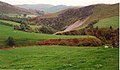
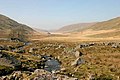
Cymraeg: Mae Ponterwyd yn bentref ym mryniau Ceredigion, a leolir tua 12 milltir i'r dwyrain o Aberystwyth ar lôn yr A44 rhwng y dref honno a Llangurig. I'r de mae pentref hanesyddol Ysbyty Cynfyn. I'r gogledd ceir moelydd llwm Pumlumon. Rhed Afon Rheidol i'r de o'r pentref.
English: Ponterwyd is a village in Ceredigion, Wales. It lies in the Cambrian Mountains of Mid Wales, approximately 12 miles west of Aberystwyth on the A44 road.
Subcategories
This category has the following 3 subcategories, out of 3 total.
C
- Capel Ponterwyd (3 F)
L
- Llynnoedd Ieuan (3 F)
Media in category "Ponterwyd"
The following 74 files are in this category, out of 74 total.
-

-
 Afon Castell - geograph.org.uk - 274006.jpg 640 × 480; 99 KB
-
 An incised meander near Ponterwyd - geograph.org.uk - 5708.jpg 640 × 371; 57 KB
-
 Birthplace of Sir John Rhys Ponterwyd.JPG 640 × 480; 126 KB
-
 Bridge over Hirnant at Hirnant - geograph.org.uk - 929177.jpg 640 × 480; 184 KB
-
 Bridleway through Dyll Faen - geograph.org.uk - 235992.jpg 640 × 480; 138 KB
-
 Cattle Grid, Nant-y-Moch - geograph.org.uk - 26544.jpg 640 × 480; 148 KB
-
 Craig Dolwen - geograph.org.uk - 582025.jpg 640 × 471; 65 KB
-
 Dinas power station - geograph.org.uk - 763046.jpg 640 × 428; 85 KB
-
 Dismantled Wind Turbine - geograph.org.uk - 404110.jpg 639 × 429; 124 KB
-
 Dyffryn Castell Hotel near Ponterwyd - geograph.org.uk - 208201.jpg 640 × 480; 115 KB
-
 Entrance to the Sweet Lamb Motor Complex - geograph.org.uk - 301771.jpg 640 × 480; 227 KB
-
-

-
 Fields north of Hirnant - geograph.org.uk - 821709.jpg 640 × 428; 153 KB
-
 Footbridge beside the Nant y Moch ford - geograph.org.uk - 930219.jpg 640 × 480; 211 KB
-
 Footbridge beside the Nant y Moch ford - geograph.org.uk - 930223.jpg 640 × 480; 243 KB
-
 Ford across Nant y Moch - geograph.org.uk - 930216.jpg 640 × 480; 253 KB
-
 Ford across Nant y Moch - geograph.org.uk - 930220.jpg 640 × 480; 224 KB
-
 Ford on the Nant y Moch - geograph.org.uk - 1130169.jpg 640 × 428; 122 KB
-
 Forestry road in the Myherin valley - geograph.org.uk - 522518.jpg 640 × 480; 98 KB
-
 George Borrow Hotel at Ponterwyd - geograph.org.uk - 610457.jpg 640 × 480; 110 KB
-
 Glacial mound - geograph.org.uk - 375693.jpg 640 × 480; 74 KB
-
 Gorge of the Nant Dinas - geograph.org.uk - 1493971.jpg 640 × 480; 137 KB
-
 Moorland north of Dinas - geograph.org.uk - 1493918.jpg 640 × 480; 78 KB
-
 Mountain stream - geograph.org.uk - 791191.jpg 640 × 480; 140 KB
-
 Nantsyddion - geograph.org.uk - 153973.jpg 640 × 479; 99 KB
-
 Path with dry stone wall boundary - geograph.org.uk - 359042.jpg 640 × 480; 87 KB
-
 Pen Pumlumon Fawr from Nantymoch - geograph.org.uk - 346624.jpg 640 × 441; 110 KB
-
 Ponterwyd from the north west - geograph.org.uk - 1539726.jpg 640 × 428; 111 KB
-
 Post box in mine adit, Llynwernog - geograph.org.uk - 76839.jpg 640 × 387; 115 KB
-

-
 The bridge from below - geograph.org.uk - 365033.jpg 480 × 640; 114 KB
-
 The Drybedd ridge - geograph.org.uk - 389613.jpg 640 × 479; 49 KB
-
 The Hirnant below Hirnant farm - geograph.org.uk - 1485382.jpg 640 × 462; 96 KB
-
 Wind Turbine - geograph.org.uk - 380464.jpg 480 × 640; 48 KB
-
 Yr Hen Bont Ponterwyd - geograph - 3275334.jpg 1,024 × 685; 151 KB
-

-
 Afon Gwy (River Wye) - geograph.org.uk - 300418.jpg 640 × 480; 206 KB
-
 Afon Hengwm - geograph.org.uk - 376159.jpg 640 × 427; 58 KB
-
 Afon Rheidol - geograph.org.uk - 515024.jpg 640 × 480; 267 KB
-
 Banc Lluestnewydd - geograph.org.uk - 376167.jpg 427 × 640; 85 KB
-
 Bwlch Helygen - geograph.org.uk - 274870.jpg 640 × 479; 73 KB
-
 Dinas reservoir - geograph.org.uk - 754249.jpg 640 × 428; 73 KB
-
 Dinas reservoir - geograph.org.uk - 754261.jpg 640 × 428; 84 KB
-
 Dolwen House - geograph.org.uk - 658954.jpg 640 × 480; 73 KB
-
 Drum Peithnant - geograph.org.uk - 274744.jpg 640 × 475; 87 KB
-
 Farm north of Ysbyty Cynfyn, Ceredigion - geograph.org.uk - 1420095.jpg 640 × 480; 137 KB
-
 Fields by the Nant Ceiro - geograph.org.uk - 763043.jpg 640 × 428; 77 KB
-
 Forest Road on Banc Dolwen - geograph.org.uk - 658949.jpg 480 × 640; 76 KB
-
 Forestry on Banc Dolwen - geograph.org.uk - 658952.jpg 640 × 480; 102 KB
-
 Fuches Wen - geograph.org.uk - 274033.jpg 640 × 479; 44 KB
-

-
 Moorland south of Bryn Gwyn forest - geograph.org.uk - 375727.jpg 640 × 479; 61 KB
-
 Northward panorama from Plynlimon - geograph.org.uk - 59270.jpg 640 × 263; 44 KB
-
 Pant-gwyn, Moriah - geograph.org.uk - 72415.jpg 640 × 480; 129 KB
-
 Parson's Bridge - geograph.org.uk - 515007.jpg 480 × 640; 313 KB
-
 Path to Parson's Bridge - geograph.org.uk - 514983.jpg 640 × 480; 286 KB
-
 Ravine of the Nant Dinas - geograph.org.uk - 553865.jpg 640 × 480; 107 KB
-
 Remains of Temple Mine - geograph.org.uk - 515041.jpg 640 × 480; 341 KB
-
 Retaining Wall - geograph.org.uk - 250905.jpg 640 × 480; 118 KB
-
 Small forestry stand at Llidiart Coch - geograph.org.uk - 301756.jpg 480 × 640; 183 KB
-
 Start of the River Wye - geograph.org.uk - 273616.jpg 480 × 640; 84 KB
-

-
 Stile - geograph.org.uk - 362219.jpg 640 × 480; 112 KB
-
 Temple Mine - geograph.org.uk - 515048.jpg 480 × 640; 343 KB
-
 The A4120 Road - geograph.org.uk - 285588.jpg 640 × 480; 143 KB
-
 The Afon Myherin - geograph.org.uk - 657774.jpg 800 × 600; 309 KB
-
 Track near Nant Rhuddnant - geograph.org.uk - 583279.jpg 640 × 480; 103 KB
-
 Track to Fuchesgau - geograph.org.uk - 250901.jpg 640 × 480; 96 KB
-
 Upper Nant Glas - geograph.org.uk - 375711.jpg 640 × 479; 52 KB
-
-

-
 Wild camp - geograph.org.uk - 274738.jpg 640 × 475; 72 KB


_-_geograph.org.uk_-_300418.jpg)


