Category:Political maps of Seine-et-Marne
Jump to navigation
Jump to search
Subcategories
This category has the following 2 subcategories, out of 2 total.
E
- Election maps of Seine-et-Marne (27 F)
M
Media in category "Political maps of Seine-et-Marne"
The following 10 files are in this category, out of 10 total.
-
 77-Pres2022-T1-1er.png 3,519 × 3,197; 3.07 MB
-
 77-Pres2022-T1-abst.png 3,519 × 3,197; 3.05 MB
-
 Carte résultats cantons 2015 Seine-et-Marne.svg 462 × 599; 100 KB
-
 Députés sortants de Seine-et-Marne en 2017.svg 752 × 975; 17 KB
-
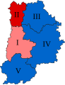
 Seine-et-Marne législatives 1958.svg 1,004 × 1,301; 18 KB
-
 Seine-et-Marne législatives 1962.svg 1,004 × 1,301; 18 KB
-
 Seine-et-Marne législatives 1967.svg 1,004 × 1,301; 18 KB
-
 Seine-et-Marne législatives 1973.svg 1,004 × 1,301; 18 KB
-
 Seine-et-Marne législatives 1978.svg 1,004 × 1,301; 18 KB
-
 Seine-et-Marne législatives 1981.svg 1,004 × 1,301; 18 KB


