Category:Political maps of Saône-et-Loire
Jump to navigation
Jump to search
Subcategories
This category has the following 2 subcategories, out of 2 total.
E
- Election maps of Saône-et-Loire (34 F)
M
Media in category "Political maps of Saône-et-Loire"
The following 6 files are in this category, out of 6 total.
-
 71-Pres2022-T1-1er.png 3,519 × 3,197; 3.1 MB
-
 71-Pres2022-T1-abst.png 3,519 × 3,197; 3.1 MB
-
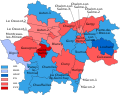 Carte résultats cantons 2015 Saône-et-Loire.svg 759 × 600; 124 KB
-
 Députés sortants de Saône-et-Loire en 2017.svg 970 × 766; 16 KB
-
 Députés élus de Saône-et-Loire en 2017.svg 970 × 766; 18 KB
-
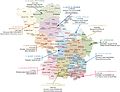 Mise a jour cartographie01012010.jpg 4,068 × 3,134; 2.09 MB


