Category:Political maps of Putnam County, Ohio as of the 2000 United States Census
Jump to navigation
Jump to search
Media in category "Political maps of Putnam County, Ohio as of the 2000 United States Census"
The following 33 files are in this category, out of 33 total.
-
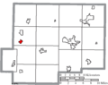
 Map of Putnam County Ohio Highlighting Belmore Village.png 574 × 455; 22 KB
-
 Map of Putnam County Ohio Highlighting Blanchard Township.png 574 × 455; 22 KB
-
 Map of Putnam County Ohio Highlighting Cloverdale Village.png 574 × 455; 22 KB
-
 Map of Putnam County Ohio Highlighting Columbus Grove Village.png 574 × 455; 22 KB
-
 Map of Putnam County Ohio Highlighting Continental Village.png 574 × 455; 22 KB
-
 Map of Putnam County Ohio Highlighting Dupont Village.png 574 × 455; 22 KB
-
 Map of Putnam County Ohio Highlighting Fort Jennings Village.png 574 × 455; 22 KB
-
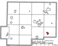
 Map of Putnam County Ohio Highlighting Gilboa Village.png 574 × 455; 22 KB
-
 Map of Putnam County Ohio Highlighting Glandorf Village.png 574 × 455; 22 KB
-
 Map of Putnam County Ohio Highlighting Greensburg Township.png 574 × 455; 22 KB
-
 Map of Putnam County Ohio Highlighting Jackson Township.png 574 × 455; 22 KB
-
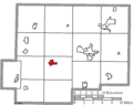
 Map of Putnam County Ohio Highlighting Jennings Township.png 574 × 455; 22 KB
-
 Map of Putnam County Ohio Highlighting Kalida Village.png 574 × 455; 22 KB
-
 Map of Putnam County Ohio Highlighting Leipsic Village.png 574 × 455; 22 KB
-
 Map of Putnam County Ohio Highlighting Liberty Township.png 574 × 455; 22 KB
-
 Map of Putnam County Ohio Highlighting Miller City Village.png 574 × 455; 22 KB
-
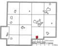
 Map of Putnam County Ohio Highlighting Monroe Township.png 574 × 455; 22 KB
-
 Map of Putnam County Ohio Highlighting Monterey Township.png 574 × 455; 22 KB
-
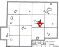
 Map of Putnam County Ohio Highlighting Ottawa Township.png 574 × 455; 22 KB
-
 Map of Putnam County Ohio Highlighting Ottawa Village.png 574 × 455; 22 KB
-
 Map of Putnam County Ohio Highlighting Ottoville Village.png 574 × 455; 22 KB
-
 Map of Putnam County Ohio Highlighting Palmer Township.png 574 × 455; 22 KB
-
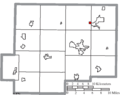
 Map of Putnam County Ohio Highlighting Pandora Village.png 574 × 455; 22 KB
-
 Map of Putnam County Ohio Highlighting Perry Township.png 574 × 455; 22 KB
-
 Map of Putnam County Ohio Highlighting Pleasant Township.png 574 × 455; 22 KB
-
 Map of Putnam County Ohio Highlighting Riley Township.png 574 × 455; 22 KB
-
 Map of Putnam County Ohio Highlighting Sugar Creek Township.png 574 × 455; 22 KB
-
 Map of Putnam County Ohio Highlighting Union Township.png 574 × 455; 22 KB
-
 Map of Putnam County Ohio Highlighting Van Buren Township.png 574 × 455; 22 KB
-
 Map of Putnam County Ohio Highlighting West Leipsic Village.png 574 × 455; 22 KB
-
 Map of Putnam County Ohio With Municipal and Township Labels.PNG 574 × 455; 43 KB
-
 Map of Putnam County, Ohio No Text, Municipalities Distinct.png 574 × 455; 22 KB
-
 Map of Putnam County, Ohio No Text.png 574 × 455; 21 KB


