Category:Political maps of Preble County, Ohio as of the 2000 United States Census
Jump to navigation
Jump to search
Media in category "Political maps of Preble County, Ohio as of the 2000 United States Census"
The following 26 files are in this category, out of 26 total.
-
 Map of Preble County Ohio Highlighting Camden Village.png 411 × 559; 20 KB
-
 Map of Preble County Ohio Highlighting College Corner Village.png 411 × 559; 20 KB
-
 Map of Preble County Ohio Highlighting Dixon Township.png 411 × 559; 20 KB
-
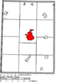 Map of Preble County Ohio Highlighting Eaton City.png 411 × 559; 20 KB
-
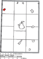
 Map of Preble County Ohio Highlighting Eldorado Village.png 411 × 559; 20 KB
-
 Map of Preble County Ohio Highlighting Gasper Township.png 411 × 559; 20 KB
-
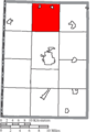
 Map of Preble County Ohio Highlighting Gratis Township.png 411 × 559; 20 KB
-
 Map of Preble County Ohio Highlighting Gratis Village.png 411 × 559; 20 KB
-
 Map of Preble County Ohio Highlighting Harrison Township.png 411 × 559; 20 KB
-
 Map of Preble County Ohio Highlighting Israel Township.png 411 × 559; 20 KB
-
 Map of Preble County Ohio Highlighting Jackson Township.png 411 × 559; 20 KB
-
 Map of Preble County Ohio Highlighting Jefferson Township.png 411 × 559; 20 KB
-
 Map of Preble County Ohio Highlighting Lanier Township.png 411 × 559; 20 KB
-
 Map of Preble County Ohio Highlighting Lewisburg Village.png 411 × 559; 20 KB
-
 Map of Preble County Ohio Highlighting Monroe Township.png 411 × 559; 20 KB
-
 Map of Preble County Ohio Highlighting New Paris Village.png 411 × 559; 20 KB
-
 Map of Preble County Ohio Highlighting Somers Township.png 411 × 559; 20 KB
-
 Map of Preble County Ohio Highlighting Twin Township.png 411 × 559; 20 KB
-
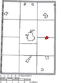
 Map of Preble County Ohio Highlighting Verona Village.png 411 × 559; 20 KB
-
 Map of Preble County Ohio Highlighting Washington Township.png 411 × 559; 20 KB
-
 Map of Preble County Ohio Highlighting West Alexandria Village.png 411 × 559; 20 KB
-
 Map of Preble County Ohio Highlighting West Elkton Village.png 411 × 559; 20 KB
-
 Map of Preble County Ohio Highlighting West Manchester Village.png 411 × 559; 20 KB
-
 Map of Preble County Ohio With Municipal and Township Labels.PNG 411 × 559; 35 KB
-
 Map of Preble County, Ohio No Text, Municipalities Distinct.png 411 × 559; 20 KB
-
 Map of Preble County, Ohio No Text.png 411 × 559; 20 KB


