Category:Political maps of Perry County, Ohio as of the 2000 United States Census
Jump to navigation
Jump to search
Media in category "Political maps of Perry County, Ohio as of the 2000 United States Census"
The following 29 files are in this category, out of 29 total.
-
 Map of Perry County Ohio Highlighting Bearfield Township.png 601 × 541; 23 KB
-
 Map of Perry County Ohio Highlighting Clayton Township.png 601 × 541; 23 KB
-
 Map of Perry County Ohio Highlighting Coal Township.png 601 × 541; 23 KB
-
 Map of Perry County Ohio Highlighting Corning Village.png 601 × 541; 23 KB
-
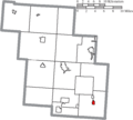
 Map of Perry County Ohio Highlighting Crooksville Village.png 601 × 541; 23 KB
-
 Map of Perry County Ohio Highlighting Glenford Village.png 601 × 541; 23 KB
-
 Map of Perry County Ohio Highlighting Harrison Township.png 601 × 541; 23 KB
-
 Map of Perry County Ohio Highlighting Hemlock Village.png 601 × 541; 23 KB
-
 Map of Perry County Ohio Highlighting Hopewell Township.png 601 × 541; 23 KB
-
 Map of Perry County Ohio Highlighting Jackson Township.png 601 × 541; 23 KB
-
 Map of Perry County Ohio Highlighting Junction City Village.png 601 × 541; 23 KB
-
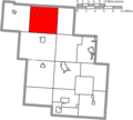
 Map of Perry County Ohio Highlighting Madison Township.png 601 × 541; 23 KB
-
 Map of Perry County Ohio Highlighting Monday Creek Township.png 601 × 541; 23 KB
-
 Map of Perry County Ohio Highlighting Monroe Township.png 601 × 541; 23 KB
-
 Map of Perry County Ohio Highlighting New Lexington Village.png 601 × 541; 23 KB
-
 Map of Perry County Ohio Highlighting New Straitsville Village.png 601 × 541; 23 KB
-
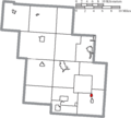
 Map of Perry County Ohio Highlighting Pike Township.png 601 × 541; 23 KB
-
 Map of Perry County Ohio Highlighting Pleasant Township.png 601 × 541; 23 KB
-
 Map of Perry County Ohio Highlighting Reading Township.png 601 × 541; 23 KB
-
 Map of Perry County Ohio Highlighting Rendville Village.png 601 × 541; 23 KB
-
 Map of Perry County Ohio Highlighting Roseville Village.png 601 × 541; 23 KB
-
 Map of Perry County Ohio Highlighting Salt Lick Township.png 601 × 541; 23 KB
-
 Map of Perry County Ohio Highlighting Shawnee Village.png 601 × 541; 23 KB
-
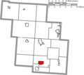
 Map of Perry County Ohio Highlighting Somerset Village.png 601 × 541; 23 KB
-
 Map of Perry County Ohio Highlighting Thorn Township.png 601 × 541; 23 KB
-
 Map of Perry County Ohio Highlighting Thornville Village.png 601 × 541; 23 KB
-
 Map of Perry County Ohio With Municipal and Township Labels.PNG 601 × 541; 44 KB
-
 Map of Perry County, Ohio No Text, Municipalities Distinct.png 601 × 541; 23 KB
-
 Map of Perry County, Ohio No Text.png 601 × 541; 22 KB


