Category:Political maps of Norway
Jump to navigation
Jump to search
Countries of Europe: Albania · Austria · Azerbaijan‡ · Belarus · Belgium · Bosnia and Herzegovina · Bulgaria · Croatia · Cyprus‡ · Czech Republic · Denmark · Estonia · Finland · France‡ · Georgia‡ · Germany · Greece · Hungary · Iceland · Republic of Ireland · Italy · Kazakhstan‡ · Latvia · Moldova · Montenegro · Netherlands‡ · Norway · Poland · Portugal‡ · Romania · Russia‡ · Serbia · Slovenia · Spain‡ · Sweden · Switzerland · Turkey‡ · Ukraine · United Kingdom
Specific status: Jersey – Limited recognition: Kosovo · South Ossetia‡
‡: partly located in Europe
Specific status: Jersey – Limited recognition: Kosovo · South Ossetia‡
‡: partly located in Europe
Subcategories
This category has the following 4 subcategories, out of 4 total.
Media in category "Political maps of Norway"
The following 9 files are in this category, out of 9 total.
-
 Differences in Norwegian Electoral Districts.svg 1,363 × 1,080; 1.62 MB
-
 Gemeinden Norwegen 2024.png 4,405 × 5,043; 5.15 MB
-
 Jan Mayen ringed.png 1,680 × 2,850; 1.1 MB
-
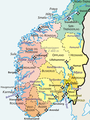
 Map Norway political-geo.png 1,920 × 2,902; 924 KB
-
 N.º de Ministros por Provincias Noruega.png 806 × 666; 69 KB
-
 Norra kaart.png 1,920 × 2,902; 1,019 KB
-
 Norra lõunaosa.png 562 × 752; 252 KB
-
 Norway Exclusive Economic Zones.png 2,410 × 1,178; 309 KB
-
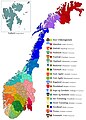 Norwegian Regions.jpg 3,223 × 4,489; 2.15 MB


